jhb171achill Posted December 26, 2015 Share Posted December 26, 2015 So the last No. 2 was identical to the one in Cultra. There doesn't seem to be exact information on when each last worked, or was officially withdrawn, nor whether the Derry dockside railway was perhaps operated y road vehicles after they went? Does anyone know, for example, definitive information about the last rail=borne movements on this network (narrow or broad gauge?)... Quote Link to comment Share on other sites More sharing options...
airfixfan Posted December 30, 2015 Share Posted December 30, 2015 The official closure date of the LPHC is 1962 but the steam locos appear to have been last used in 1959 with road tractors shunting the declining freight traffic from 1959 to 1962. Quote Link to comment Share on other sites More sharing options...
Chris_w Posted July 6, 2021 Share Posted July 6, 2021 On 12/12/2015 at 2:47 PM, Dhu Varren said: Below is a picture of Derry docks with an arrow showing where I believe the original picture was taken. http://www.britainfromabove.org.uk/image/XAW027080 Here are also two pictures of the LPHC locos, No1 in what has to be a posed shot with both broad gauge and narrow gauge wagons behind it, at the entrance to the loco shed. Also No3 taken towards the L&LSR Graving Dock Station further along the quay. Note the offset NG coupling on the buffer beams. Note the rope wound round the buffers of No3, used for dragging wagons into parallel tracks. I’m working on evolution of track layouts for the CDRJC (and predecessors) and the whole of Derry / Londonderry. I too am having a great deal of trouble locating that mixed gauge photograph. Here’s my thinking on the subject, after studying lots of OS plans and photographs, particularly aerial ones. 1 Quote Link to comment Share on other sites More sharing options...
airfixfan Posted July 6, 2021 Share Posted July 6, 2021 Did an article on the LPHC in February 2021 issue of Railway Bylines with maps and some rare photos. Quote Link to comment Share on other sites More sharing options...
Chris_w Posted July 6, 2021 Share Posted July 6, 2021 1 hour ago, airfixfan said: Did an article on the LPHC in February 2021 issue of Railway Bylines with maps and some rare photos. I Googled the magazine (never heard of it till now). That issue is missing from the list. Any chance you could provide me with a copy of the article? Quote Link to comment Share on other sites More sharing options...
NIR Posted July 6, 2021 Share Posted July 6, 2021 8 hours ago, Chris_w said: I’m working on evolution of track layouts for the CDRJC (and predecessors) and the whole of Derry / Londonderry. I too am having a great deal of trouble locating that mixed gauge photograph. That tower is very distinctive https://www.google.co.uk/maps/@55.0033021,-7.321225,3a,75y,149.76h,85.33t/data=!3m6!1e1!3m4!1s1GKLFvAuTcg6SuFvGGbKBg!2e0!7i16384!8i8192 1 Quote Link to comment Share on other sites More sharing options...
airfixfan Posted July 6, 2021 Share Posted July 6, 2021 1 hour ago, Chris_w said: I Googled the magazine (never heard of it till now). That issue is missing from the list. Any chance you could provide me with a copy of the article? Check their website for a digital.copy?Will also check with the editor tomorrow as well for you. Quote Link to comment Share on other sites More sharing options...
NIR Posted July 6, 2021 Share Posted July 6, 2021 10 hours ago, Chris_w said: I’m working on evolution of track layouts for the CDRJC (and predecessors) and the whole of Derry / Londonderry. I too am having a great deal of trouble locating that mixed gauge photograph. A particularly clear photograph here https://www.londonderryport.com/history-of-the-Port 1 Quote Link to comment Share on other sites More sharing options...
airfixfan Posted July 7, 2021 Share Posted July 7, 2021 See also Disused Stations website as we have some more photos posted there. Check under Derry or Londonderry Foyle Road station Quote Link to comment Share on other sites More sharing options...
Irishswissernie Posted July 7, 2021 Share Posted July 7, 2021 (edited) This is the site of the posed photo. The building behind the tower in the background of the posed photo still exists and if you look on Google the large building up the hill is also still there. Photo is another Britain from the Air Web site but not so good quality and rather cruel enlargment. Photo is farther down river towards the Graving Dock terminus. The building with the Tower was probably the Boating Club clubhouse, the road is called Boating Club lane and the large building is now the Magee University Music building. Godfrey Maps do a 1905 reprint of the old 25" to the Mile one which annoyingly just covers the boating club on its upper edge. Edited July 7, 2021 by Irishswissernie 2 Quote Link to comment Share on other sites More sharing options...
Dhu Varren Posted July 7, 2021 Share Posted July 7, 2021 The building marked X and still there, was the Technical College, known as 'The Tech'. The building behind and to the right was Foyle College, still there but the school moved out in the late 1960s. The building next to the X where the photo was taken, was the LPHC engine shed. Noticeably missing from the picture is HMS Stalker (known locally as HMS Neverbudge), a submarine depot ship. permanently moored at the two jetties in the top right of the picture. Can be clearly seen in the picture posted earlier by NIR. 1 Quote Link to comment Share on other sites More sharing options...
Chris_w Posted July 7, 2021 Share Posted July 7, 2021 Thanks for the replies. Unfortunately, there’s nothing to say where that mixed gauge phot is actually located. Looking at the photo in question, the following observations: - it’s facing north with the river bending to the left - the dual gauge track always had the ‘common’ rail on the landward side - the building on the left is on the landward side and some of it’s features seem to match where I have indicated with arrows - it can’t be where the previous person indicated between warehouses and transit shed - not enough tracks and wrong direction - there are very few locations where dual gauge track does not exist My drawings show (early 1960s): - 1 broad gauge track parallel with the dual gauge track leading up to the wagon turntable on the bridge - continuation of this line beyond the bridge has a short section of 4 rail dual gauge track which stops at the fence boundary - another track in the vicinity is narrow gauge (see photo looking back at Foyle Road station with the BCNR / LMS / NCC / UTA good depot in front of it). Note: I haven’t plotted that one yet, because I think it was gone by the 1960s. Quote Link to comment Share on other sites More sharing options...
Chris_w Posted July 7, 2021 Share Posted July 7, 2021 While I’m at it….. Anyone have photos of the section roughly drawn in yellow? Got plenty of Graving Dock Station and goods depot, but not what’s behind the platform wall. Quote Link to comment Share on other sites More sharing options...
Irishswissernie Posted July 7, 2021 Share Posted July 7, 2021 I would go for here just north of the City Goods Depots. Its another enlargment of a Britain from the Air photo Quote Link to comment Share on other sites More sharing options...
Chris_w Posted July 7, 2021 Share Posted July 7, 2021 I tend to agree with you. Wonder if anyone has more photos of this area? In hope……… Quote Link to comment Share on other sites More sharing options...
NIR Posted July 7, 2021 Share Posted July 7, 2021 (edited) On 6/7/2021 at 1:19 PM, Chris_w said: Referencing in relation to this photo... Below looks a lot like the mystery location, it's between the two long sheds on the quay Below seems to be at the corner just north of the northernmost shed Both taken from here https://flickr.com/photos/librariesni/sets/72157632817125623/detail Edited July 7, 2021 by NIR 1 Quote Link to comment Share on other sites More sharing options...
Irishswissernie Posted July 7, 2021 Share Posted July 7, 2021 I have this one on my Flickr "Ernies Railway Archive" This is the north end of the long quayside shed with the curved roof. 23 August 1954 2 Quote Link to comment Share on other sites More sharing options...
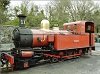
Andy Cundick Posted July 7, 2021 Share Posted July 7, 2021 It always interested me in how the various items of stock were coupled ,granted the locos had both couplings but coupling chopper centre couplings to three link with the added fun of buffering up with the distinct chance of a buffer punching out the corner of the narrow gauge vehicle.and yet most photos show both gauges of stock in trains.Memo to self must dig out the Avonside kit.Andy. Quote Link to comment Share on other sites More sharing options...
NIR Posted July 7, 2021 Share Posted July 7, 2021 I notice the crossways setts seem to indicate a building entrance, another clue to add to the mystery photo. Quote Link to comment Share on other sites More sharing options...
Chris_w Posted July 7, 2021 Share Posted July 7, 2021 Hadn’t thought about crossways sets and entrances. If the last photo is the location, then when did the broad gauge bit get added. It’s a mystery. Quote Link to comment Share on other sites More sharing options...
airfixfan Posted July 7, 2021 Share Posted July 7, 2021 53 minutes ago, Chris_w said: Hadn’t thought about crossways sets and entrances. If the last photo is the location, then when did the broad gauge bit get added. It’s a mystery. Send me a PM about the LPHC? Quote Link to comment Share on other sites More sharing options...
Chris_w Posted July 8, 2021 Share Posted July 8, 2021 Sorry, what’s a PM? Quote Link to comment Share on other sites More sharing options...
Galteemore Posted July 8, 2021 Share Posted July 8, 2021 (edited) Personal messenger. Click on Airfixfan’s name and it should come up as an option - an icon of an envelope …. Edited July 8, 2021 by Galteemore Quote Link to comment Share on other sites More sharing options...
Chris_w Posted July 8, 2021 Share Posted July 8, 2021 Thanks Galteemore 1 Quote Link to comment Share on other sites More sharing options...
Irishswissernie Posted July 8, 2021 Share Posted July 8, 2021 I don't think my photo is the location, it is just another one of the general area, however I reckon the crane being used to load the bell photo is the same crane that is in the background of mine. Quote Link to comment Share on other sites More sharing options...
Chris_w Posted July 8, 2021 Share Posted July 8, 2021 On 7/7/2021 at 11:34 AM, Chris_w said: Thanks for the replies. Unfortunately, there’s nothing to say where that mixed gauge phot is actually located. Looking at the photo in question, the following observations: - it’s facing north with the river bending to the left - the dual gauge track always had the ‘common’ rail on the landward side - the building on the left is on the landward side and some of it’s features seem to match where I have indicated with arrows - it can’t be where the previous person indicated between warehouses and transit shed - not enough tracks and wrong direction - there are very few locations where dual gauge track does not exist My drawings show (early 1960s): - 1 broad gauge track parallel with the dual gauge track leading up to the wagon turntable on the bridge - continuation of this line beyond the bridge has a short section of 4 rail dual gauge track which stops at the fence boundary - another track in the vicinity is narrow gauge (see photo looking back at Foyle Road station with the BCNR / LMS / NCC / UTA good depot in front of it). Note: I haven’t plotted that one yet, because I think it was gone by the 1960s. Should have included key. Don’t know. Need more photos…… Quote Link to comment Share on other sites More sharing options...
NIR Posted July 8, 2021 Share Posted July 8, 2021 (edited) 19 hours ago, Chris_w said: It’s a mystery As well as an entrance out of sight to the left, as indicated by the crossways setts, I think we can assume the tracks were further apart before converging to round a corner of some sort to the left (see 03:22 and 06:10) Edited July 8, 2021 by NIR 1 Quote Link to comment Share on other sites More sharing options...
NIR Posted July 8, 2021 Share Posted July 8, 2021 (edited) Building entrance, corner, converging tracks. I'm even seeing the track formation right there at the corner https://britainfromabove.org.uk/en/image/XAW027080 Edited July 8, 2021 by NIR Quote Link to comment Share on other sites More sharing options...
Chris_w Posted July 8, 2021 Share Posted July 8, 2021 Maybe…. Done some drawing / photo comparisons…. What do you think? Close up of track drawing…. Quote Link to comment Share on other sites More sharing options...
airfixfan Posted July 8, 2021 Share Posted July 8, 2021 LPHC officially closed by end of August 1962. Little used after 1959 and was sent some photos of LPHC last week from 1960. All LPHC lines were mixed Gauge track up to the LPHC boundary posts. Have many photos of LPHC lines alongside Foyle on the East bank of the river. Quote Link to comment Share on other sites More sharing options...
Chris_w Posted July 8, 2021 Share Posted July 8, 2021 Hi, would you be willing to share them online or privately? Quote Link to comment Share on other sites More sharing options...
airfixfan Posted July 8, 2021 Share Posted July 8, 2021 (edited) Private yes as some are for a future book I am working on for next year Edited July 8, 2021 by airfixfan 1 Quote Link to comment Share on other sites More sharing options...
Chris_w Posted July 23, 2021 Share Posted July 23, 2021 (edited) LOCATION SOLVED……… Edited July 23, 2021 by Chris_w Update 1 Quote Link to comment Share on other sites More sharing options...
Irishswissernie Posted July 23, 2021 Share Posted July 23, 2021 On 7/7/2021 at 12:38 PM, Irishswissernie said: I would go for here just north of the City Goods Depots. Its another enlargment of a Britain from the Air photo Thanks for confirmation of where I thought it was Quote Link to comment Share on other sites More sharing options...
Chris_w Posted July 23, 2021 Share Posted July 23, 2021 Thanks. However, it’s not another Britain from the Air photo. There aren’t a huge number of those and most are limited to NI. The best source of other aerial photos is found on the website of the National Library of Ireland. I think I’ve only found ~4 aerial photos from BfA. Most of the rest are NLI. There are also some newspaper ones (based in Belfast) - can’t remember the name off hand. Quote Link to comment Share on other sites More sharing options...
Recommended Posts
Join the conversation
You can post now and register later. If you have an account, sign in now to post with your account.