

Chris_w
-
Posts
43 -
Joined
-
Last visited
Content Type
Profiles
Forums
Resource Library
Events
Gallery
Blogs
Store
Community Map
Posts posted by Chris_w
-
-
On 4/12/2023 at 5:15 PM, TimO said:
@Chris_w Thank you for these very interesting maps. The development of Letterkenny is particularly fascinating. Sorry I cannot help you with the photos.
Glad you liked them. Any corrections welcome. Currently working on Killybegs.
-
DONEGAL TOWN
Plans showing the evolution of Donegal railway station using available information.
The original jpg images did show enough resolution. Hopefully these PDFs will be much better.
-
 5
5
-
-
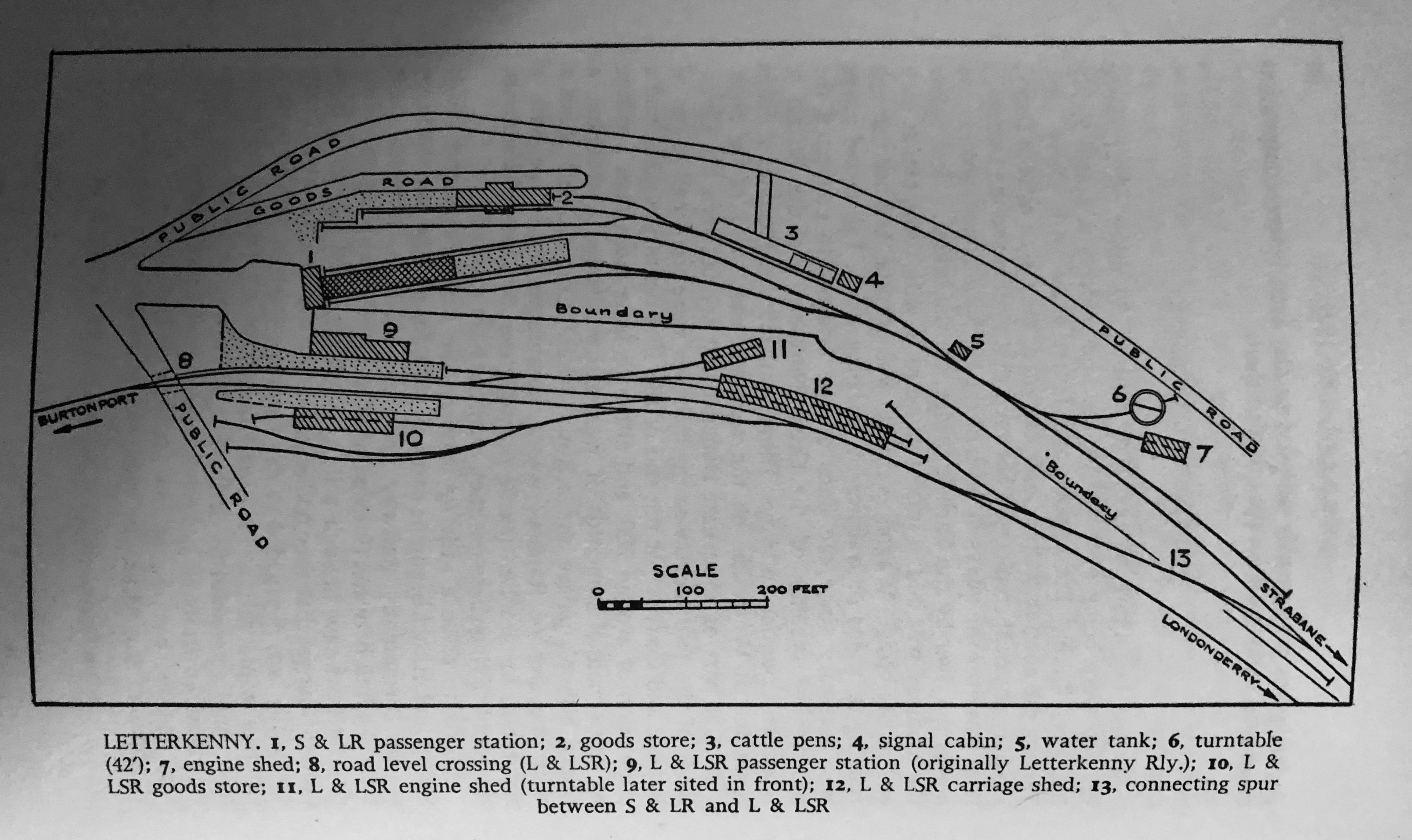
LETTERKENNY
Plans showing the evolution of Letterkenny railway stations using available information.If you look at the insert for 1901 you’ll see reference to 1 or 2 photos. Does anyone have any other photos showing the early L&LSR station from other angles? It would enable completion of a 1901 plan.
The original jpg images did show enough resolution. Hopefully these PDFs will be much better.
-
4
-
 1
1
-
-
I have reached a stage where I can’t do any more for Derry-Londonderry without the 1848 plan and inter-war revisions (1920s/30s). So here is my current state of Londonderry Railway Evolution…….
Once again I’ll ask if anyone can visit the National Archive of Ireland and PRONI with a digital camera to take shots to allow me to finish Derry. Anyone????

-
On 2/8/2019 at 9:15 AM, Dhu Varren said:
I have a 40ft to 1in scale drawing of the whole station site which includes the trackplan, and the floorplan of buildings. I obtained this from NIR some 40 years ago when I was building a layout of Londonderry Waterside.
If there is any specific area(s) you are looking for plans of, let me know and I can photograph the appropriate part of the drawing. Unfortunately the drawing is 4.5ft long by 1.5ft wide, so is too big to copy in one piece.
Just noticed your post. Is there any chance you could photograph the track plan, floor plans, etc.? Obviously, it would have to be in sections. I could join them together. Currently working on Waterside evolution - E1960s, 1973, 1986. Have material for c.2019. 1973 shown below.

-
1
-
-
That’s OK. Glad it was of some use.
Thanks for the link. That was new to me

-
1
-
-
On 19/3/2023 at 2:24 PM, Colin R said:
The hardest bit for me is to try and work out the various heights from water level up to the trackbed and then on up to the road level, you can only get so much detail from maps.
I have been buying digital copies of Parliamentary plans attached to various Bills and Acts.
HL_PO_PB_3_plan1846_L65.Londonderry Railway
Contact the Parliamentary Archives with this reference if you want to obtain this plan and other documents. They are very helpful.
I know I’m breaking copyright, but it’s only a small portion of this particular plan. Not sure whether this was part of one of the finished schemes. The point is it gives heights above a datum (doesn’t say what that was) and some other heights. Almost looks like ground level; again there just isn’t enough information on the plans. You would probably need to obtain supporting documents with written details. Still it might give you a starting point. Note the gradient of the proposal is shown.
Try cross-referencing with OS spot heights on their plans.
Hope this is of some help (?)
-
1
-
-
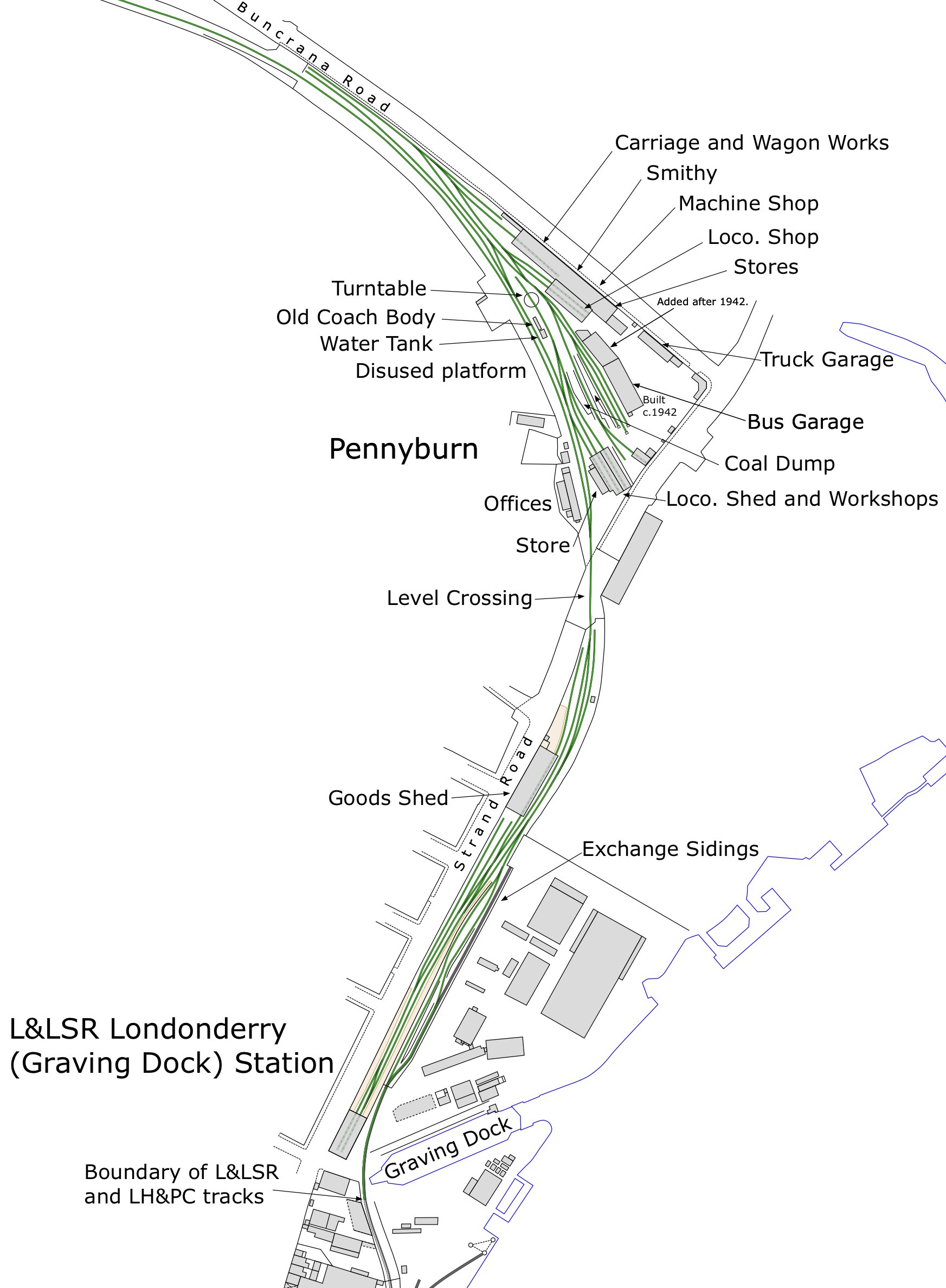
On 2/4/2023 at 5:27 PM, Chris_w said:
Can anyone help with questions on this attached infographic? I’ve only found one photo of the ‘mystery’ siding. Hard to date, but definitely before WWII.
Also found no evidence of that coach body being located by the water tank earlier than 1948.
Any help welcomed; especially photographs.
Corrections: c.1907 = photo is dated May 1921.
-
I bought 2 of the former and 1 of the latter in digital form. Hardly anything of relevance in the bus magazine. An unexpected side was mention of 2 ex-South Down coaches. I do remember seeing South Down buses when I was very young in Lancing / Brighton. The anonymous photo collection looks interesting. I’ll email you separately about that.
-
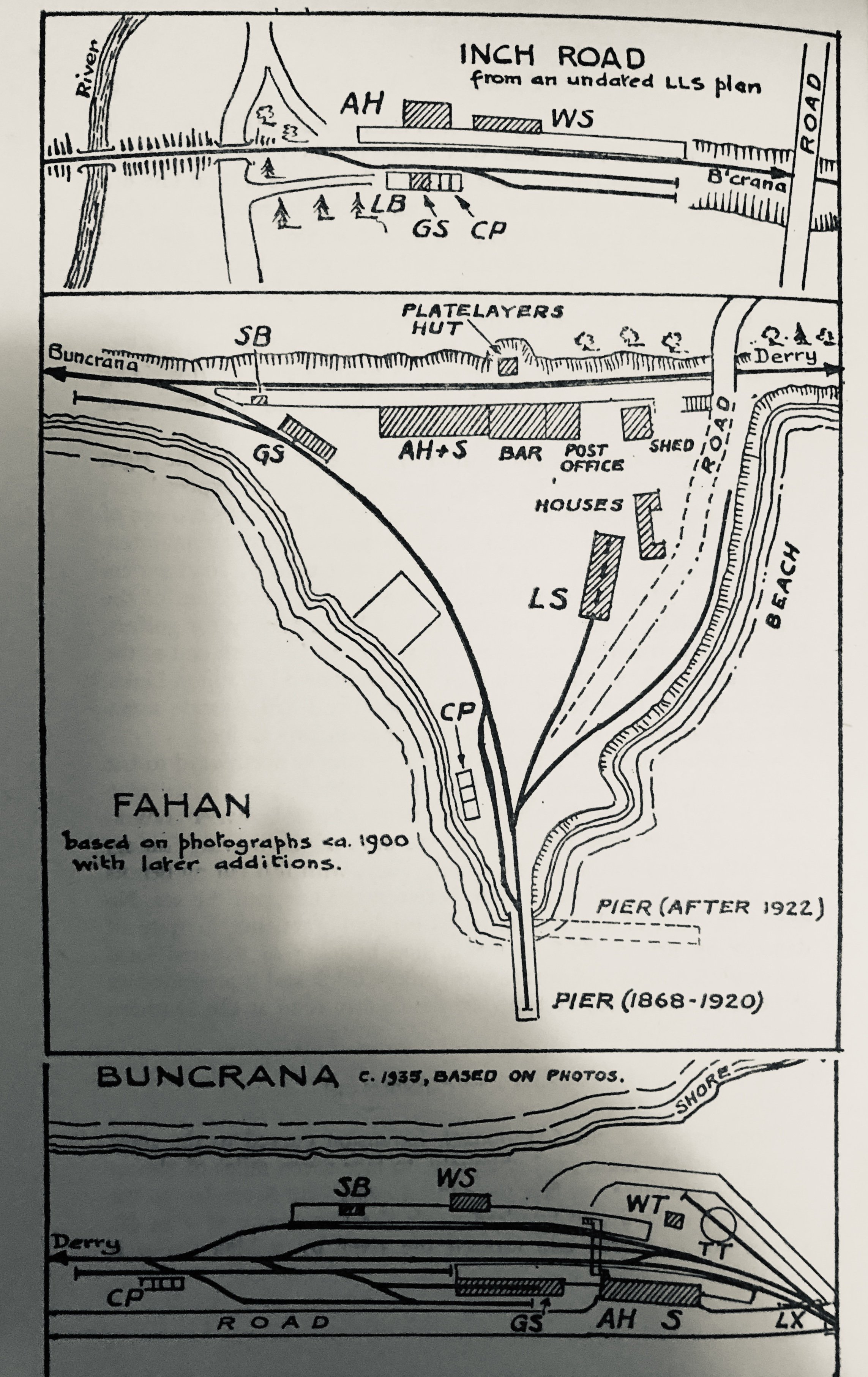
Has anyone got early photos of L&LSR Pennyburn before the mid 1920s - preferably WWI and earlier?
-
Can anyone help with questions on this attached infographic? I’ve only found one photo of the ‘mystery’ siding. Hard to date, but definitely before WWII.
Also found no evidence of that coach body being located by the water tank earlier than 1948.
Any help welcomed; especially photographs.-
1
-
-
-
Can you let me know when it’s available? Is this one of your articles??
-
I have thought about Letterkenny; even got some extra OS plans, etc. BUT, still got a lot to do on Derry. Need that information from Derry Archives
 .
.
-
1
-
-
You know the OSNI plans (1:1250 & 1:2500) have spot heights in metres. Earlier OS (1940s) we’re probably in feet. So, it’s possible to get a general idea of levels.
-
2
-
-
Thank you
. Hope you’ve seen my plans on Strabane and Derry-Londonderry on separate threads.
Currently working on Derry-Londonderry. A Guide has been finished. Plans showing the whole of City (railway parts) are finished except the earliest. Now working on the individual stations, allowing for more detailed evolution. This is taking a long time, hence my publishing on this site. After that…. Return to original intention of producing plans showing the evolution of CDRJC (and constitutes). Next will either be Donegal or Letterkenny. Don’t hold your breath
 .
.
-
4
-
-
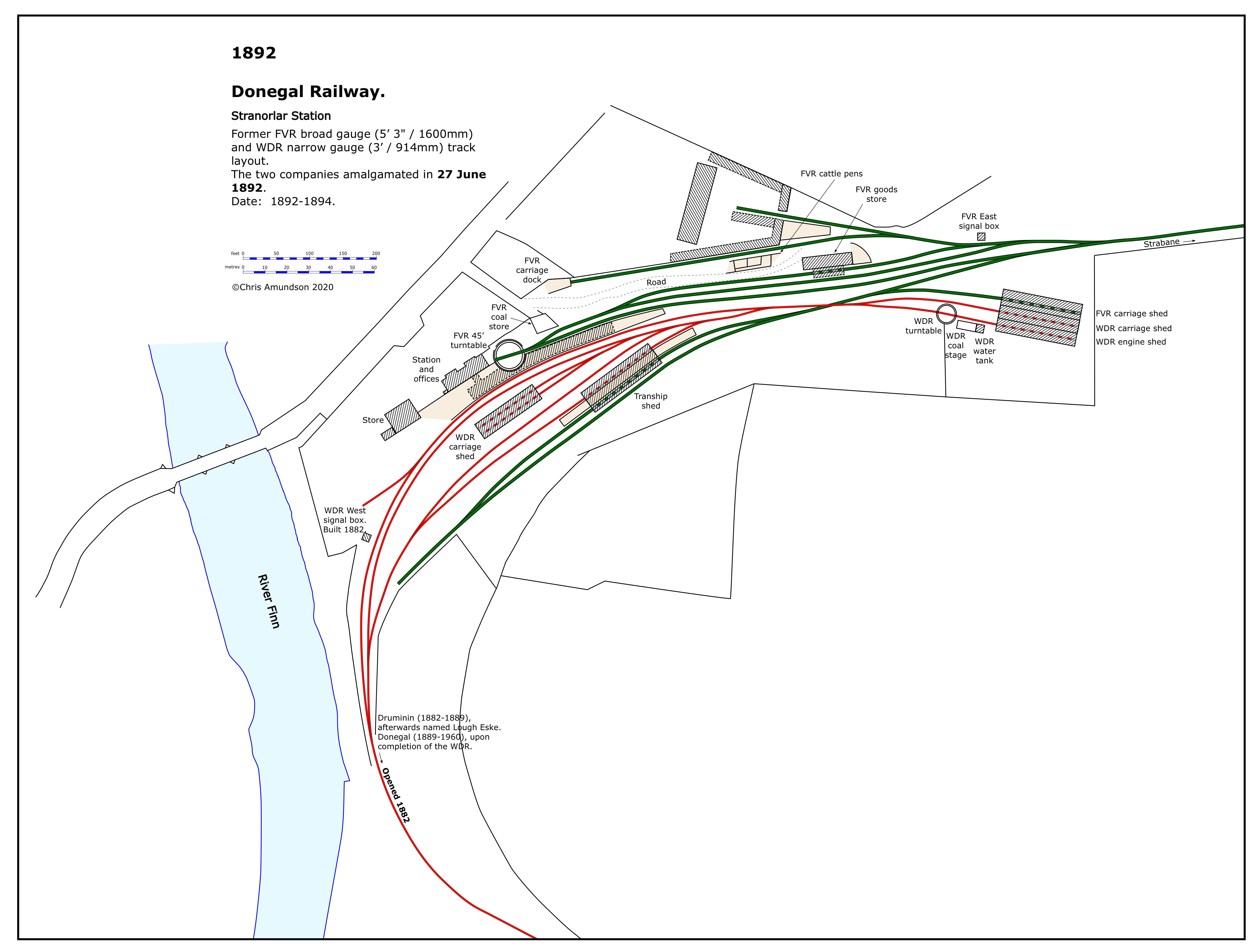
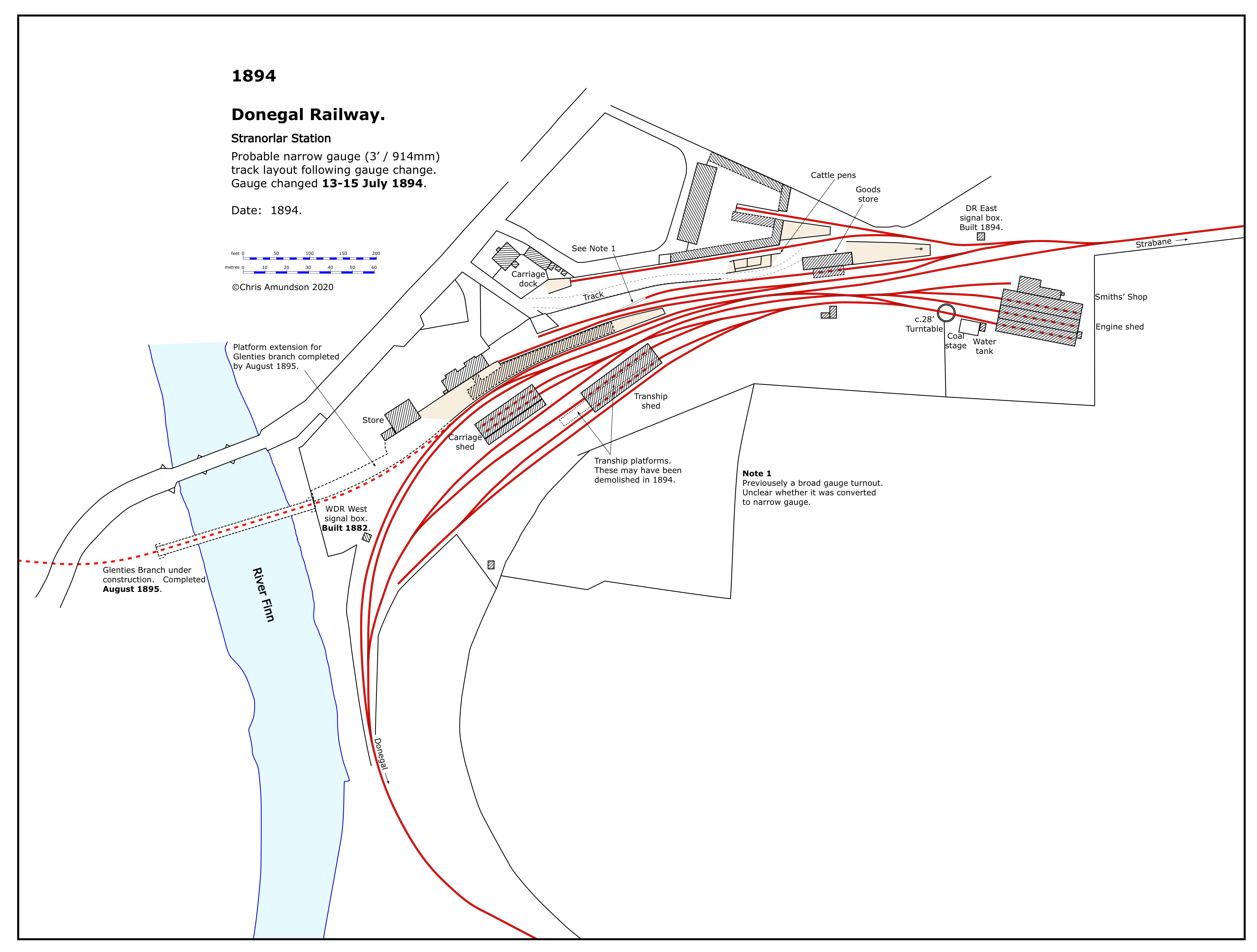
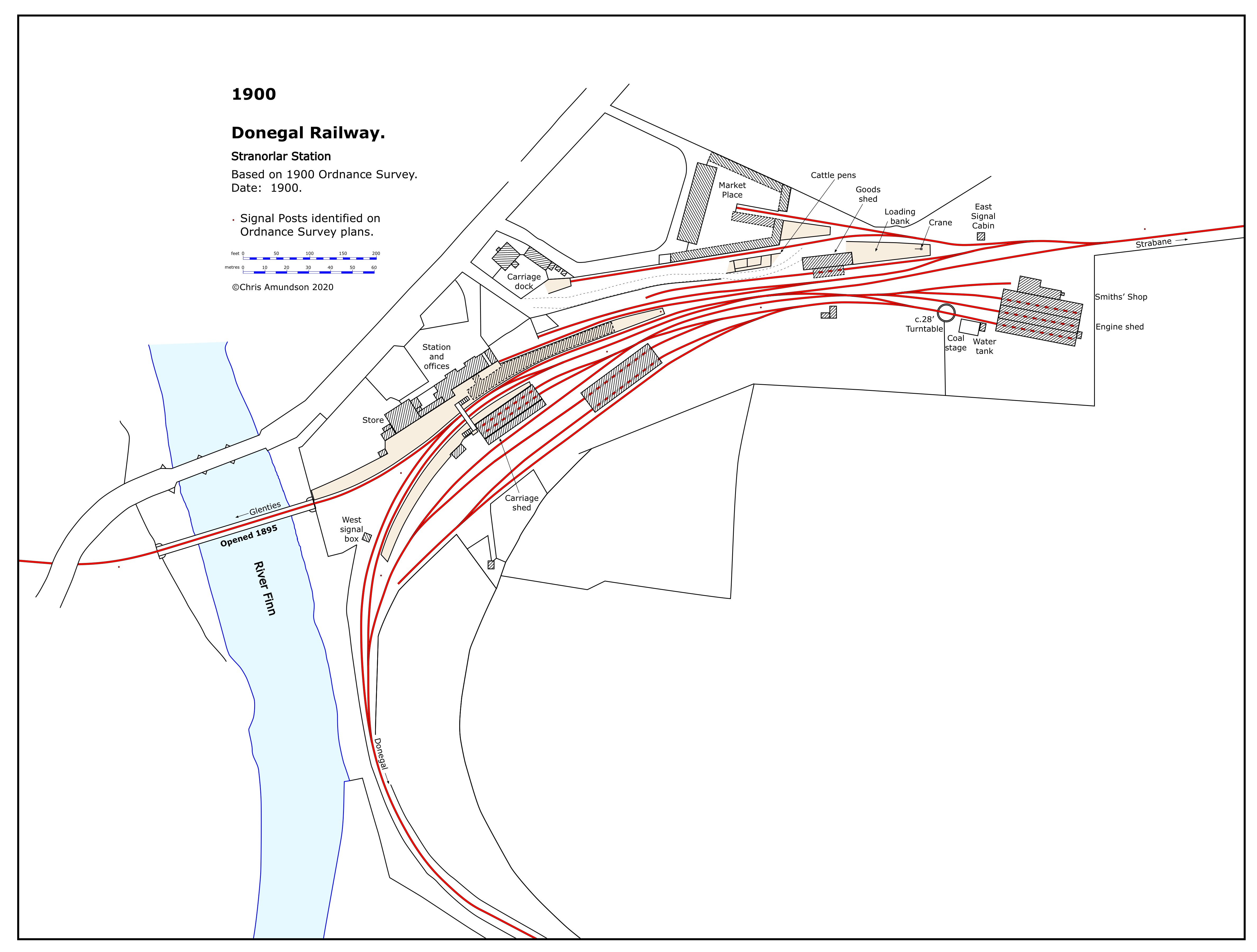
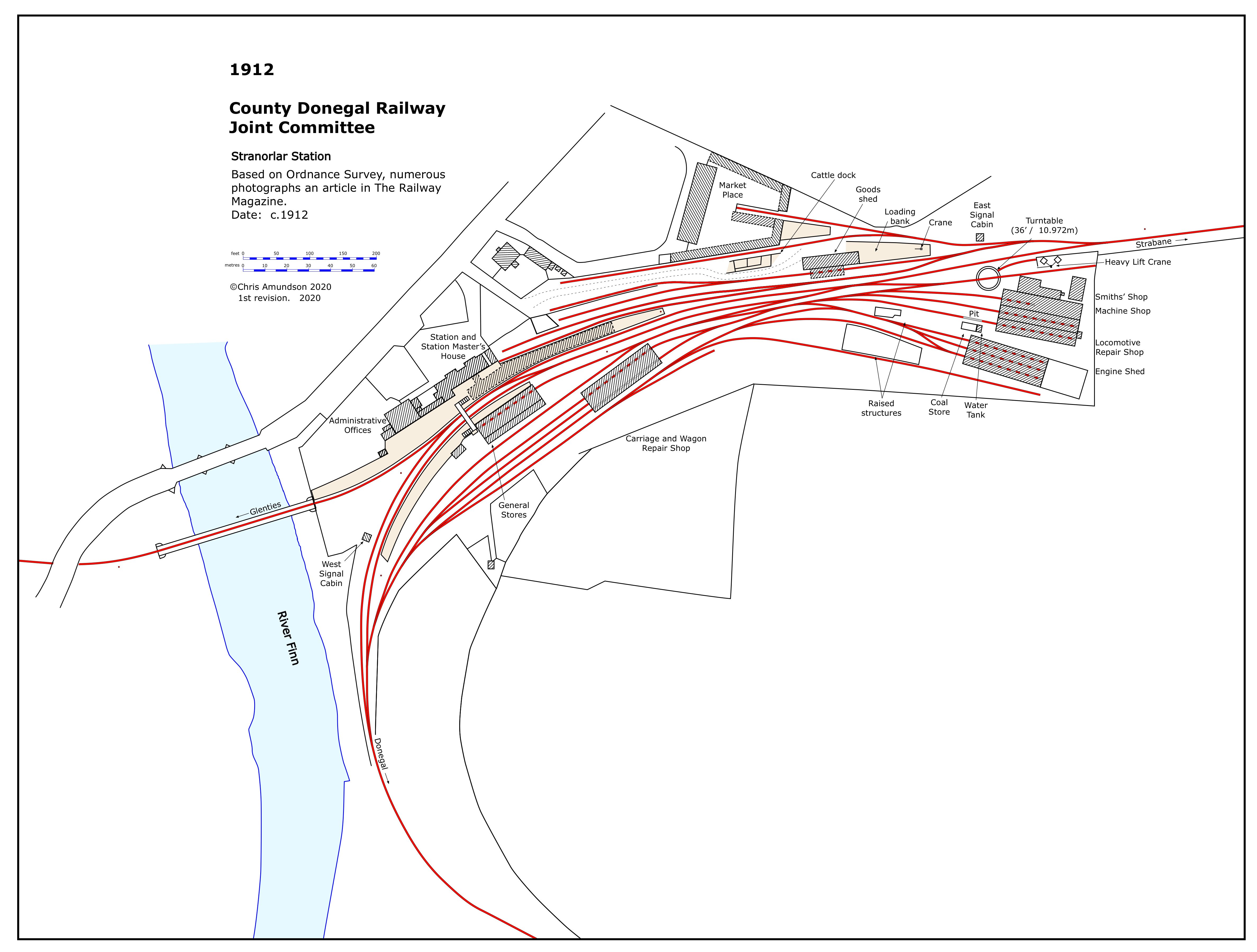
Following my publishing Strabane station evolution plans on that thread, I’m now doing the same for Stranorlar.
-
7
-
 1
1
-
2
-
 2
2
-
-
Decided to upload complete set of Strabane
-
5
-
2
-
-
On 27/12/2022 at 9:21 AM, Irishswissernie said:
, I have about 500 Irish views scanned but not titled up
Hi, Happy New Year.
Do you know if any of the 500 have anything on Derry-Londonderry?
-
1
-
-
A request….
Can anyone help trying to find an original of the 1848 map / plan of Derry-Londonderry drawn by the Ordnance Survey for the Corporation?
I believe the National Archive of Ireland may have one. There response for making a copy is difficult for me. If anyone is ever there, could they use a digital camera (smartphone) to photograph the small section of the plan? Although there is an online digital copy labelled 1848; it is in fact a revised version dating from c.1856.
I’m attaching an infographic to illustrate these comments and identify the area required. It would be the only railway in Derry-Londonderry at the time. The ‘Gallows Strand’ terminus.
-
2
-
-
Scale…. That’s actually a difficult one. They are based OS plans 1:2500, but they are not reproduced to any particular scale. Each complete plan (map) does have a dimension scale so that you can measure. That’s the best I can do for you.
This is the bottom half of the complete plan.
-
1
-
1
-
1
-
-
Strabane 1947 (
 CRA 2020)
viewable on Flickr.
-
4
-
-
On 15/4/2020 at 10:55 PM, jhb171achill said:
Here ye are, Colin:
There are more, e.g. Strabane, Donegal and Killybegs, if you want - but that’s the ones you were looking for plus a few others.
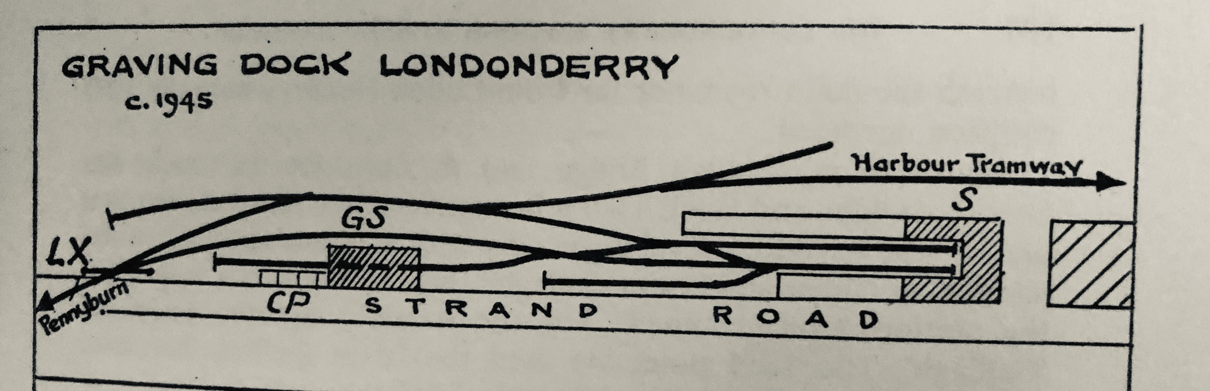
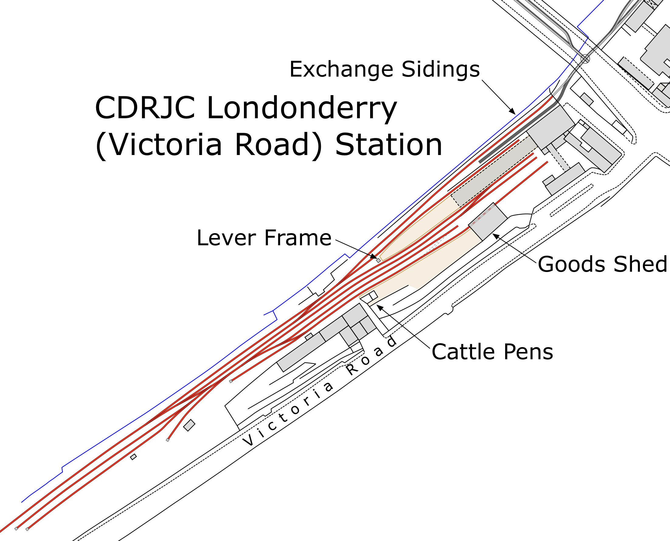
Reference "Victoria Road" station. Attached is an extract of a plan I’ve produced (
CRA 2020) for 1948-49.
Reference "Graving Dock" / Pennyburn. Another extract (
CRA 2020) for 1953.
Considering that the authors actually visited these places they didn’t get a lot of the details right, especially the L&LSR.
Hope they’re useful.
-
3
-
1
-
-
On 13/5/2022 at 8:36 PM, Irishswissernie said:
The second is U2 No 81 which was built 1925 , any ideas on the location - I'm thinking Portrush and the loco is partly on a turntable.
Ideas anyone?
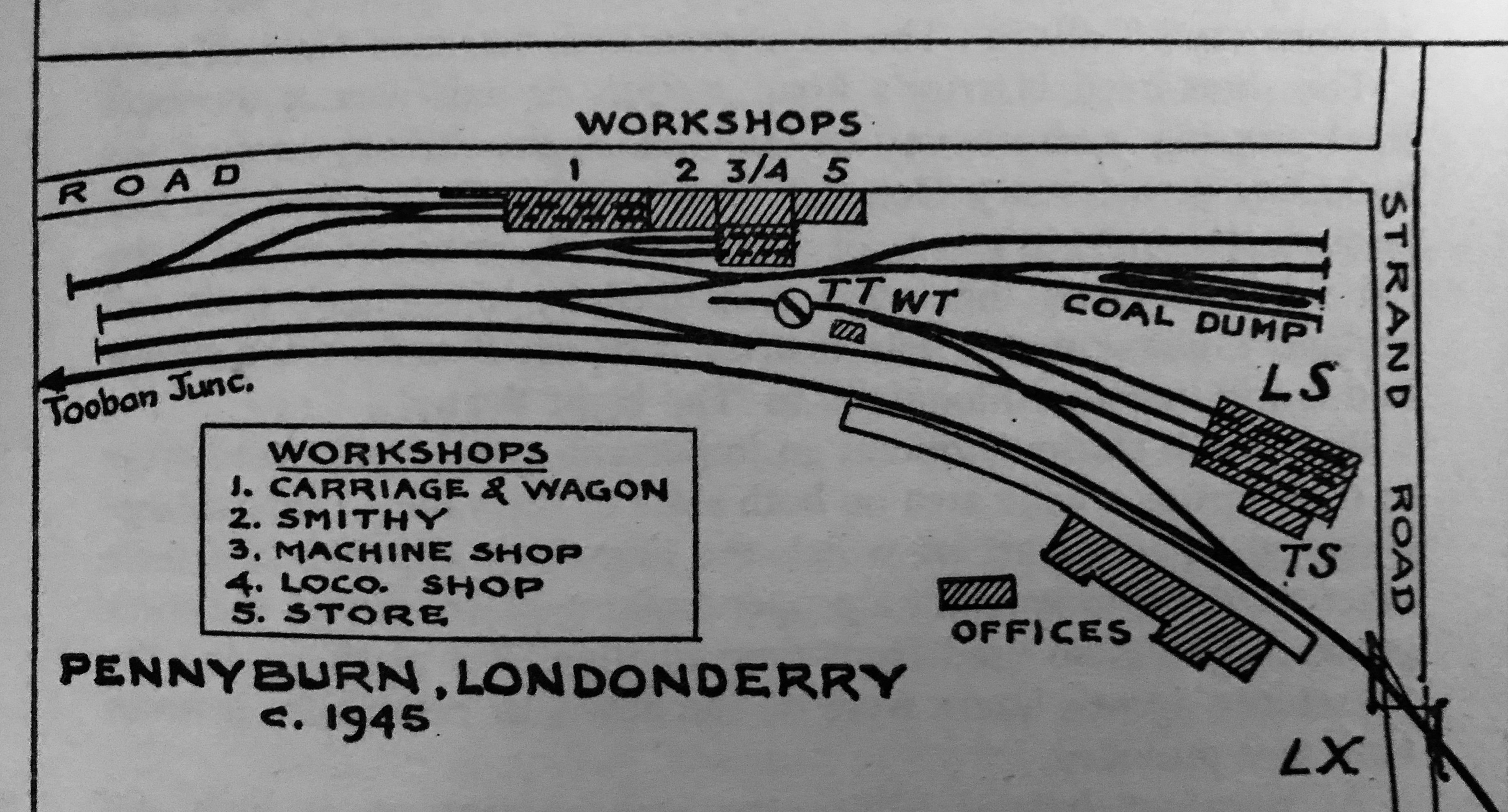
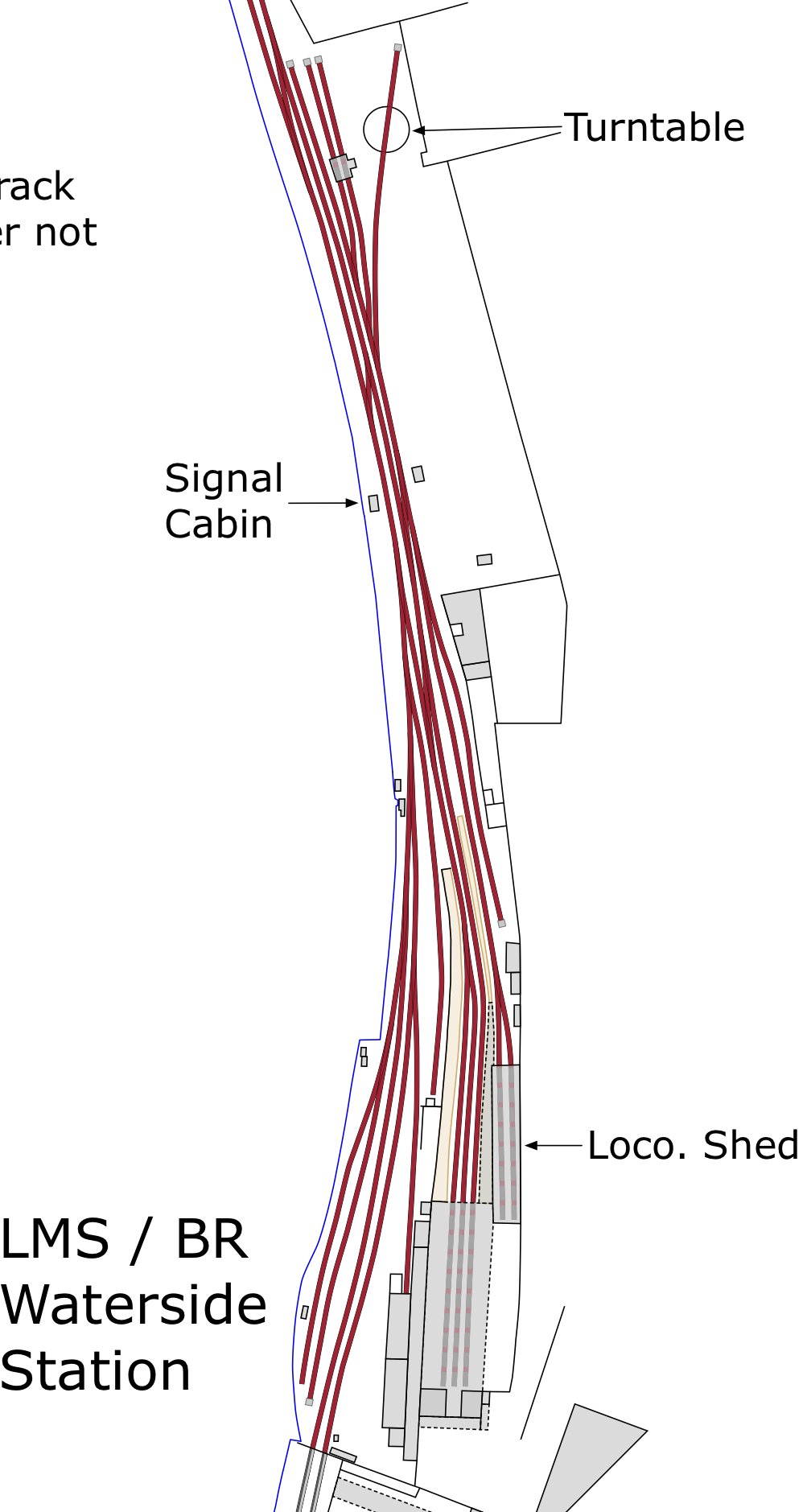
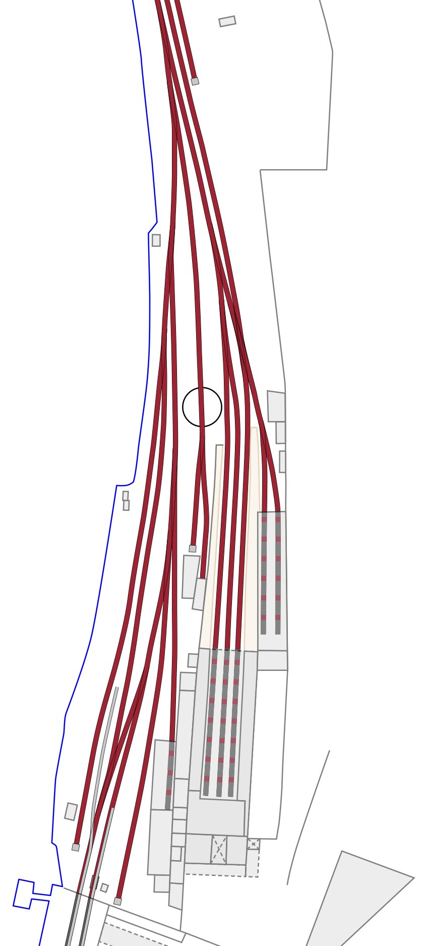
My painstakingly slow progress on Derry-Londonderry plans showing evolution of railways in the City have been finished (I hope) for early 1960s and late 1940s. Currently working on 1908.
Attached are extracts from my work on Waterside, showing locations of the turntable at different times.
The OS 1908 scale 1:1056 plans are the only ones that show dual-gauge track with 3 rails. Basically, it’s a revision of the 1873 1:500 scale plans; reduced to 1:1056. Sadly it doesn’t cover Pennyburn, but that’s another story.
Hope these help.
-
3
-
1
-


CDRJC & L&LSR & Derry
in General Chat
Posted
Hello. This is an update on my evolution of stations plans for Donegal and Derry.
I have found good ‘homes’ for them now:
- Donegal Archives (each station is a single PDF file of multiple pages) - available to view at the Archive.
- Donegal Railway Heritage Museum (same format) - available to view at the Museum.
- University College Dublin (Map Collections at UCD and on the Web) - link to UCD website and link to Flickr below:
https://libguides.ucd.ie/findingmaps/mapstheme
https://www.flickr.com/photos/spw45/with/53122169542
These will be updated when stations are finished / updated. Currently available:
- Derry / Londonderry (detailed plans and a Guide)
- Strabane (includes Lifford and former FVR junction)
- Stranorlar
- Donegal (Town) (includes temporary terminus at Druminin / Lough Eske)
- Killybegs
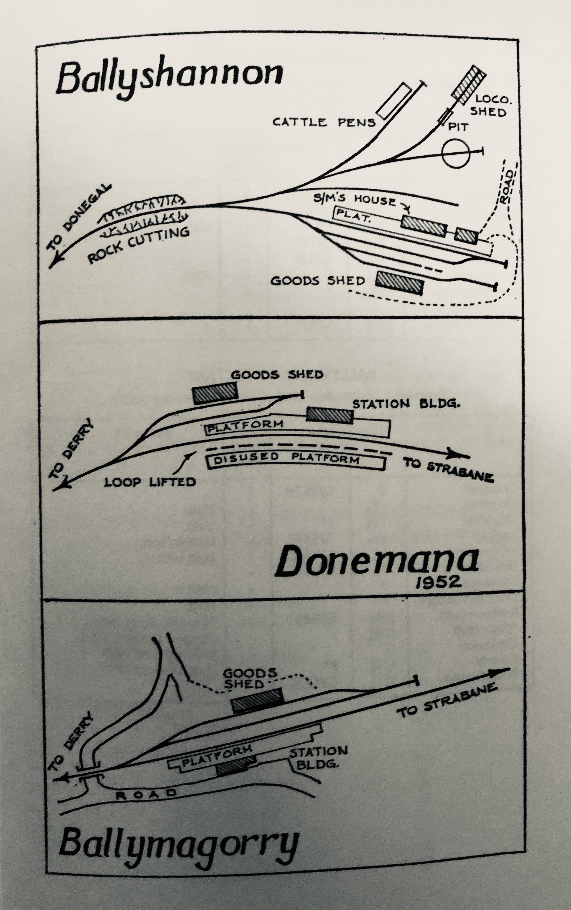
- Ballyshannon
- Glenties
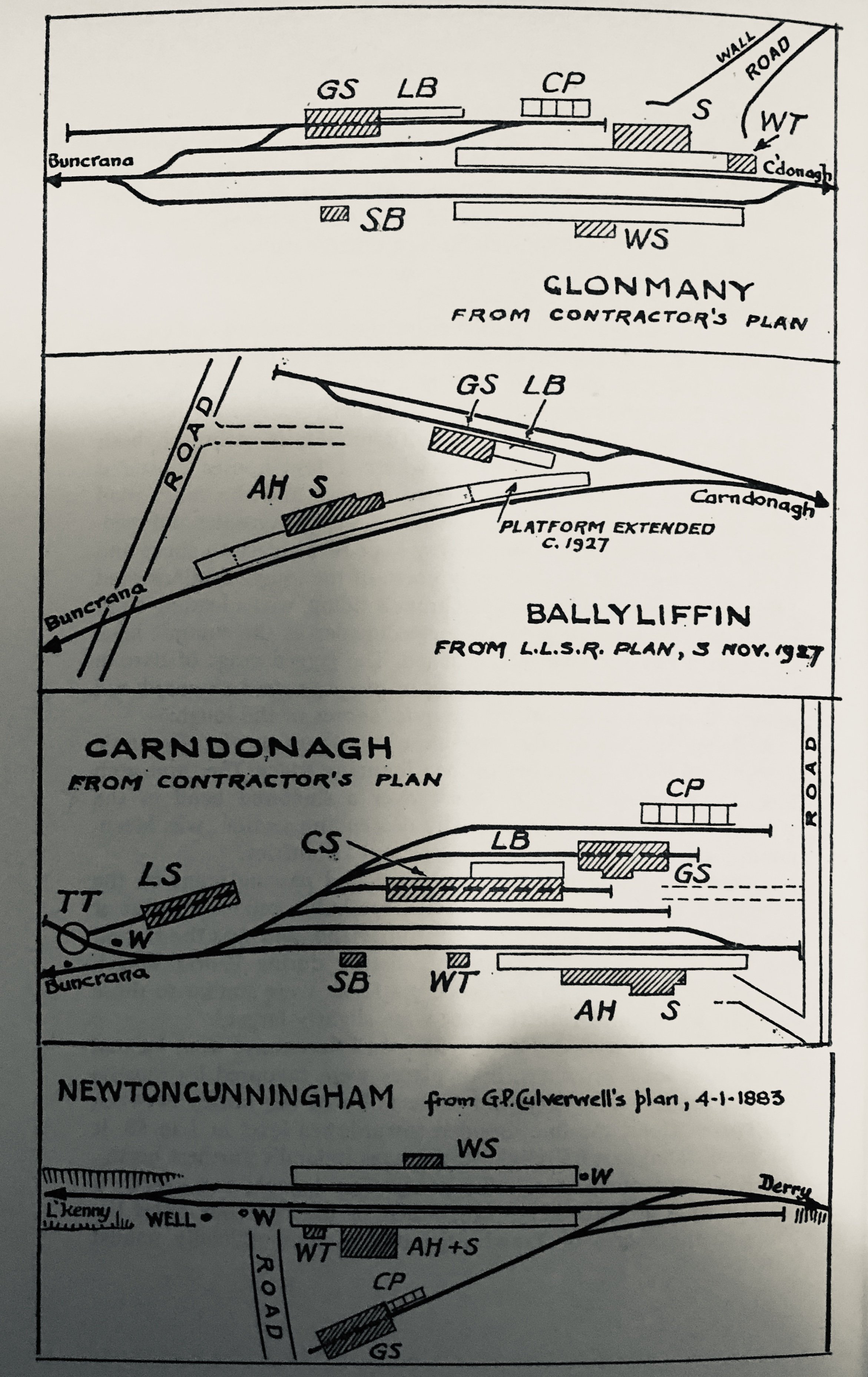
- Letterkenny
Now working on intermediate stations.