Chris_w
Members-
Posts
51 -
Joined
-
Last visited
Chris_w's Achievements
-
Proposed Donegal congestion railways from the 1880's
Chris_w replied to Colin R's topic in General Chat
In addition to being hosted on the University College Dublin website, my maps / plans are now also hosted on the CIE Archives website. https://www.cie.ie/who-we-are/heritage-and-archives/cie-group-archives/archives-blogs-and-links/atlas-of-the-railways-of-north-west-ireland Intermediate stations and halts being prepared. Nearly finished Glenties branch. That will leave only the S&LR to be drawn. Sometime in 2026 I hope. CIE have done an excellent job. -
Proposed Donegal congestion railways from the 1880's
Chris_w replied to Colin R's topic in General Chat
Try my best. Glad you like them. Hope they’re useful. -
Proposed Donegal congestion railways from the 1880's
Chris_w replied to Colin R's topic in General Chat
Thank you. They’re there to be shared. All I ask is appropriate credit where applicable. Still working on intermediate stations and halts. None have been published yet. So far I’ve completed: - Strabane - Stranorlar - Stranorlar - Donegal (Town) - Donegal (Town) - Killybegs - Donegal (Town) - Ballyshannon Working on: - Strabane - Londonderry / Derry (Victoria Road) To be done: - Stranorlar - Glenties - Strabane - Letterkenny. Then we’ll see what happens…… If I do any more, it’ll be the L&LSR (at least the main stations). -
Proposed Donegal congestion railways from the 1880's
Chris_w replied to Colin R's topic in General Chat
The finished atlas is now available on the University College Dublin website. https://libguides.ucd.ie/findingmaps/mapstheme Go to this link. Go to the right side of web page and then scroll down to Railway Maps. Further down you will find PDFs and the ‘Railways of North Western Ireland: An Atlas Through Time’. The 2 maps I posted here are now superseded by this finished atlas. -
Proposed Donegal congestion railways from the 1880's
Chris_w replied to Colin R's topic in General Chat
Railways of North West Ireland: An Atlas Through Time. https://drive.google.com/file/d/1N_tY68-C68MJL0o6r_1TNtO1FiVOoSRB/view This link should take you to the completed atlas, hosted on the University College Dublin website. Please let me know if there are any problems accessing it. This file is on a Google Drive, in case you wonder what’s happening. All my other completed plans are available on the UCD website as PDF files: https://libguides.ucd.ie/findingmaps/mapstheme Hope they are of interest and help. These are now superseded by those in the completed atlas. -
Proposed Donegal congestion railways from the 1880's
Chris_w replied to Colin R's topic in General Chat
The links you asked for: - to my Flickr plans of evolution of CDRJC stations (only the main ones at present; working on intermediate stations) https://www.flickr.com/photos/spw45/ - to Frank Sweeney PhD https://mural.maynoothuniversity.ie/id/eprint/5278/ I’m sorry I am not familiar with the places you mentioned. I’m not Irish nor do I live in Ireland. Sorry. -
Proposed Donegal congestion railways from the 1880's
Chris_w replied to Colin R's topic in General Chat
Thanks very much So far, there will be about 26 maps in the atlas. It will be made available via the University College Dublin website. I am aware of other proposed railways, but not been able to find maps of routes. Main source here has been the UK Parliamentary Archives (not free!). Very helpful though. Highly recommend Frank Sweeney PhD. Don’t forget the other sources, such as the revised editions of Dr EM Pattersons histories of the CDRJC and L&LSR. If you do write a book then please contact me about maps. -
Proposed Donegal congestion railways from the 1880's
Chris_w replied to Colin R's topic in General Chat
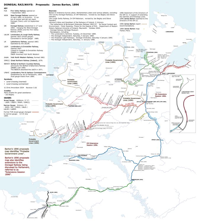
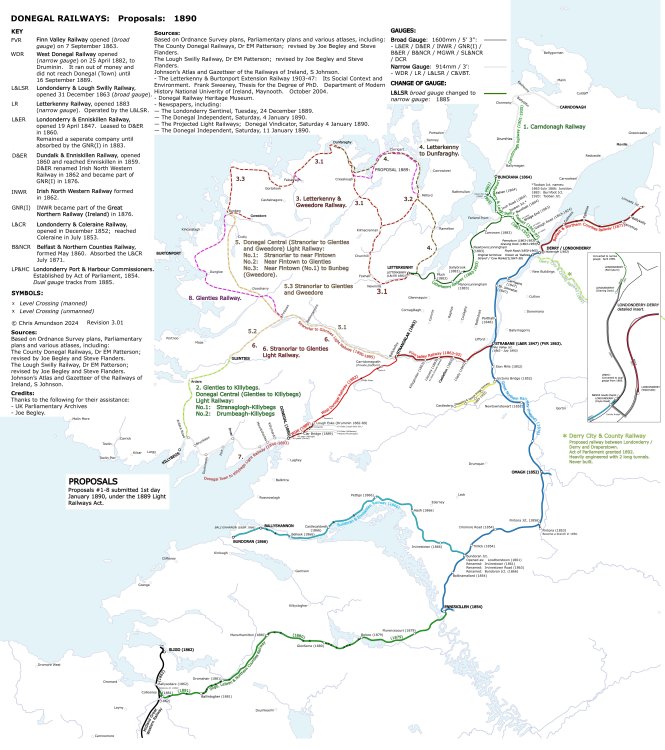
Hope this information is not too late or no longer of interest … jhb: one of the best sources of information on NW Donegal, Congestion, Light Railwys and the social conditions is the PhD by the late Frank Sweeney. https://mural.maynoothuniversity.ie/id/eprint/5278/ The link is to the University where he did his research and download links to the 2 parts of the research. Part 1 is the one you’ll be most interested in. The maps are not the best, but I’m working on an atlas of NW Ireland. A couple of sample pages are attached. Buncrana is not one of these lines. That was the Sligo, Buncrana & Enniskillen Railway. They were slow to go beyond Buncrana (money) and the SL&NCR got to Sligo first. As a result, the SB&ER sort an Act of Parliament to drop the Sligo extension. I MADE A MISTAKE. Confusing Buncrana with Bundoran! My comments were not about Buncrana. Sorry about the mixup. The other lines: - CDRJC (Donegal Railway): Glenties branch, Killybegs branch were Government funded (re. Light Railways Act 1889, Congested Districts Board / Commission. - L&LSR: the Carndonagh ‘railway’ and the LB&ER were Government funded projects. (YES Buncrana to Carndonagh). Light Railways Act 1889: Sparked a lot of schemes (see Sweeney). I’ve not been able to determine how many lines were surveyed. The 1896 reference is to the map attached to the Barten Report with more schemes. The Donegal Railway Heritage Museum map contains an error. It shows the Killybegs branch extended to Teelin Pier. This section was never part of the Killybegs branch, but was an aspirational proposal. Design periods: Strabane - Stranorlar was originally the broad gauge Finn Valley Railway. Stranorlar - Donegal (Town) was the narrow gauge West Donegal Railway. -
Chris_w started following CDRJC & L&LSR & Derry and Proposed Donegal congestion railways from the 1880's
-
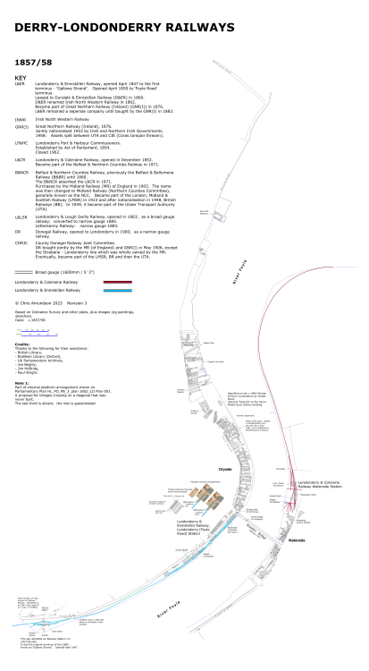
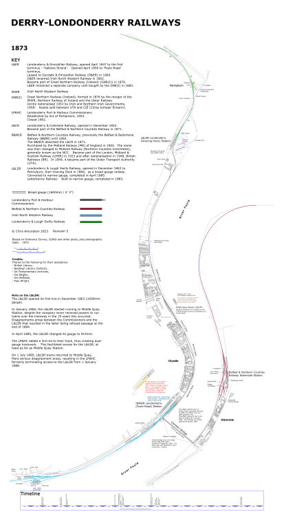
Hello. This is an update on my evolution of stations plans for Donegal and Derry. I have found good ‘homes’ for them now: - Donegal Archives (each station is a single PDF file of multiple pages) - available to view at the Archive. - Donegal Railway Heritage Museum (same format) - available to view at the Museum. - University College Dublin (Map Collections at UCD and on the Web) - link to UCD website and link to Flickr below: https://libguides.ucd.ie/findingmaps/mapstheme https://www.flickr.com/photos/spw45/with/53122169542 These will be updated when stations are finished / updated. Currently available: - Derry / Londonderry (detailed plans and a Guide) - Strabane (includes Lifford and former FVR junction) - Stranorlar - Donegal (Town) (includes temporary terminus at Druminin / Lough Eske) - Killybegs - Ballyshannon - Glenties - Letterkenny Now working on intermediate stations.
-
Glad you liked them. Any corrections welcome. Currently working on Killybegs.
-
DONEGAL TOWN Plans showing the evolution of Donegal railway station using available information. The original jpg images did show enough resolution. Hopefully these PDFs will be much better. Don 1896 FIN4.pdf Don 1900 FIN1.pdf Don 1948 FIN1.pdf
-
LETTERKENNY Plans showing the evolution of Letterkenny railway stations using available information. If you look at the insert for 1901 you’ll see reference to 1 or 2 photos. Does anyone have any other photos showing the early L&LSR station from other angles? It would enable completion of a 1901 plan. The original jpg images did show enough resolution. Hopefully these PDFs will be much better. LK 1904 A FIN5.pdf LK 1948 A FIN3.pdf LK 1954-59 A FIN4.pdf
-
Chris_w started following LMS-NCC-Londonderry Waterside Station.
-
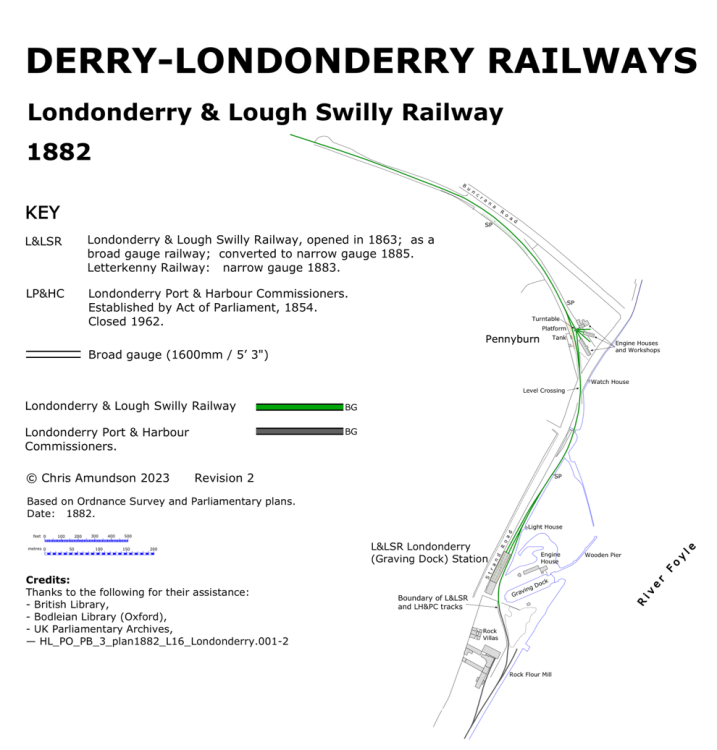
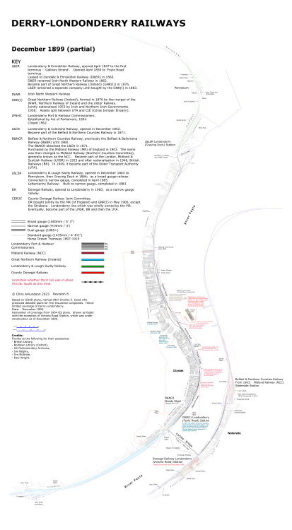
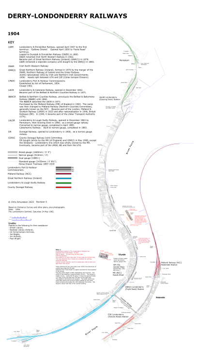
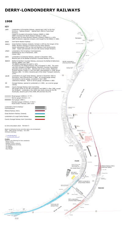
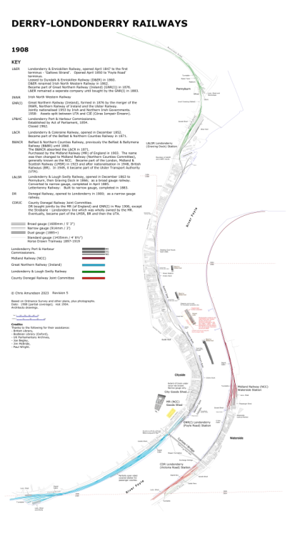
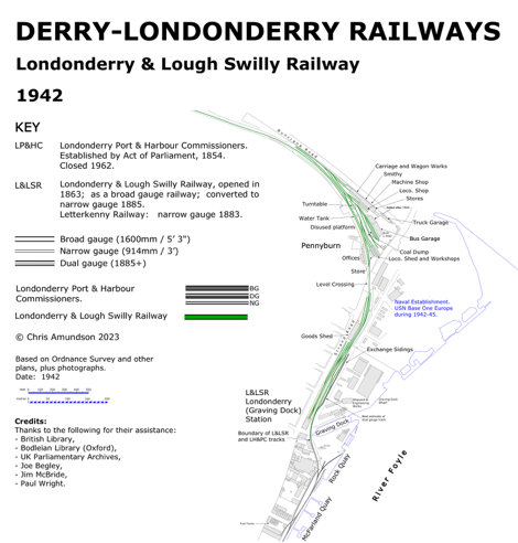
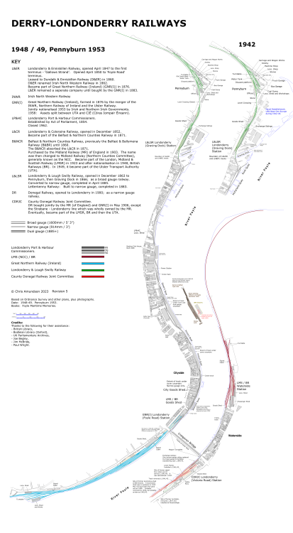
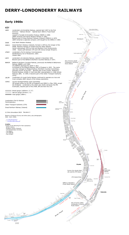
I have reached a stage where I can’t do any more for Derry-Londonderry without the 1848 plan and inter-war revisions (1920s/30s). So here is my current state of Londonderry Railway Evolution……. Once again I’ll ask if anyone can visit the National Archive of Ireland and PRONI with a digital camera to take shots to allow me to finish Derry. Anyone????
-
LMS-NCC-Londonderry Waterside Station.
Chris_w replied to Rails_of_Belfast's topic in Irish Model Layouts
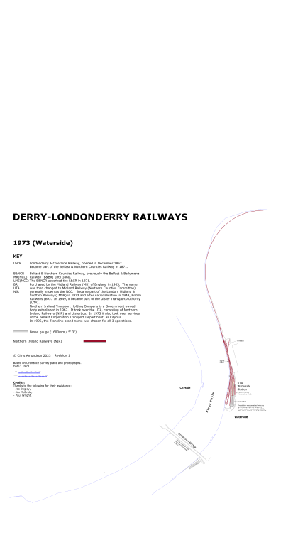
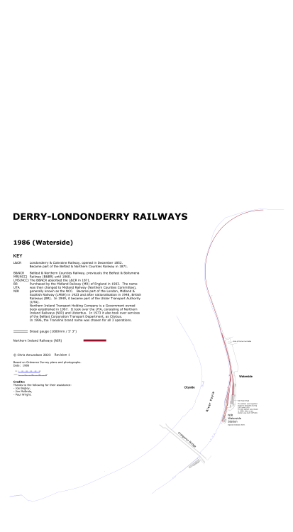
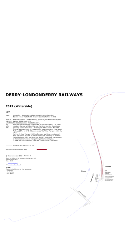
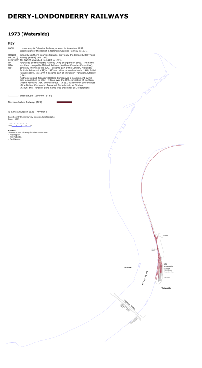
Just noticed your post. Is there any chance you could photograph the track plan, floor plans, etc.? Obviously, it would have to be in sections. I could join them together. Currently working on Waterside evolution - E1960s, 1973, 1986. Have material for c.2019. 1973 shown below. -
Stranorlar County Donegal Railway Station and Yard
Chris_w replied to Colin R's question in Questions & Answers
That’s OK. Glad it was of some use. Thanks for the link. That was new to me
.png.c363cdf5c3fb7955cd92a55eb6dbbae0.png)

