Darrman
-
Posts
148 -
Joined
-
Last visited
Content Type
Profiles
Forums
Events
Gallery
Blogs
Store
Community Map
Everything posted by Darrman
-
There are currently 1,698 (per Wikipedia, citation needed) miles of railway in Ireland. A thought exercise: keep the mileage the same (plus or minus a few miles), but rearrange the places served. For example, closing Portarlington-Athlone to reopen Mullingar-Athlone. I'd close the Nenagh Branch (52 1/2 miles) and in its place reinstate Harcourt Street (10 1/2 miles), the Bandon to Bandon and relevant connections to Kent (21 miles), the Waterford and Tramore (7 1/4 miles, with another half-mile or so to bridge the Suir and flatten half of Waterford in the interest of connecting it to Plunkett), and the County Down to Comber (8 miles). Then I'd close the GNR Navan line if that counts as open (17 1/4 miles) to replace it with the MGWR Navan line (~19 1/2 miles). That's 69 3/4 miles replaced with 66 3/4 miles. Take a mile and a quarter of Kingscourt to have a northern Navan terminus, another quarter-mile to move Rosslare Harbour back to its original site, 3/4 miles of the Drogheda cement branch for a Dart turn back station, and I can't think of anything else to use the last 3/4 miles on.
-

Limerick to Foynes railway reopening plan
Darrman replied to spudfan's topic in What's happening on the network?
https://irishbuildingmagazine.ie/2025/03/28/sisk-completes-track-laying-and-next-phase-of-works-commence-on-limerick-to-foynes-freight-line/ Tracklaying has been completed. Providing the signalling and level crossing upgrades are proposed to take 18 months from here. -
I notice that destination set as Youghal!
-
County Cork? Well, there goes my bank account. I've seen the real thing in Cultra, so I'll gladly add this to my collection.
-
Seeing testing begin on the new Darts is good news. However, I bring bad news from my daily search of Irish Rail. https://www.independent.ie/regionals/dublin/dublin-news/legal-challenges-delay-plans-to-extend-dart-from-dublin-to-maynooth/a346743761.html The headline speaks for itself. Construction is delayed until late 2026-early 2027 pending resolution of legal challenges. As for who to blame, I'll just quote the Independent directly: Considering the state of the Irish justice system (it's of a similar calibre to the Irish planning system), I have little faith in this being resolved swiftly. Can anything be built in this country?
-
Limerick to Foynes railway reopening plan
Darrman replied to spudfan's topic in What's happening on the network?
https://www.limerickleader.ie/news/golf/1745743/rail-boss-issues-positive-update-on-return-of-trains-to-limerick-village-for-ryder-cup-2027.html The prospect of Ryder Cup trains is talked up here. Adare is suggested to receive temporary platforms for January 2027: whether or not the discussions with the National Transport Authority (or No Trains Authority, as some on this forum have dubbed it) will go well is another question. 2027's only two years away and this country's planning system is glacial: I'd be wanting to see boots on the ground before long. -
https://www.echolive.ie/corknews/arid-41586925.html Irish Rail's CEO says Cork should have trains every ten minutes to Mallow, Cobh, and Midelton. "Future-proofing the electrification of the Cork route, with all trains electrical within the next five years" is mentioned: presumably this implies replacement of the 2600s with new battery units. They're hardly going to replace the Mark 4s with battery units considering the GSWR's main line has a grand total of zero out of 165 miles electrified. Maybe they'll try something silly with a bi-mode vehicle. However they go about things, I just hope they put in a passing loop somewhere south of Blarney to avoid replicating the Enterprise crawl in Cork. In related news, this Echo article says a public consultation (the first of half a dozen probably) will be held in 2025 for the new stations, depot, and some form of electrification. Everything else is on schedule. On a more trivial note, this piece (also the Echo) tells us that as the old silos in the docklands come down, the concrete is being reused as part of the doubling works in Midleton.
-
Well IRM started (loco-wise) with an A. The C is a smaller A. Add in a few extra bells and whistles and bingo. Probably fails the ambition test, though. If steam, it's probably a preserved loco. The 800s certainly fit the ambition bill in so far as they're the biggest locos out there. The J15s are the most numerous. But if the event's in Malahide, maybe something GNR might fit better. Of the preserved classes, what Wikipedia calls the Q class (131) was the largest at 13 locomotives. So perhaps that one? No electric locos, and I can't see a Dart being produced! With how bumpy the ICR road's been, I don't see any other railcar announcements either. Every chance I end up with egg on my face, of course. Either way, I've been good for... maybe a month. If it ran in the lands of West Cork, I'll buy it. If it ran in County Cork, I'll probably buy it. If neither are true, the odds are decent I'll want to buy it anyway. All will be revealed in time...
-
https://www.greystonesguide.ie/hourly-wicklow-town-dart-by-2028i/ This piece mostly consists of councillors talking hot air, but a date of 2028 for hourly Dart service to Wicklow (via battery) is given. Platforms at Wicklow and Kilcoole will be extended to fit. Some reduction of the Bray-Greystones single section is mentioned (without details as to how - I'll interpret "Irish Rail will seek to double the track in some strategic areas north of Greystones" as a passing loop between the end of the Bray Head tunnels and Greystones station but don't quote me on that). There's vague statements of Dart+ Coastal South being split in phases (Bray-Greystones being phase 1) and the fate of the Rosslare intercity trains is not addressed.
-
The "Eyre Lee Bird" railtour Cork-Galway-Return 5th April 2025
Darrman replied to Niles's topic in What's On?
I've my tickets booked: I'm a Corkman, I'm hardly going to pass up on something starting in Cork, am I? As for the fate of the 2600s, I wouldn't know any solid information, so I'll speculate based on fleet sizes. The first order of new Darts will be made up of 6 electric and 13 battery units, five coaches each. The only place the electrics are going is the currently electrified line. That leaves 13 battery units most likely going to Drogheda at first. The Dart+ North page mentions at peak times wanting 5 Darts, 2 commuters from Dundalk, and 1 Enterprise per peak hour departing from Drogheda. Current Dart services have six trains an hour south of Howth Junction: three to Malahide, three to Howth. Dart+ plans for this to go up to nine an hour during the peak: 5 Drogheda, 2 Malahide, 2 Clongriffin, 0 Howth as it will be relegated to a shuttle. Right now at peak times there's three commuter trains an hour up to Drogheda, and these would be turned over to the new Darts. Some of these extend to Dundalk, though, and would remain under the 29s. Combined with a more regular Dundalk service, might the 29s just end up running there instead? A new Dart is roughly equal to the current 4 car sets, so I wouldn't rule out Irish Rail coupling up some pairs of the battery Darts to have greater capacity. Realistically, those are ultimate ambitions and the first wave of battery units wouldn't reach them. Four 5*2, five 5 with one kept as a spare for eight diagrams? Drogheda-Bray direct trains take two hours, but I wouldn't rule out some Connolly terminators as a temporary measure considering the current service pattern. So with at most about 12, realistically probably about 8-9 29s freed up. This does neatly line up with a 1:1 replacement with the 26s. But they and the ten 28s are still in decent working order. Irish Rail do have the intent of having electric services on Cork commuter lines - this presumably means batteries to pinch a few pennies. Going by the above, they might keep the 26s around until a bunch of Cork electrics (Carts?) turn up. There's 29 29s, coincidentally. Assuming the sheds get lengthened somehow Limerick would take at least 10 29s, probably a few more if they decide to open Foynes to passenger services again. Would it be unreasonable to have somewhere in Waterford for hypothetical South Wexfords or Galway for longer WRC services? Probably. A few 29s would still need to stay in Dublin to handle Longfords and Dundalks that would fall out of electrification range. It would be easier to analyse these with the proper diagrams, but I could speculate all day. Even if there's no great cascade of 29s after wave 1, the next 18 battery Darts in the second wave will largely replace 29s to Maynooth, and that will trigger a cascade. But that won't be for a few years yet, and by then the new Enterprises will have arrived - though I assume the De Dietrichs will have shuffled off to the scrapyard and won't be a factor. The 2600s won't be cascading anywhere. Their replacement will probably be some battery vehicles so they can score some green points as part of the upgrades going on in Cork. Anyway, I'll probably turn up come April with some literature about the WRC and daydreaming about actual service Cork-Galway trains. -
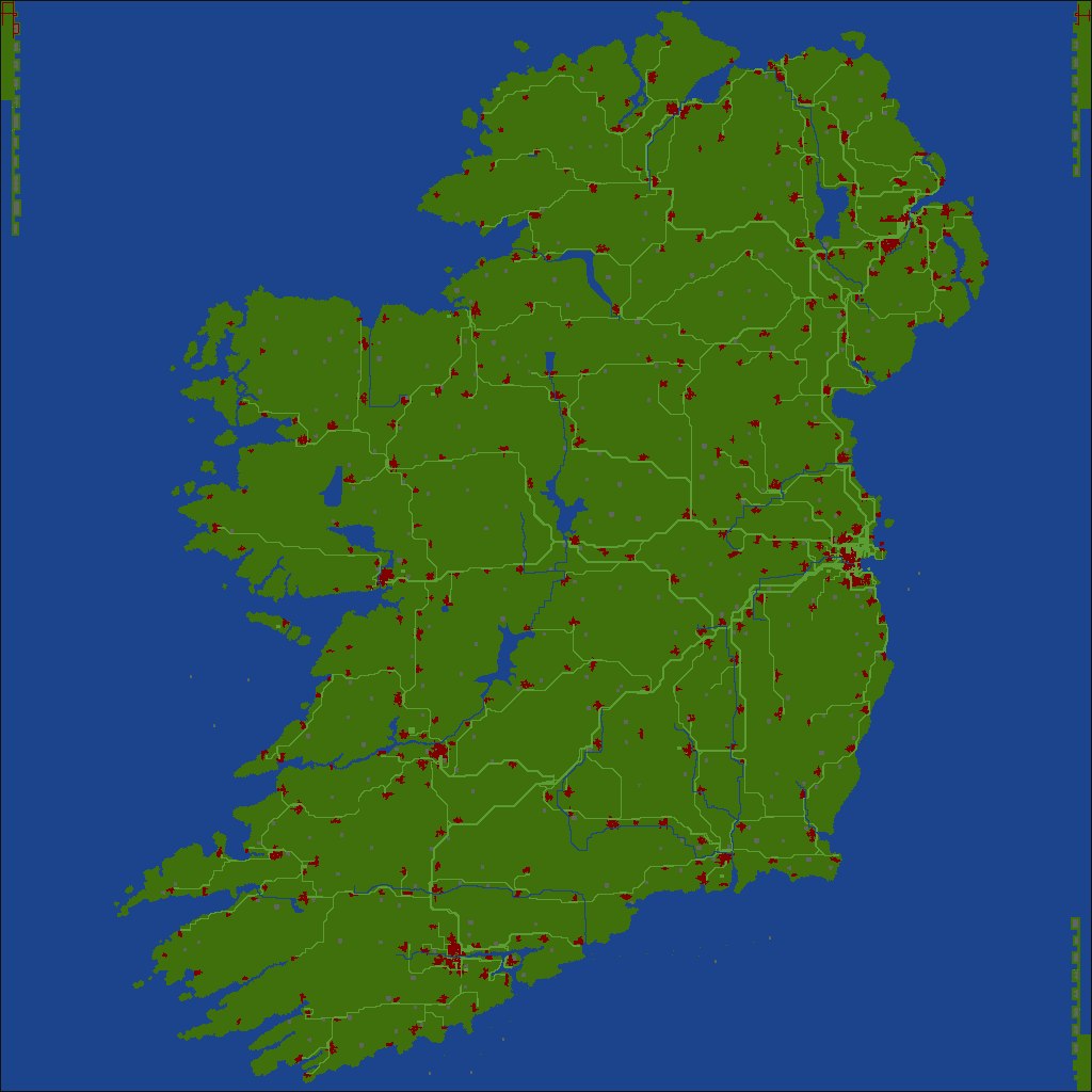
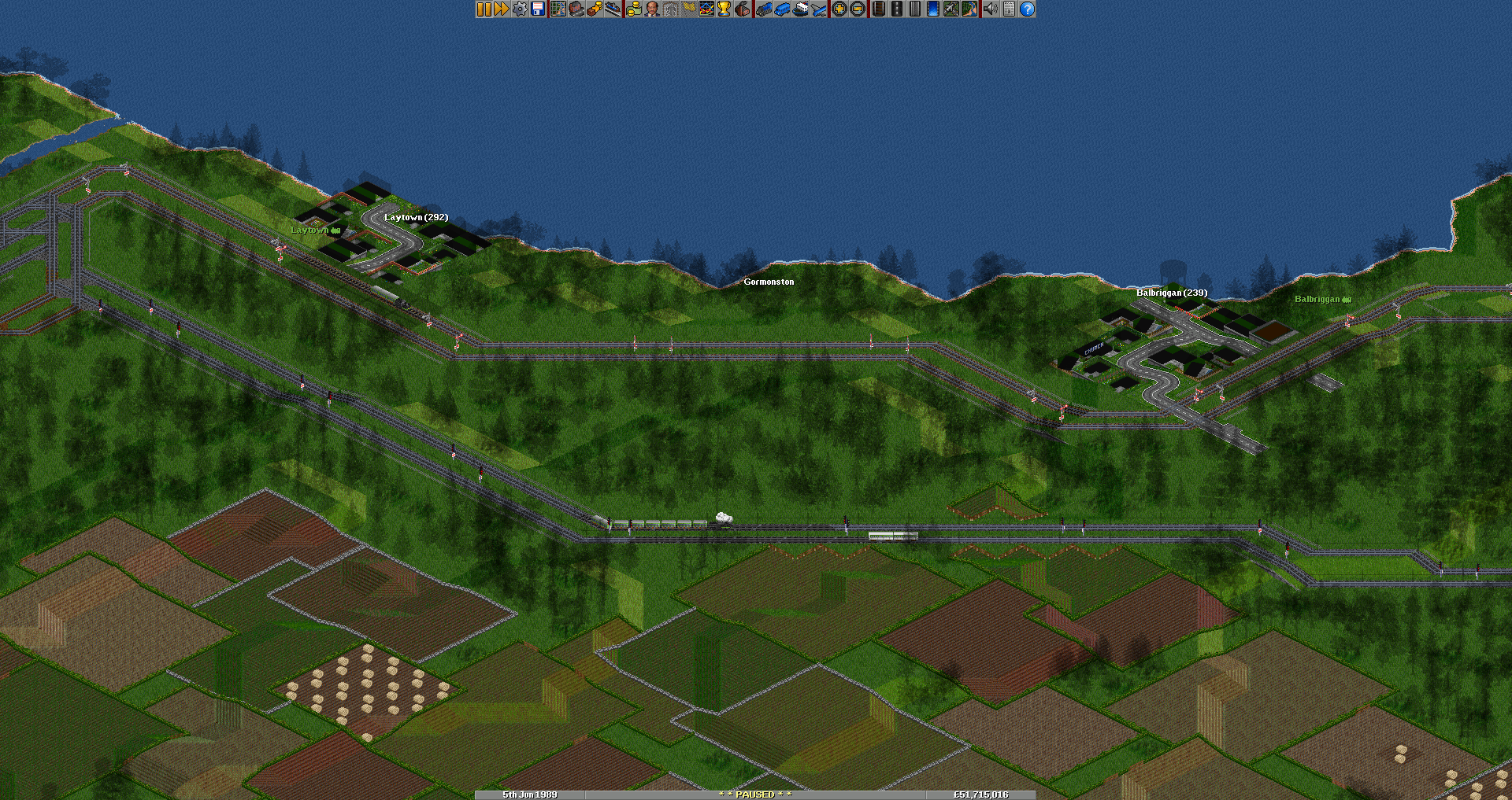
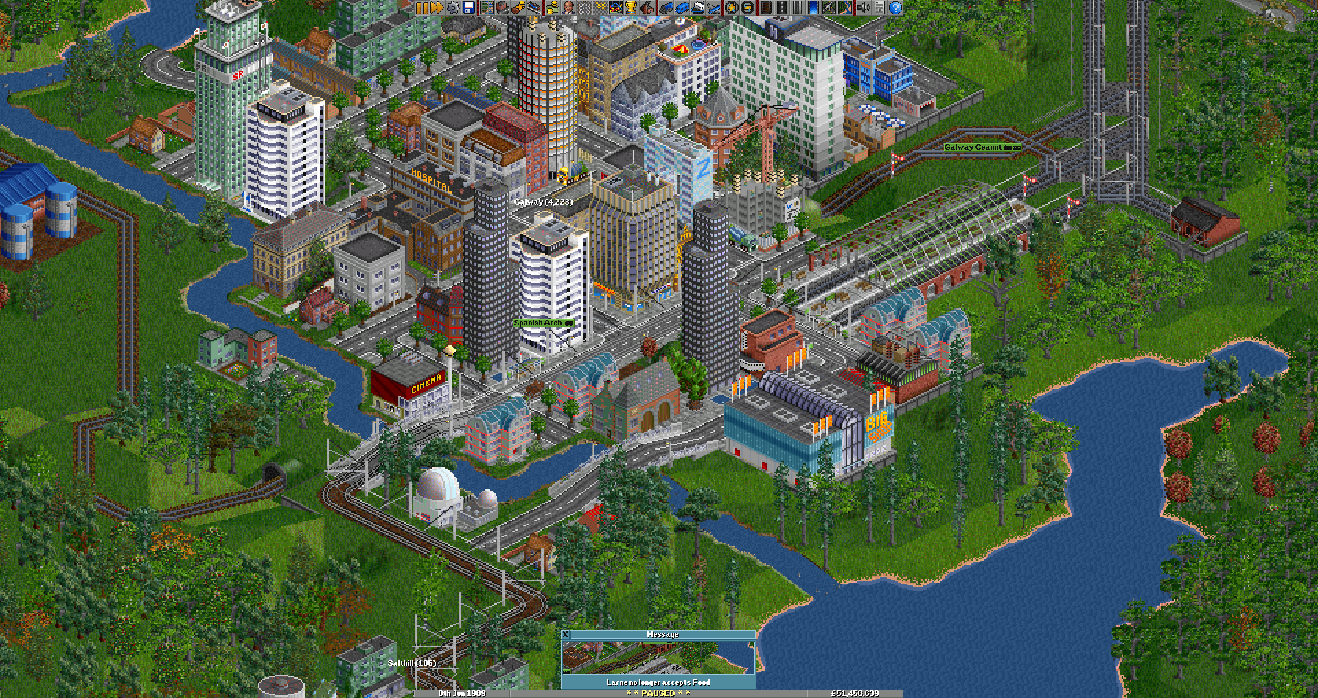
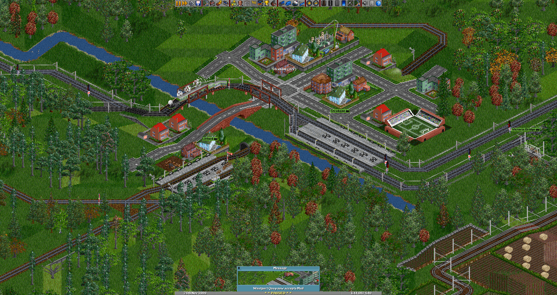
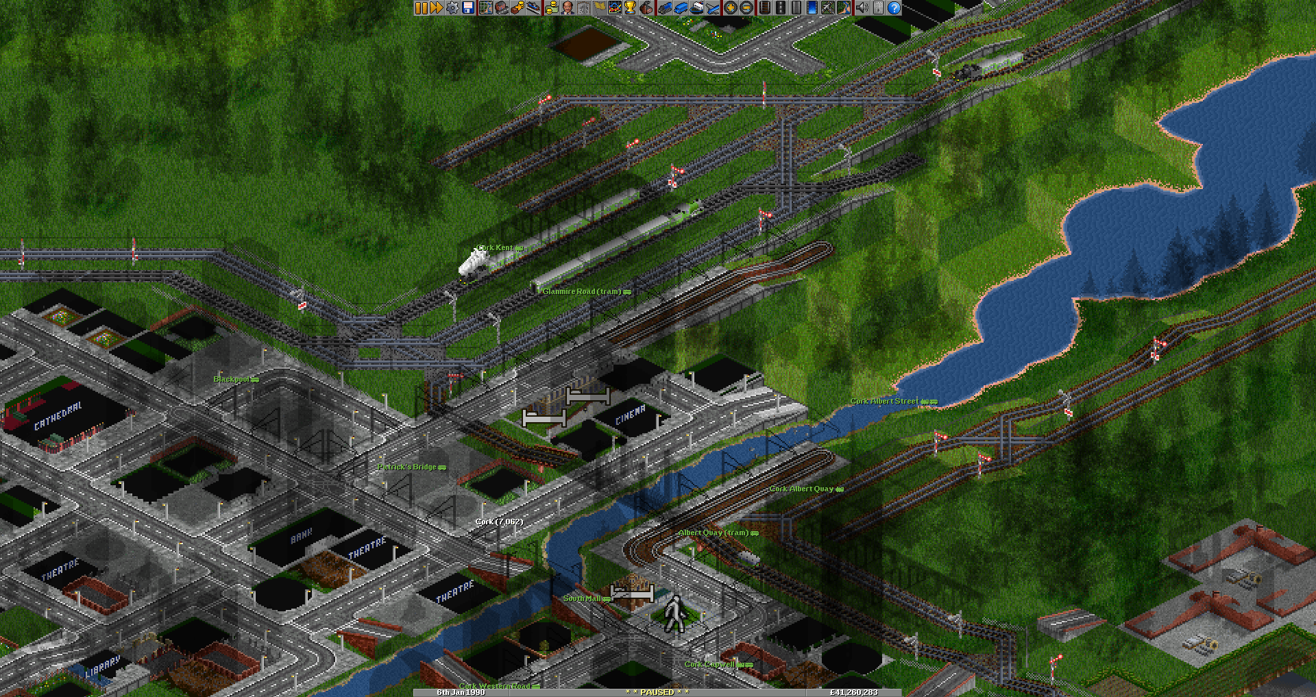
The map can be found by searching in-game and downloading the "Ireland 1930" scenario, though I made some changes to it in the scenario editor. I've attached my edited version (it has a few more towns, water features are somewhat crudely added, and I took off indications of jurisdiction so it won't default to naming stations "Dublin (ROI) Suffix". The original scenario can be downloaded on the OpenTTD forums, but the images are broken for some reason. There's a few other Irish scenarios available to download: searching "Ireland" will get most of those. The trains can be found in the "2cc Trains in NML" "NewGRF" as they are called: searching "2cc" in-game should work. You can read more about it here. While I'm here, I've largely recreated the historical Irish network and built some more speculative additions while I was at it. Ireland as a whole. This screenshot mode doesn't annotate town names, though. I made a point to add in most intermediate stations on operational lines, at least. An Enterprise steams away with no heed to the overhead wires on the GNR bypass, as a Dart approaches on the other track. The horse tram in Galway continues to pull its load. The Derry Road may be electrified and doubled, but J15s still appear to rule the roost, somehow. A railcar awaits passengers in nearby Lifford. Two intercity trains pull into Kent Station, while a railcar sets out onto the Cork City Railways. Ireland 1930-modified.scn

-
https://www.railadvent.co.uk/2025/02/significant-milestone-reached-in-modernising-irelands-railway.html Signalling marches on: installation of ETCS level 1 from Greystones to Dundalk is complete, ready for the new Darts to use when they arrive and are tested. I assume going all the way to Dundalk will save Irish Rail some bother when the new Enterprises roll in. Hopefully they get started with wiring up to Maynooth sooner or later: Irish Rail's network statement (see Annex 1, p37) has several track lowering possessions pencilled in. The first one on the M3 Parkway branch has already happened: has anyone spotted any differences?
-
Single lines, block sections, travel times, and train frequencies
Darrman replied to Darrman's topic in General Chat
Johnson's Atlas and Gazetter is the best source for broader data such as station locations, with the caveat that is was published in 1997 so some newer developments aren't represented in it. OpenStreetMap is also a good place if you need to take a closer look at a particular location. The route a modern Sligo intercity train takes is composed of several sections built to access the North Wall before reaching the former Midland Great Western Railway's main line at the site of Liffey Junction, near Broombridge. It follows this as far as Mullingar (the main line used to reach Galway, but the section between Mullingar and Athlone is disused) before it branches off towards Sligo: I've everything relevant listed below. It's worth noting the distances are measured in miles and chains as this is what they were measured in when originally built: there are eighty chains to a mile. Mileages sourced from Johnson, the line speeds from Irish Rail's network statement. Mileage from Islandbridge Junction (at the western edge of Heuston yard) Line speed: 30 mph Dublin Connolly (Platforms 5-7, Amiens Street Junction): 4:61 Drumcondra: 3:28 Glasnevin Junction: 2:53 (mileage change: MGWR North Wall branch, from Liffey Junction) Glasnevin Junction: 0:57 Liffey Junction: 0:00 Overall, the section between Connolly and Liffey Junction is 2 miles, 65 chains long. Mileage change: Midland Great Western Railway, from Broadstone (the original MGWR terminus, now closed) Line speed: 70 mph Liffey Junction: 1:33 Broombridge: 1:67 Pelletstown: ~2:30 (approximation) Ashtown: 3:08 Castleknock: 4:68 Coolmine: 5:56 Clonsilla: 7:08 Leixlip Confey: 10:20 Leixlip Louisa Bridge: 11:20 Maynooth: 14:72 Double track ends here. Line speed: 75mph Kilcock: 18:50 (no passing loop) Enfield: 26:40 (no operational platform at loop, passenger trains cannot stop when using it) Killucan: 41:58 (station closed, passing loop still in use) Mullingar: 50:17 (passing loop) Edgeworthstown: 67:52 (passing loop) Longford: 76:22 (passing loop) Dromod: 87:25 (passing loop) Carrick-on-Shannon: 97:62 (passing loop is located just north of the platform) Boyle: 106:33 (passing loop) Ballymote: 120:15 (no passing loop, second platform still evident) Collooney: 127:56 (no passing loop) Sligo MacDiarmada: 134:16 (two platforms, but only one currently in use; two tracks for a few hundred metres approaching it) Today's Sligo intercity trains travel 135 miles and 48 chains in total. Many stations have been closed along the line: I've omitted them when not of operational relevance. I've similar information for the rest of the country, but it would take a while to properly clean up and make presentable. -
https://www.echolive.ie/corknews/arid-41559028.html Platform 6 completion scheduled for March, signal upgrades and doubling to Midleton on target for 2026 completion.
-
The Strategic Rail Review has the most hypothetical electrification, and that doesn't get any further than Athlone, and that's well short of Ballina. The Navan branch is just greyed out here, but if Taras ever restart that hypothetical could just use the direct route. Of course, the electrification this mentions focuses on the major passenger routes, not freight. Of course, we all know how long it takes to build anything in this country. Beyond Dublin, electrification doesn't exist, and Dart+ isn't exactly moving at a breakneck pace. (Hopefully they figure out a new depot sooner or later.) As for the 071 modifications, they're getting on in years. If converting them to hydrogen power lets them work better and for longer, then great. If not, then we'll know for the future.
-
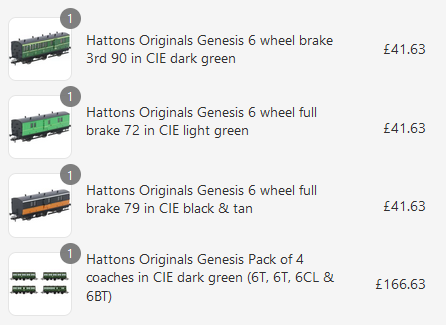
I just went ahead and bought a bunch of coaches. I probably bought too many brakes, but I imagined a train in West Cork having a 90 at both ends of the train - a good enough reason for me to hit buy. Besides, my birthday's coming up, it's train purchase season.
-
https://www.corkindependent.com/2025/01/08/rail-returning-to-west-cork/ I got sent this article: interesting, I must say... The plan is for 500 metres of narrow gauge (15 inch, more specifically) to be laid. The fundraiser does mention wanting passenger rides, insurance allowing - if it comes about, you'll know where to find me! No relation to the Bandon!
-
https://www.echolive.ie/corknews/arid-41547553.html The Echo reports that the government have applied for another round of funding from the European fund covering these works. The headline says "electrification", but the article says "enable future electrification". The money is conditional on unspecified milestones being met, but with construction going apace I think there's no danger of that.
-
Setting the politics aside, does anyone have any pictures of these sidings being removed? Is there any chance of it being just some form of maintenance? And are there any planning applications for the relevant land? Concerning, certainly, but we don't have any great amount of information aside from "the sidings are gone".
-
https://www.irishtimes.com/transport/2024/12/04/proposed-navan-dublin-rail-line-likely-to-cost-up-to-3bn-transport-authority-estimates/ Article in the Times prices Navan at €2-3 billion, up from €1.5-2 billion in 2021. Inflation is blamed for the revised estimate. For comparison, I tried to find the cost to build up to M3 Parkway and I found this: (source: https://www.railway-technology.com/projects/dublinnavanrailline/) "Phase I of the project is estimated to cost around €160m, while phase II will total around €500m. Phase I of the project is expected to be completed by September 2010 and phase II by 2015." Let's assume those estimates are accurate for 2010. A six-fold cost increase in fifteen years is not good. We better get a double-track electrified railway travelling at least 100mph for that...
-
mgwr preserved railway Connemara Railway project.
Darrman replied to ttc0169's topic in What's happening on the network?
I watched the section live on TV tonight. Whenever Maam Cross opens for business, I'll be there. Good luck! -
https://www.irishrail.ie/en-ie/news/project-development-for-navan-rail-line-to-begin Irish Rail press release today: RPS appointed as consultants, two years spent planning with a public consultation at some point in that, railway order application for 2027. Stations at Dunshaughlin and Kilmessan explicitly mentioned. Just speaking for myself, what's stopping them from reusing the pre-crash plans as opposed to going through planning again?
-
Single lines, block sections, travel times, and train frequencies
Darrman replied to Darrman's topic in General Chat
I've updated the frequencies for the 2024 timetables. Rather than flood the forum with a big paste I'll attach the relevant file. The most notable change is Grand Central's opening: 73 trains either way approach it from the Great Northern and 93 trains depart and 100 arrive from the Blythefield Curve and Belfast Central: I've no idea where the discrepancy comes from. Two extra Galways and an extra Waterford increase the numbers on the relevant lines (there's 19 trains from Athenry to Galway now), and with work to double Midleton underway that will remove a busy single-track section. Incidentally, the busiest tracks are all around Connolly: 143 trains depart towards Clontarf Road and 73/74 (there's a Mullingar service with no return) towards Drumcondra, while heading south 155 cross Loopline Bridge towards Pearse. Loopline Bridge certainly won't ever be quadrupled! There's still 105 trains travelling down the DSER to Bray: it badly needs something somewhere - no, dumping everyone out of the train at Wicklow and changing to a slow stopper is not a solution. Incidentally, the actual quadruple section, Cherry Orchard to Hazelhatch, has 97 trains a day, slightly quieter. But still necessary, plus there's the occasional goods train bound for North Wall. frequency2024.txt -
Since this thread's come back around, if I was to toss out any rationality I'd reopen Clonakilty, being the biased West Cork man that I am. Which by extension would force Bandon open again... And Albert Quay... Who needs the South Link Road and the skyscrapers on top of Albert Quay anyway? Black Ash park and ride could connect to the railway instead. And it's not that far from the Bandon Road either, you could put a park and ride there too. And then may as well reopen Waterfall. (Madness with crayons excised for everyone's sake...) Even if the West Cork never closed, I'd say there's a fair bet the first station out of Albert Quay today would be Bandon! (As of the June 1958 working timetable, the only stations not designated as halts were Albert Quay, Bandon, Ballineen, Dunmanway, Drimoleague, and Bantry, along with Skibbereen, Ballinascarthy, and Clonakilty on their branches. Clonakilty Junction is inconsistent: there's no H on the Clonakilty branch timetable, but there is on the main line.) I could try to rationally figure out how to work out how to reopen/how to prune West Cork so as to avoid total closure, but that's for another thread.