Patrick Davey
-
Posts
2,647 -
Joined
-
Last visited
-
Days Won
143
Content Type
Profiles
Forums
Events
Gallery
Blogs
Everything posted by Patrick Davey
-
Kells, Co. Antrim, narrow gauge Ballymena & Larne line! You're thinking of the GNR(I broad gauge Kells on the Oldcastle branch! There was another one too, Kells, Co. Kerry, on the Valencia Harbour line......
-
Very interesting thread - enjoying this one!
-
Much appreciated JB, noted!
-
Enjoyed that GM, thanks for sharing - nice to hear Grenfell Morton's voice, I have some of his books.
-
Do you have in-service B&L photos of: Kells - have seen a few Moorfields - one I think Ballynashee - none so far Collin - none so far Ballyeaston - none so far TIA
-
Evening all - I have been thinking recently about which Irish railway lines were the least-photographed. As I'm in Ulster I am more familiar with those northern lines which have generally escaped the attention of photographers, but there will be many others I'm sure elsewhere. Obviously the earlier a line closed, the less chance there would have been for it to have been photographed, possibly the most extreme example being the Parsonstown and Portumna Bridge line (closed in 1878 I think?) Some northern examples which come to mind are the Ballymena & Larne narrow gauge line (very few photographs) and the GNR line from Banbridge to Newcastle (a few but not many photographs). There are of course plenty of actual stations which have remained camera shy, such as Creevyargon and the other small halts on the BCDR (I know of just one photo of Creevyargon). Two of the least-photographed GNR lines link to Armagh: the line from Armagh to Castleblayney was fully open by 1910 but closed beyond Keady from 1924 so the southern portion of the line was only open for 14 years which is an insanely short time (last of the 'railway age' lines to open and first to close I think?) There was a halt at Carnagh and a slightly larger halt at Creghanroe, where the classic GNR(I) wooden station building thankfully still stands despite being without a train for close on a century. I haven't yet seen a photo of Creghanroe in operation, nor of Carnagh. The other least-photographed line from Armagh was of course the route to Newry and Warrenpoint, which is well-known as having along its route the longest railway tunnel in Ireland, Lissummon tunnel, just one yard short of a full mile in length. The line was also the location of Ireland's worst railway disaster. I was working in Armagh today and took some time later on to try and find the location of Hamiltonsbawn station, which has, as far as I know, remained beyond the attention of photographers - I recall seeing a post-closure photograph though, I think it was in one of Mac Arnold's GNR books. I also visited Markethill station which thankfully survives intact as a private residence, with the trackbed through the station now a car park. This was the largest station on the line, presumably because Markethill was the largest town on the line. Ironically, every time I visit, something stops me from taking a photograph....today it was a large white van in the car park spoiling the shot, and last time it was a group of dodgy looking lads in souped up cars eyeing me up suspiciously..... There are a few excellent photographs of Markethill, mostly taken after 1933 when the line lost its passenger traffic - a railtour visited the line before final closure, hauled by a U class 440 - thankfully there are a few photographs of this railtour tour at Markethill and there are other Markethill views in the IRRS archive. So I am wondering does anyone know of any other photos of the 'camera shy' Armagh line stations, particularly Hamiltonsbawn? I have seen a few photos of other stations on the line and indeed there survives a very rare view of the Glenanne & Loughgilly horse tramway.... I am also interested in other 'camera shy' lines & stations - feel free to suggest more!
-
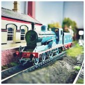
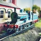
Superb scenes, can only imagine how long it takes to set these up!!
-
This really is a lovely model Noel. Always good to see the latest update.
-
Mighty work indeed. Would love to recreate the 'bleached out' sleeper look for my next project. Looks like a combination of light brown/beige shades, nicely matched by the rusted rails. Great stuff!
-
 Great scenes Ernie, and I sympathise with the situation regarding (presumably) senior management...... My domestic line manager usually has this to say when I show her my railway creations: " " And sometimes this: "Zzzzzzzzzzz....."
 -
Hattons - 6 wheel full brake 79 CIE black & tan
Patrick Davey replied to Noel's topic in Irish Models
Yip have this on order along with a pack of green CIE ones. Nice to see Hatton's supporting the Irish scene. -
Brookhall Mill - A GNR(I) Micro Layout
Patrick Davey replied to Patrick Davey's topic in Irish Model Layouts
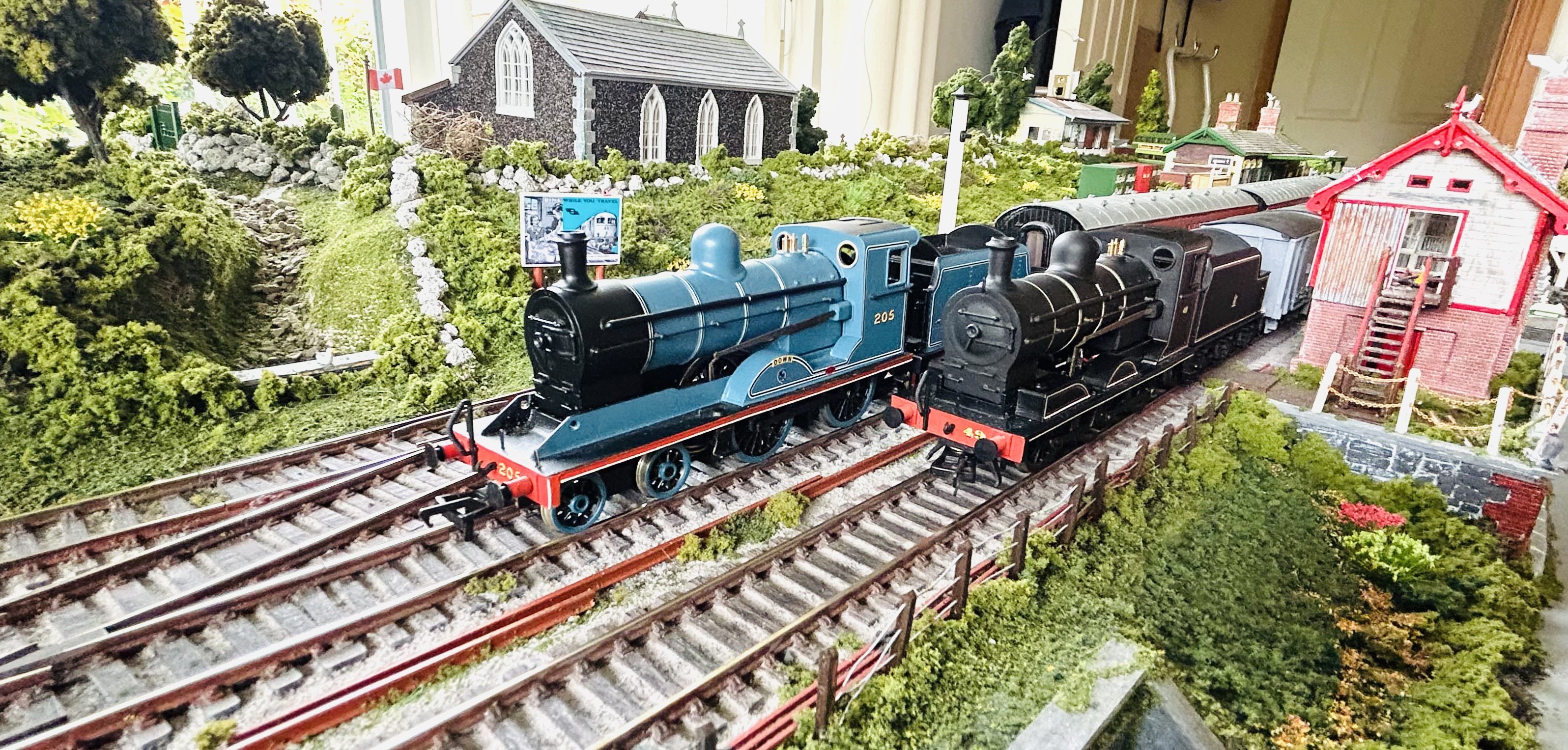
All quiet at the mill this afternoon.
-
Westport Quay and the Project 42 Inglenook
Patrick Davey replied to Sean's topic in Irish Model Layouts
Impressive use of space - enjoying your updates! -
Cracking scenes JB! The track approaching the disused turntable looks fantastic in particular!
-
That is very satisfying to watch!!!
-
Wish I had the skill to tackle the SSM PP kit - they were such elegant locos and one would look right at home on Brookhall Mill.......
-
Just one here! But yes it really holds up well with the smooth-running, even compared to the A classes. We really are very lucky.
-
I remember being at a photographic exhibition in the old church in Carlingford, now the Carlingford Heritage Centre, and there was a mini-layout based on Riverstown Viaduct, with a GNR-ish railbus doing a loop around a circuit. It was quite nice!
-
It's the LNWR 'Special' tank I think JB? https://www.hattons.co.uk/76795/gem_kb023_lnwr_special_tank_gem_kit_including_all_parts_motor_wheels_detailing_etc/stockdetail And yes it's a line I'd love to have a go at sometime - the DNGR saddle tanks might be exactly the kind of prototype that OO Works might be interested in....?
-
Brookhall Mill - A GNR(I) Micro Layout
Patrick Davey replied to Patrick Davey's topic in Irish Model Layouts
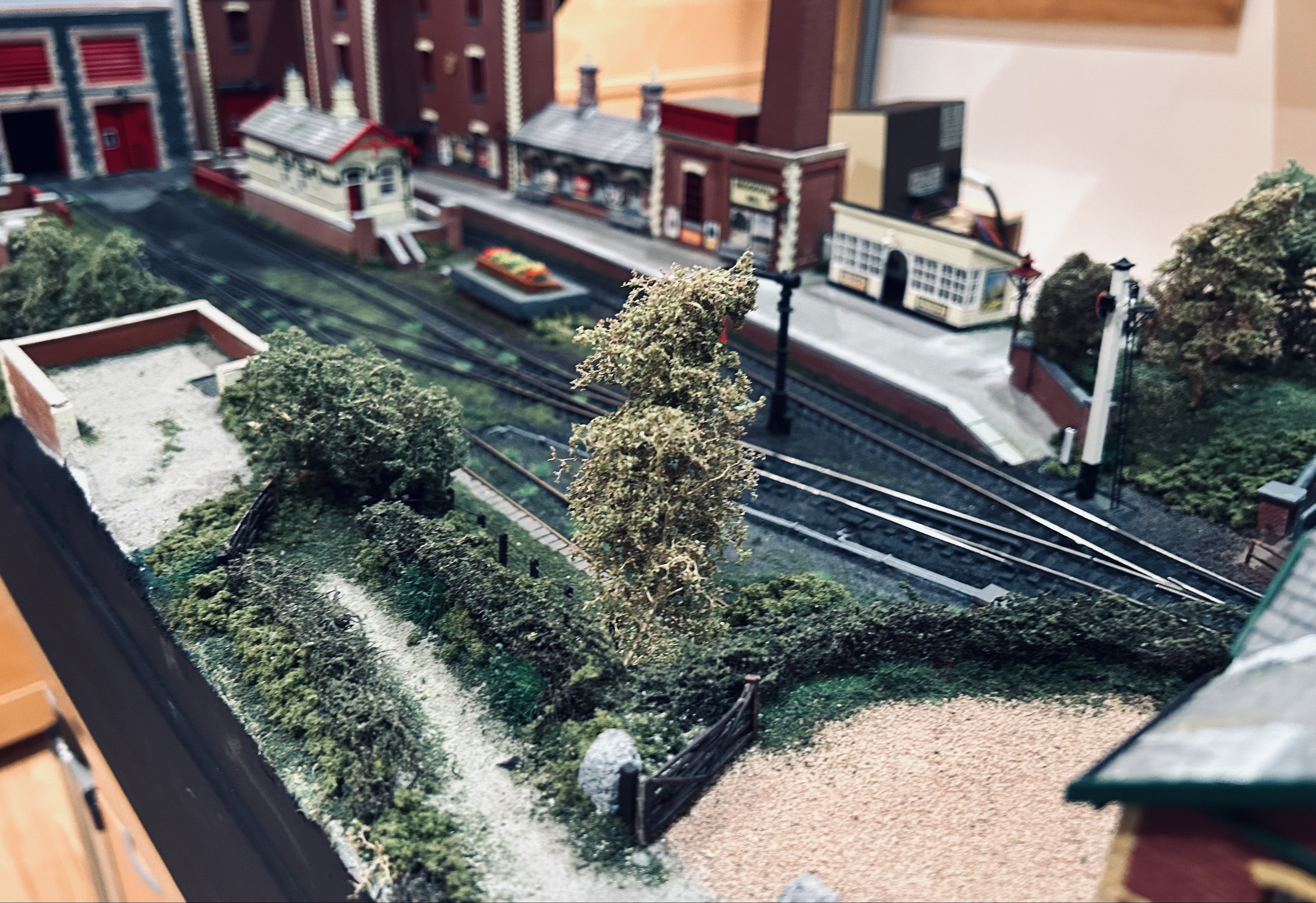
Currently working through a ‘snag’ list with the layout. Surprising how many small things still need sorting……. Drain covers - need to install along the road Fix loose lights and reposition one light which is fouling the platform road Water crane drain detail - need to paint the red bag and add more greenery and paint the drain a rust colour Platform surface - needs weathered Water tower copings - falling apart….need to make replacements from DAS clay Lifebelts - need painting for the period Signal box chimney - it’s wonky General greenery ~ base of walls, on the buildings etc Gun position copings - need DAS replacements Level crossing rails - too high and some vans are riding up on these and then dropping down Grateful for any more observations! -
Brookhall Mill - A GNR(I) Micro Layout
Patrick Davey replied to Patrick Davey's topic in Irish Model Layouts
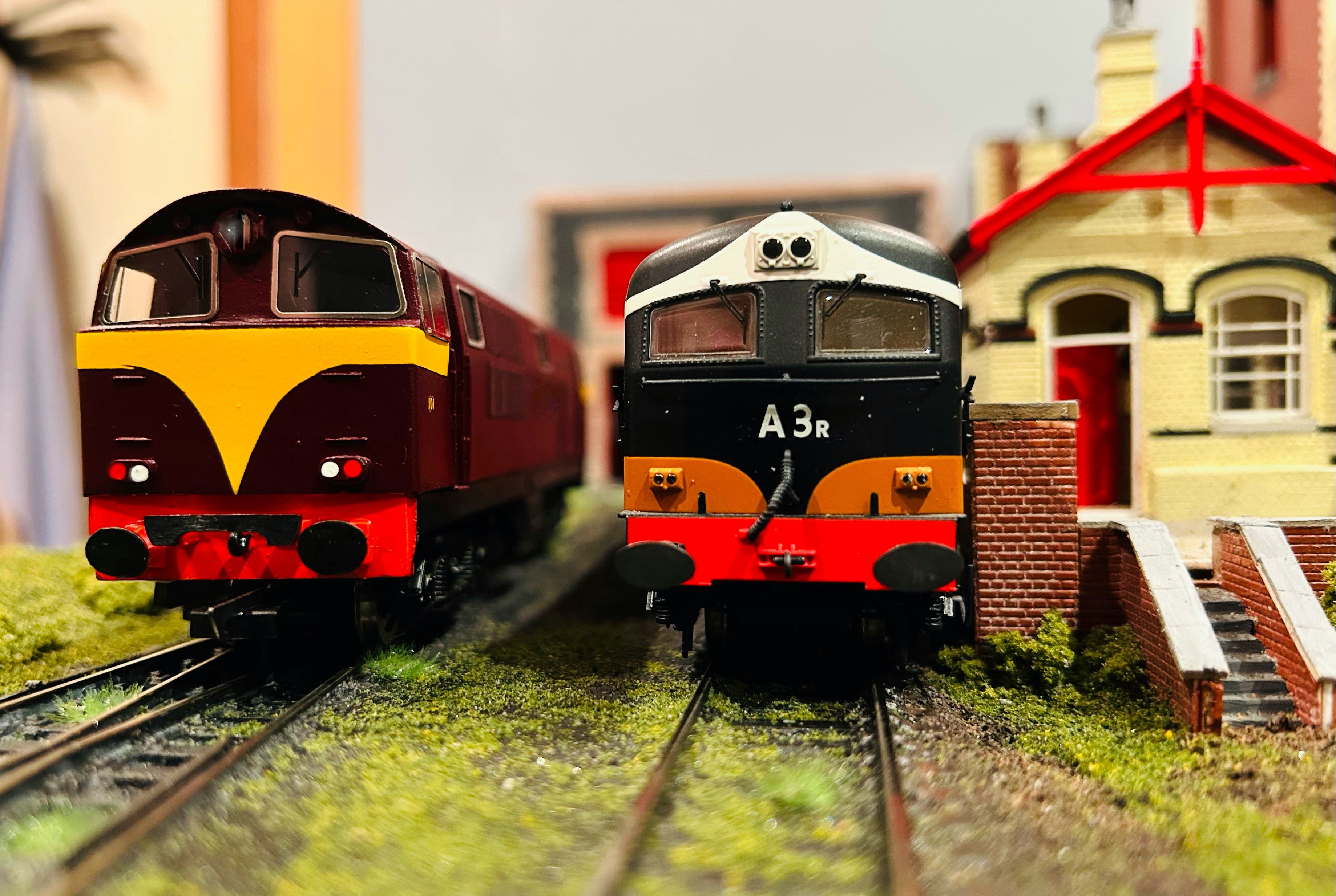
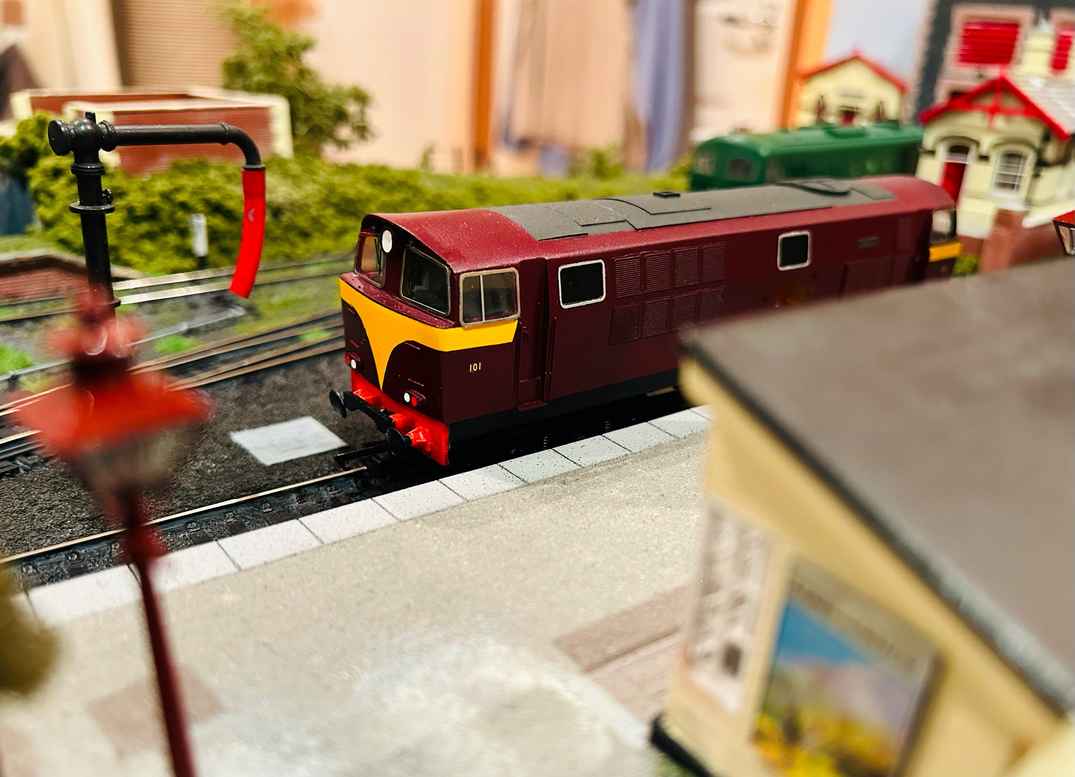
1970s regulars at the mill.
-
Again most definitely. It was always a ‘must visit’ on trips into the city centre and a lot of my early railway book purchases were made in this wonderful shop which always had a nice atmosphere with very friendly staff. The railway section, as far as I remember was along the left-hand wall about halfway down the shop. Another ‘must visit’ was The Modeller’s Nook when it was run by Joe Barlow who is thankfully still very much active, and usually has a stand at local exhibitions.
-
Superb - looking forward to progress updates!
-
Impressive news from Accurascale - going from strength to strength!!
-
- 5
-

-
Most definitely. The model railway section was initially on the right as you entered on the ground floor, then it moved up to the first floor to the far left. Jim, Gary and others were the people I remember, there were many others, including a particularly grumpy older gentleman who yelled at me once when I was looking through a catalogue, firing out some cr*p about it being a shop and not a library - my mother went back down immediately and gave off to the manager who must have been a bit intimidated by her because she got an apology from him..... The Model Shop was great, seemed to have more in the way of radio controlled stuff etc then it moved to smaller premises further down Queen Street under new management before relocating out to Boucher Road, before ceasing trading altogether.