Broithe
-
Posts
7,458 -
Joined
-
Last visited
-
Days Won
46
2 Followers
Recent Profile Visitors
11,748 profile views


Broithe's Achievements
")


-
Tom unfortunately died, just as supplies of the essential raw materials from Malaya were beginning to come back on stream. His brother, Johnnie, took over, but the railway market was gone by that point, and he took the business in a very different direction.
-
If the reg number is wrong, an ANPR check would flag the car up as 'not insured', too.
-
I went to the open day at Abbeyleix House on Sunday - I took 191 pictures. Imagine the cost with a real camera forty years ago...
-
It's the same sort of thing as the water-powered cliff elevators* do. Fill up the tank on the one at the top, use the excess weight to pull the lighter car at the bottom back up, after if has emptied it's tank, allowing for the difference in passenger weights in each car - and repeat with the two cars in sequences, as often as the water supply will allow you to. The difference with the train here is that the energy from lowering the weight is being stored in a battery, rather than dragging another empty train back up, via a cable, as the heavier one comes down, then using that stored energy to drive the train back up. And the whole thing is just a lot bigger - in every way. *I think the one in Bridgnorth operates this way.
-
If you're moving the heavy cargo downhill and returning an empty train back up, then you can use the potential energy of the extra mass of the cargo travelling down to charge the batteries enough to return the lighter empty train back up - if you get the numbers right.
-
Some of us can remember the range anxiety on a motorbike in Wales, Scotland or Connemara on a Sunday - it's just a matter of being organised.
-
-
We had a forty foot straight on a layout once, in a carport with a polycarbonate roof and the ends closed in - we had considerable expansion/contraction issues, until we fitted Fleischmann joints with most of an inch of movement I was reminded of it by this photo of the current heat expansion issue that the Romney, Hythe & Dymchurch Railway has. They have run trains over that, apparently - gently, and with trackside personnel monitoring the progress to detect derailments... As far as the layout was concerned, I remain convinced that the principal effect was actually the baseboard contracting, as the humidity was driven out, rather than the rails expanding in the high temperatures, although that would add a bit to the problem. The expansion of the metal was predictable to a fair degree of accuracy and was nowhere near enough to account for the total dimensional changes that we got.
-
Heritage Railways in the Republic of Ireland
Broithe replied to Celtic_transport's topic in General Chat
Where I worked years ago, it was known that about half the people in the office, of around twenty five or so, were in a pools syndicate. We eventually had a win - the organiser got a large cheque from Littlewoods - when I say 'large', I mean that it was physically big, for theatrical advertising promotion purposes. He showed it to the members and two of us took the opportunity to run into the boss's office with it, him being aware that we had had some sort of win, but not having the details. Waving the giant cheque, with "Littlewoods" almost all that was legible from his viewpoint, we shouted "We've won the pools, you can shove your jobs up your arse - we're all off home now!" I had my thumb carefully covering the end of the actual amount on the cheque. The twelve of us had actually won £17. We revealed that after he went all 'legal' about notice periods, etc.... -
This year's is confirmed now and I may well be around for it again - we'll se.
-
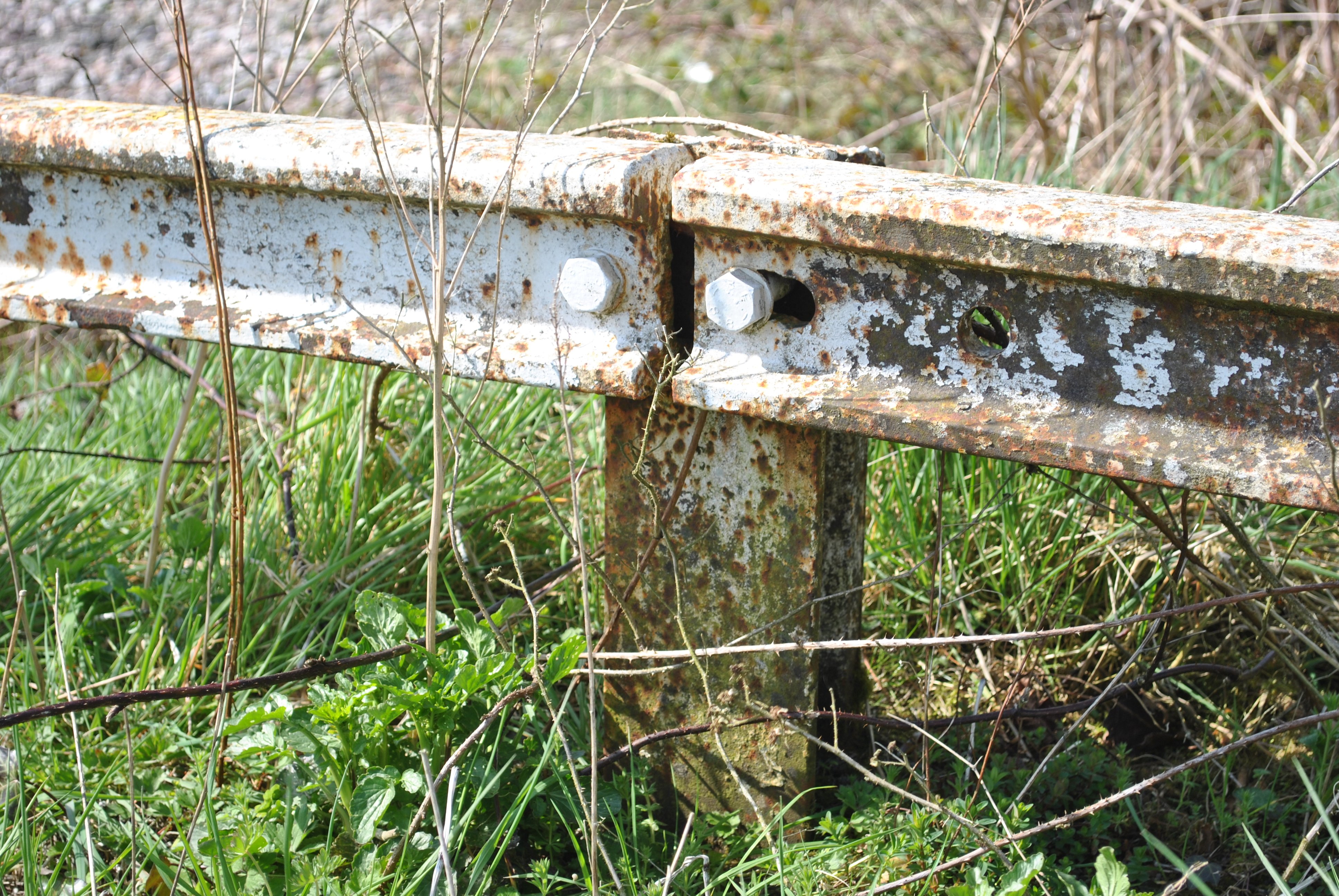
Before the upgrade to the carpark at Ballybrophy, this was the 'ersatz Armco barrier' that would stop you running off the edge.

-
Maybe someone who's prepared to believe it might buy something and let us know what happens?
-
I can see it - the IPs used come up as being in California and Canada.
-
There are several basic aspects to stopping noise from flat panels, as baseboards essentially are. Stopping the energy being transferred into the panel and stopping it coming back out as sound, in a form that causes annoying noise. Reducing the input from trains running on the tracks would require fairly soft and 'dead' material - not easy to achieve in real life, whilst maintaining reliable running. Much easier to do is changing the manner in which the energy is re-emitted. Lightness and stiffness of the panel are not helpful in this matter, and plywood is a great resonator - string instrument bodies are a good example of the opposite requirement. You can change the re-emission characteristics fairly easily, though, by the addition of some weight to the central area of the panel - this is largely the effect that sticking cork tiles on actually has. It drops the frequency of the re-emitted sound. You will find this technique used all over car bodywork, although it is usually hidden by trim panels. A better technique is to add the weight, but have it attached to the panel via 'soft ' material - a heavy sheet, with an intervening 'soft' sheet stuck to the panel.
-
People tend to like competition when they are winning, but not when they are not - then, being better or cheaper is seen as cheating. Where I worked, we had a cartoonist who would often sum up the reality of these sunset economies. One of his classics, in the late 1970s, was "The GEC Digital Watch". This was a chap walking along, struggling to hold up a pallet with an array of 100 watt bulbs on it, whilst dragging a trolley carrying a stack of car batteries and a grandfather clock with wires running from the dial to the pallet display. Later, after a ludicrous failed attempt to get into mobile phones, starting a decade too late and expecting to do it for almost zero expenditure, there was a similar one with the chap driving a fork truck with a phone box on the forks and a trolley of car batteries trailing behind, and an aerial being held aloft by a kite. These were emblematic of the attitude - everybody else should stay in their rightful place and not cheat by doing things better and/or cheaper. Lots of other UK industries were run by the same sort of deluded management - cars, motorbikes, aircraft, shipbuilding, electronics, etc. - they all stopped going forwards and expected the rest of the world to stop, too. I am constantly reminded by the fact that I drive a Korean car - I am old enough to remember when, if told that that was the future, it would have seemed as unlikely as being told, today, that you will be driving a Nigerian* car in a few year's time... * Other countries are available.