Patrick Davey
-
Posts
2,337 -
Joined
-
Last visited
-
Days Won
133
Content Type
Profiles
Forums
Events
Gallery
Blogs
Store
Community Map
Everything posted by Patrick Davey
-
Brookhall Mill - A GNR(I) Micro Layout
Patrick Davey replied to Patrick Davey's topic in Irish Model Layouts
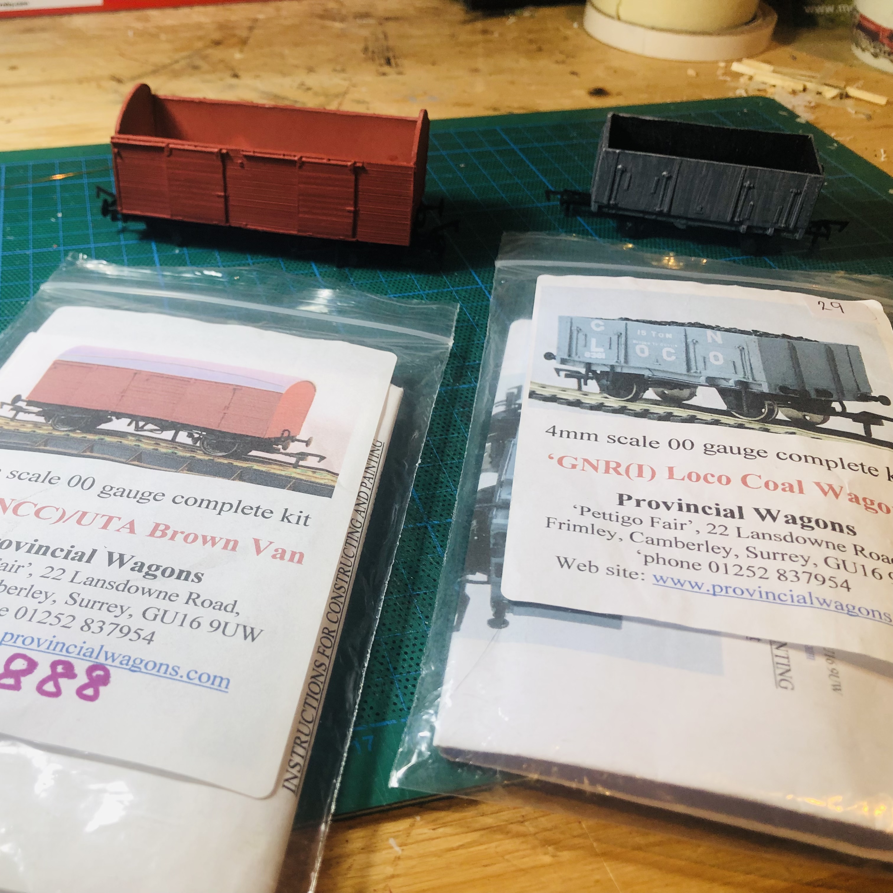
Provincial Wagons NCC brown van and GNR(I) loco coal wagon complete, with just the decals to go, which is my least favourite part of it because I seem to have less patience and poorer fine motor skills for this job these days…. The instructions for the brown van encourage the builder to add the supplied brake shoes as they apparently make a big difference to the finished model so that made me determined to master them but I had to admit defeat after a lot of expletives were uttered. The eyesight and fine motor skills really aren't what they were.... Maybe I'll add the decals next year......
- 613 replies
-
- 11
-

-
Delighted to hear of your progress Ken, great news. And that is one incredible layout, detail everywhere, and all very realistic!!! Your 'gaffer' must be a close relative of my 'Mr. Weaver' at Brookhall Mill!
-
Again am gobsmacked by your progress Alan, great work altogether!! Two questions: 1. Have you found a solution to the louvre question, and... 2. Are you planning an appropriate layout to showcase this beauty when finished? Maybe a finescale recreation of Ballynahinch terminus.......? https://mikemorant.smugmug.com/Recent-uploads-and-queries/Recent-uploads-other-material/i-2xWNWzr/A
-
Brookhall Mill - A GNR(I) Micro Layout
Patrick Davey replied to Patrick Davey's topic in Irish Model Layouts
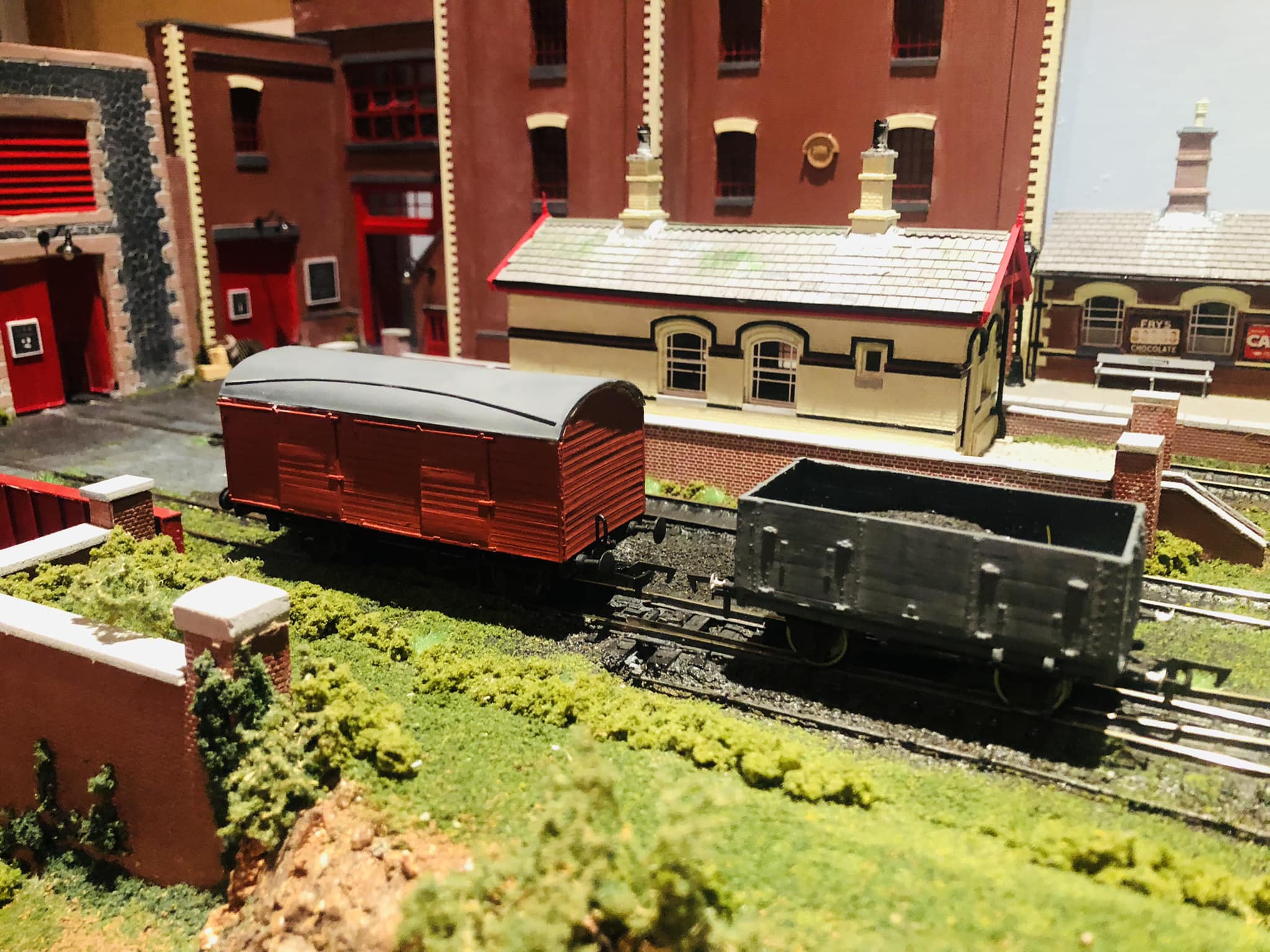
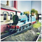
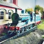
On the workbench today, two more of Leslie McAlllister’s fine Provincial Wagons kits: an NCC ‘brown’ van and a GNR loco coal wagon. Lovely models!
-
Brookhall Mill - A GNR(I) Micro Layout
Patrick Davey replied to Patrick Davey's topic in Irish Model Layouts
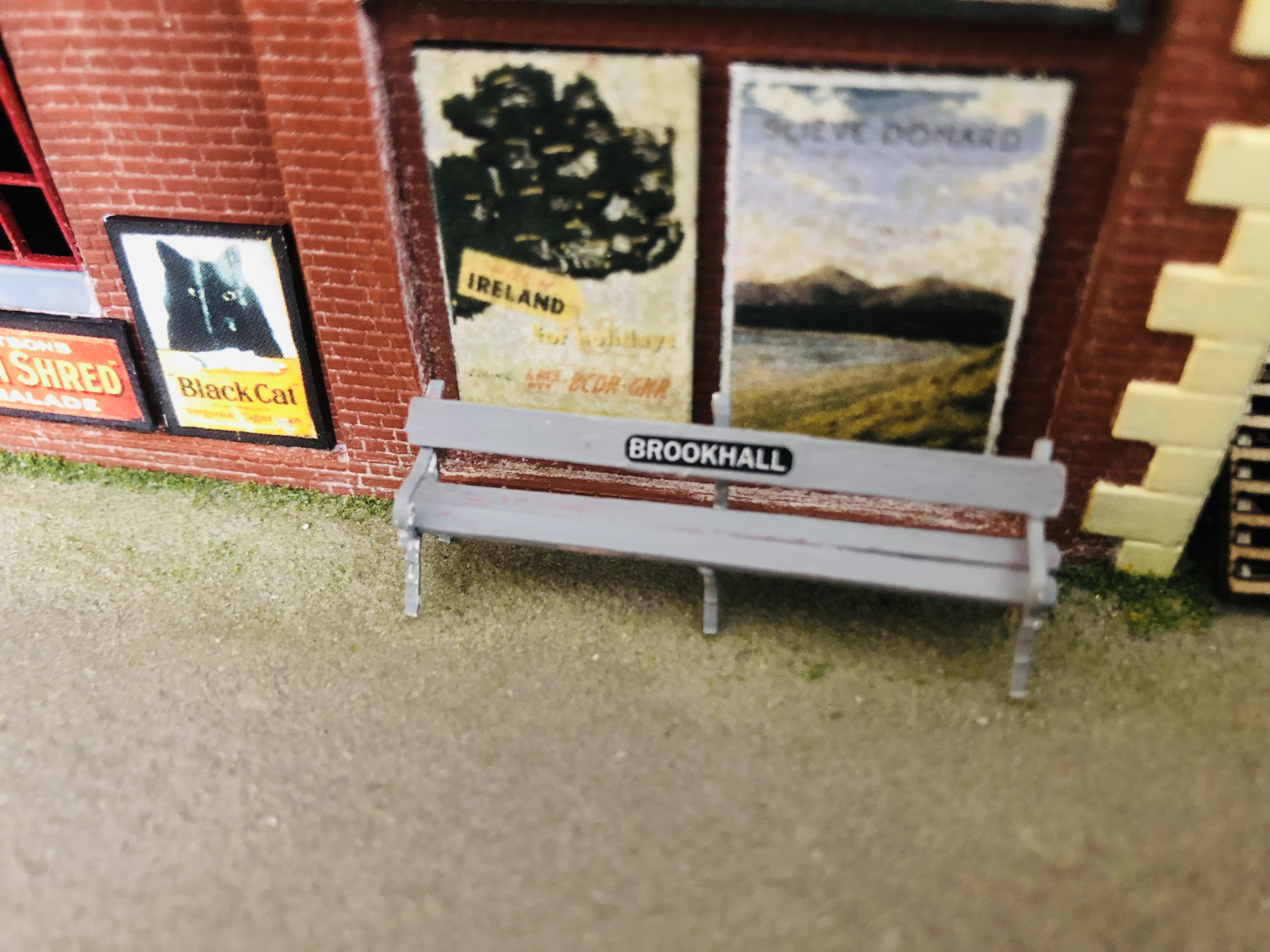
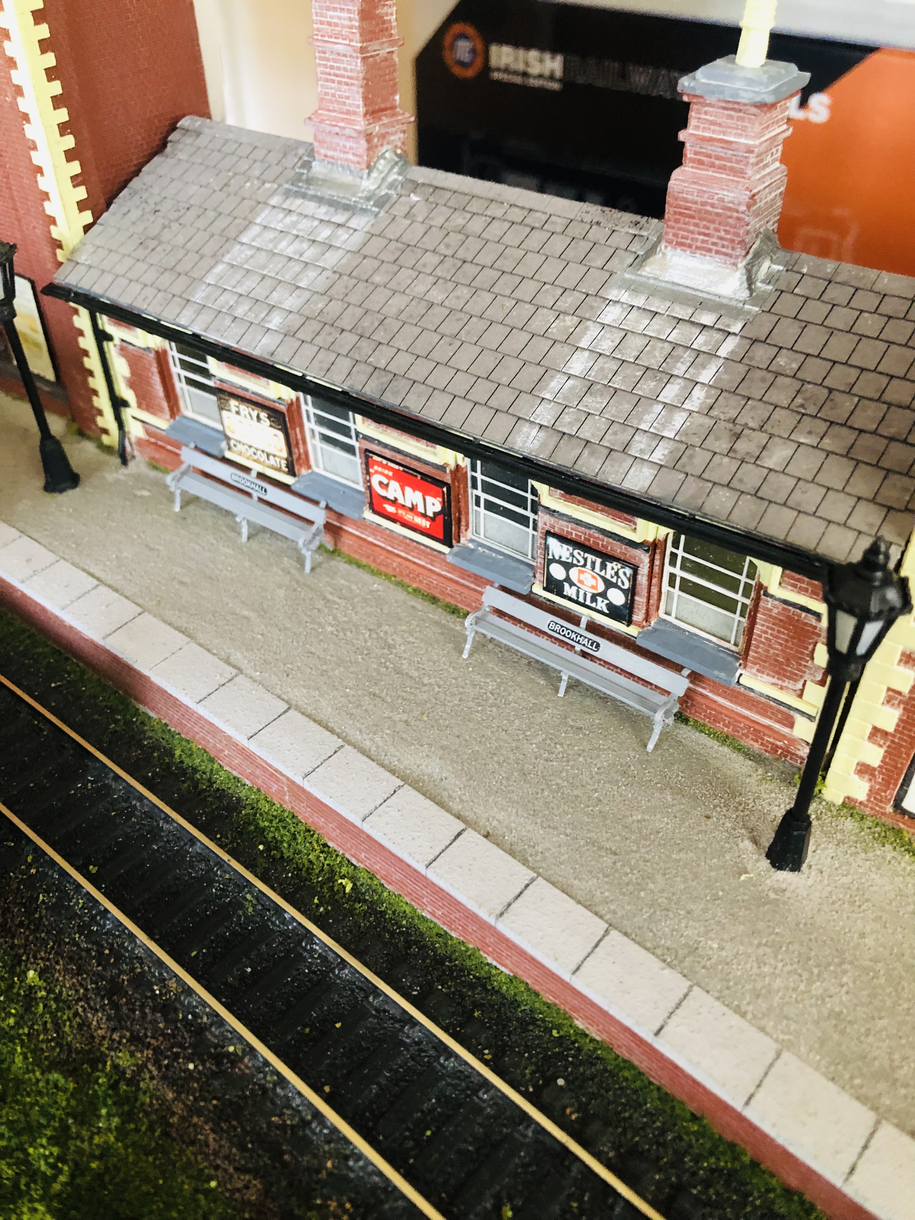
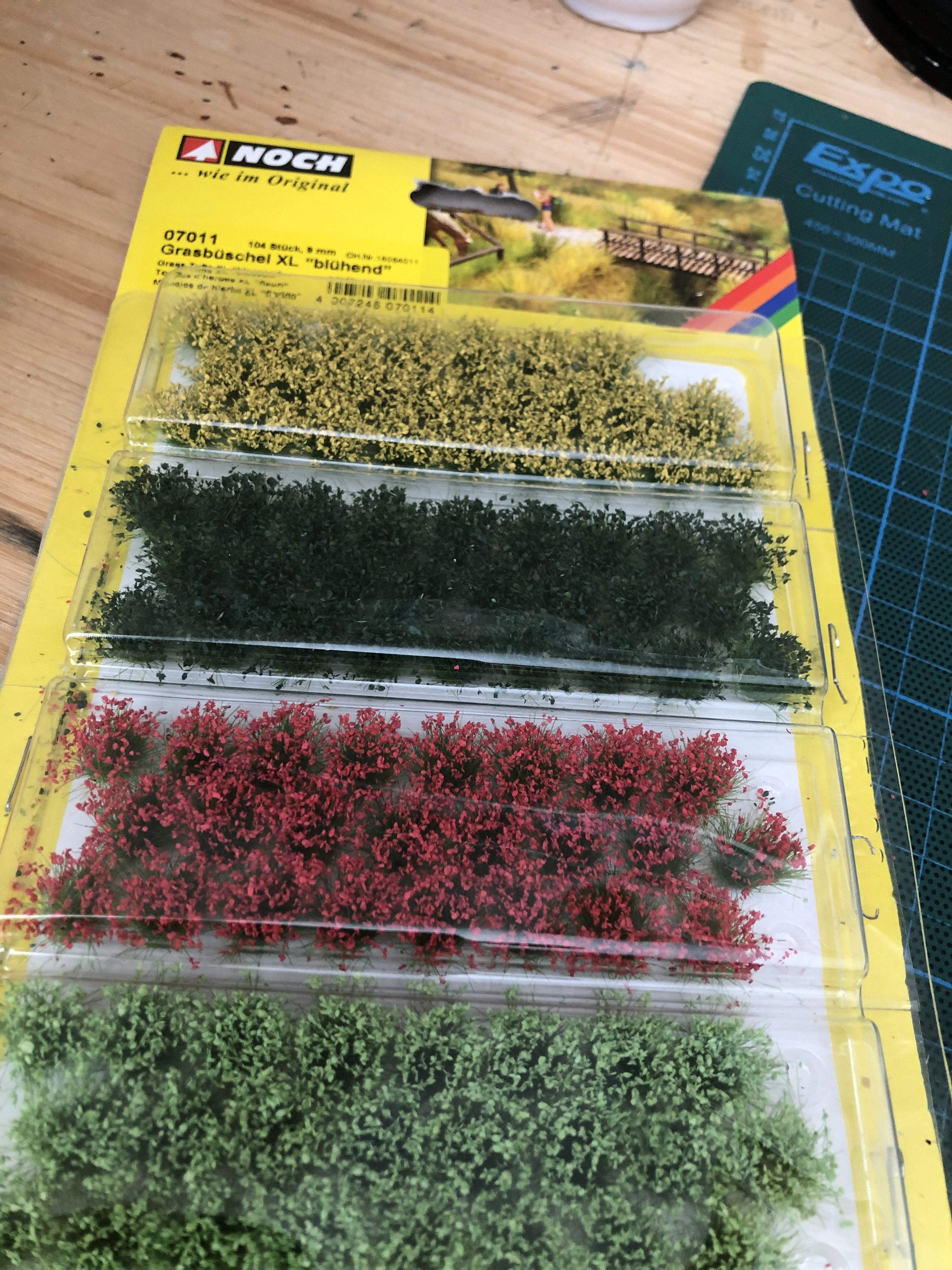
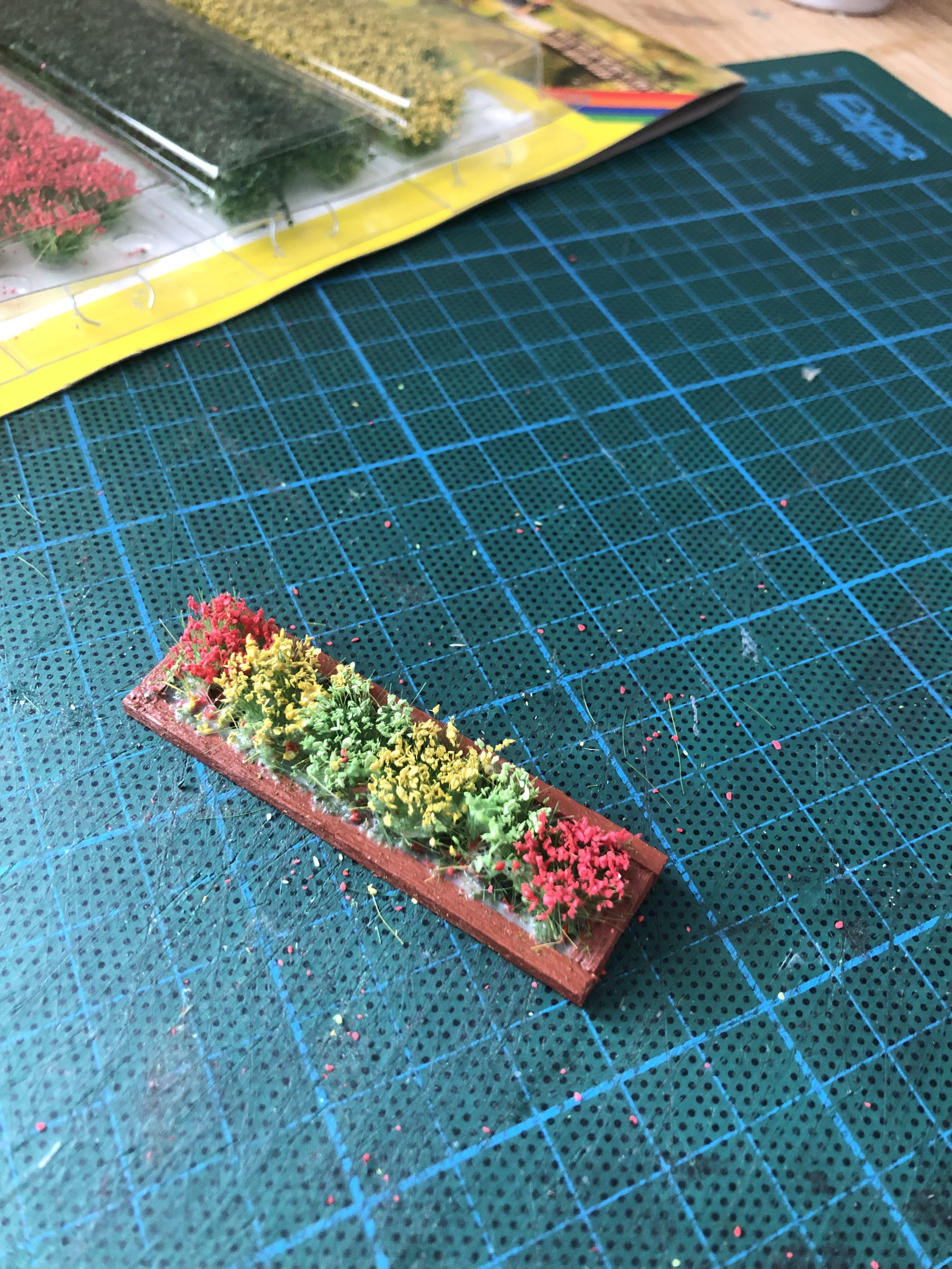
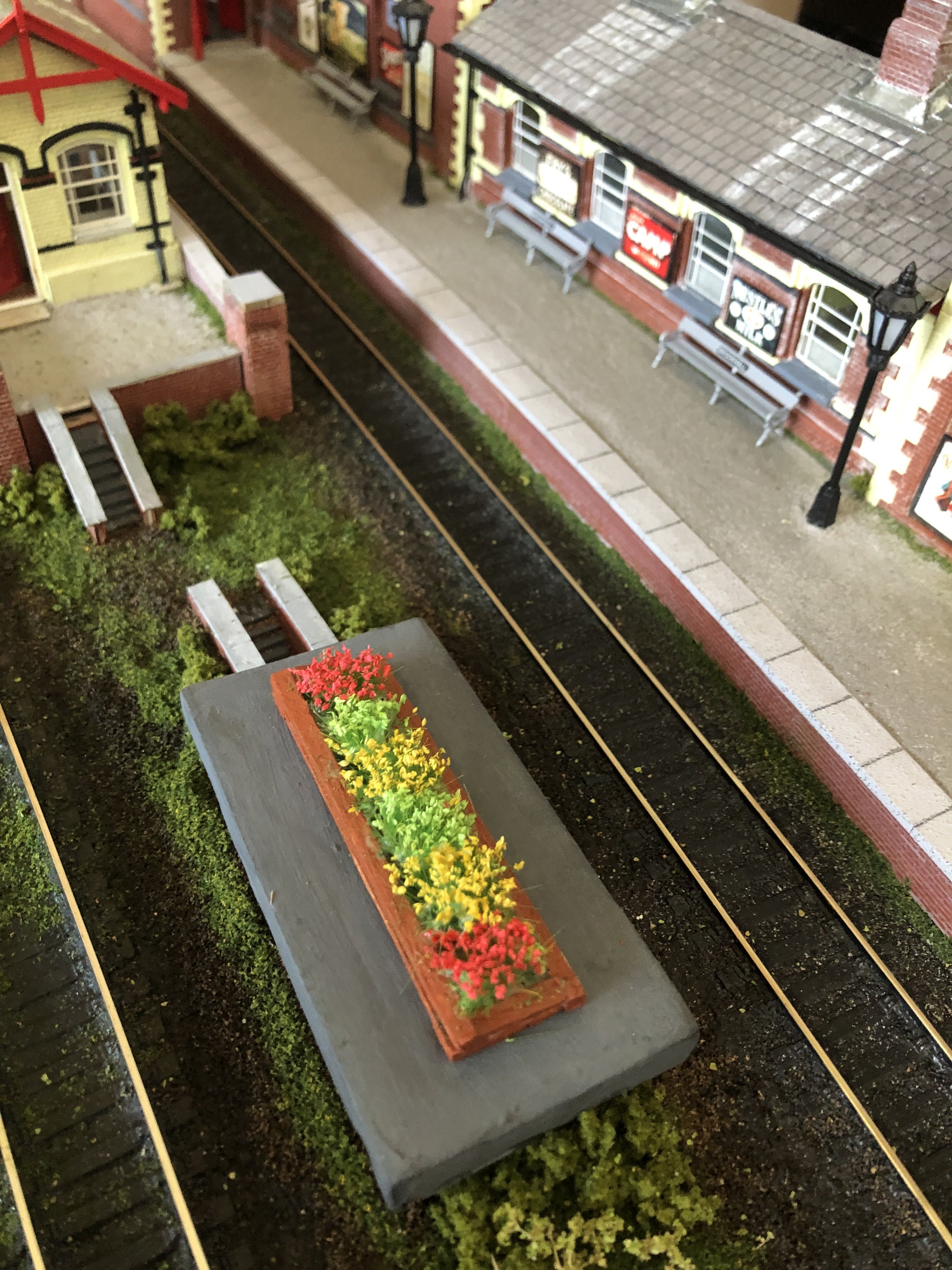
I wasn’t happy with the colour of the benches so I repainted them grey and also found an ideal use for the extra bus destination blinds which I had for my GNR buses. Also picked up some handy flower tufts at the show yesterday so I quickly knocked up a planter for some of them from matchsticks, to replace the one which used to sit on top of the air raid shelter.
-
Brilliant!!!
-
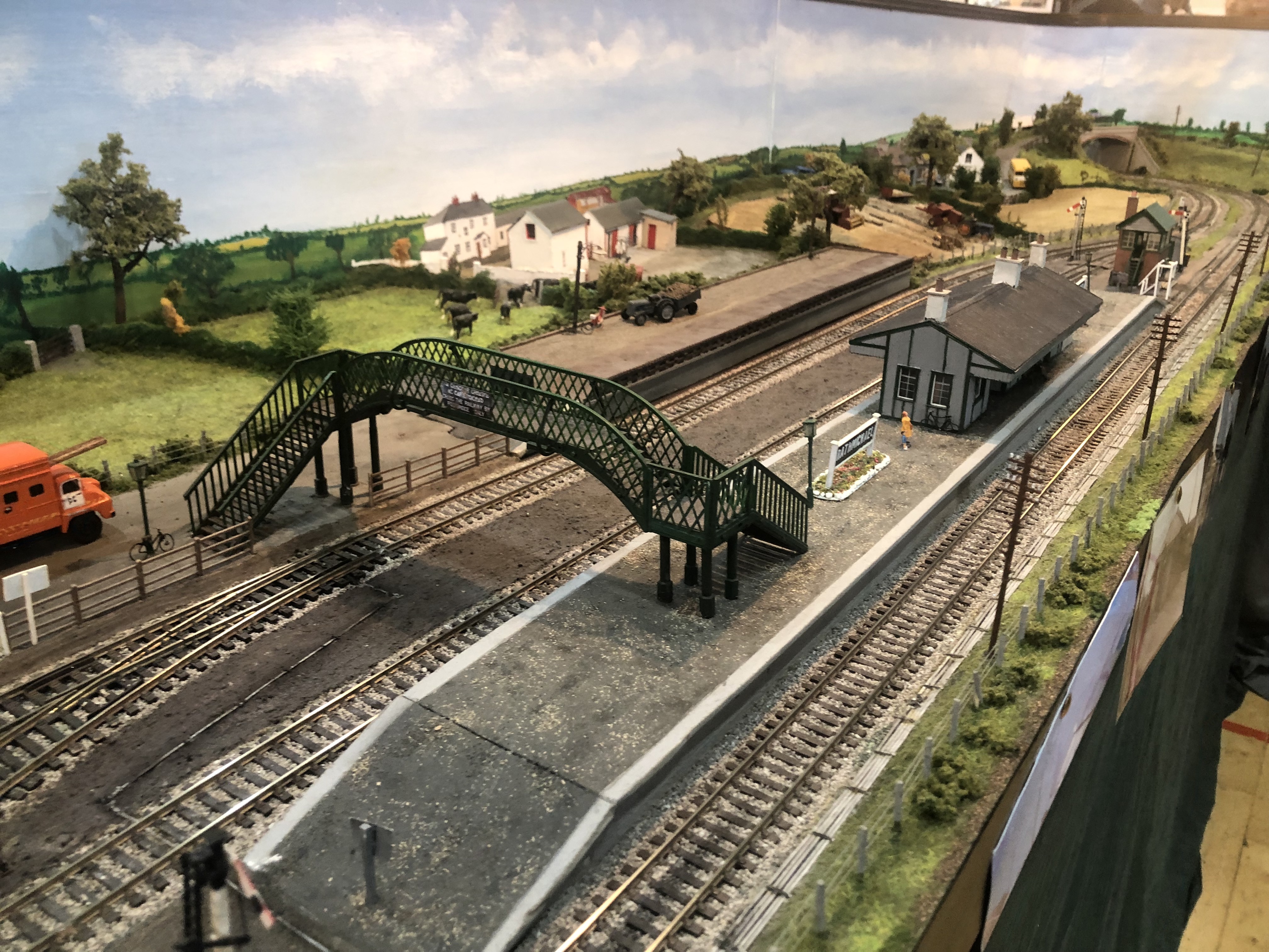
Some photos from Day 3 of the show. Lovely to be back at a show after three years and to meet so many icons of the railway modelling world and of this forum, such as the legend that is Mr. Paddy Murphy, along with @jhb171achill and @leslie10646 !! Some nice dioramas too including a comparison between the Clontarf of 1014 and the Clontarf of 2014, very clever! Two videos from the show: Rathmichael, by Wexford Model Railway Club: IMG_0769 2.MOV And Kildare, by South Dublin Model Railway Society: IMG_0767.MOV
-
I guess you just have to solder on Alan.....
-
It is looking superb Alan and your build speed is most admirable!!!
-
Brookhall Mill - A GNR(I) Micro Layout
Patrick Davey replied to Patrick Davey's topic in Irish Model Layouts
They have obviously done a few courses……. -
Brookhall Mill - A GNR(I) Micro Layout
Patrick Davey replied to Patrick Davey's topic in Irish Model Layouts
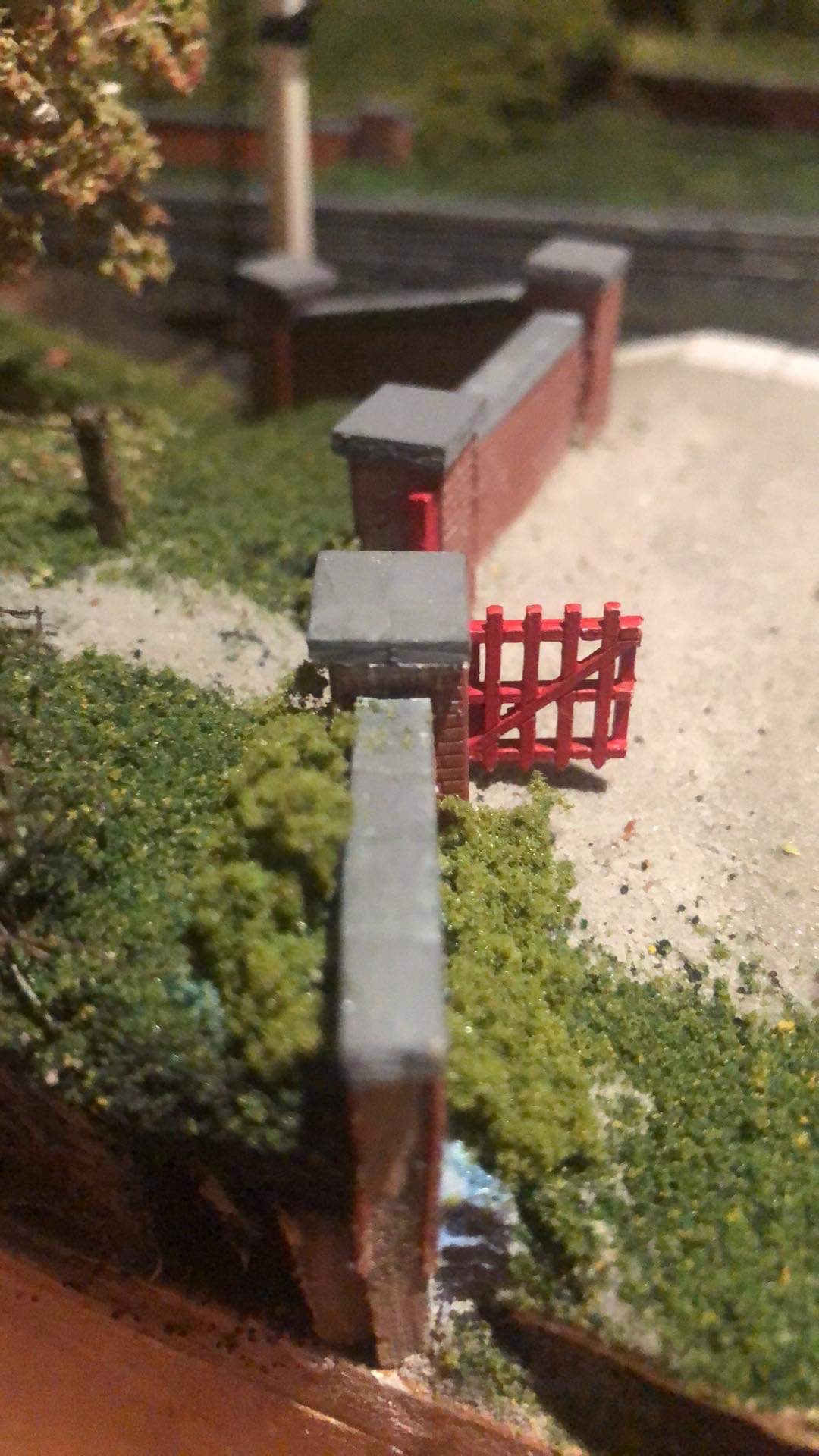
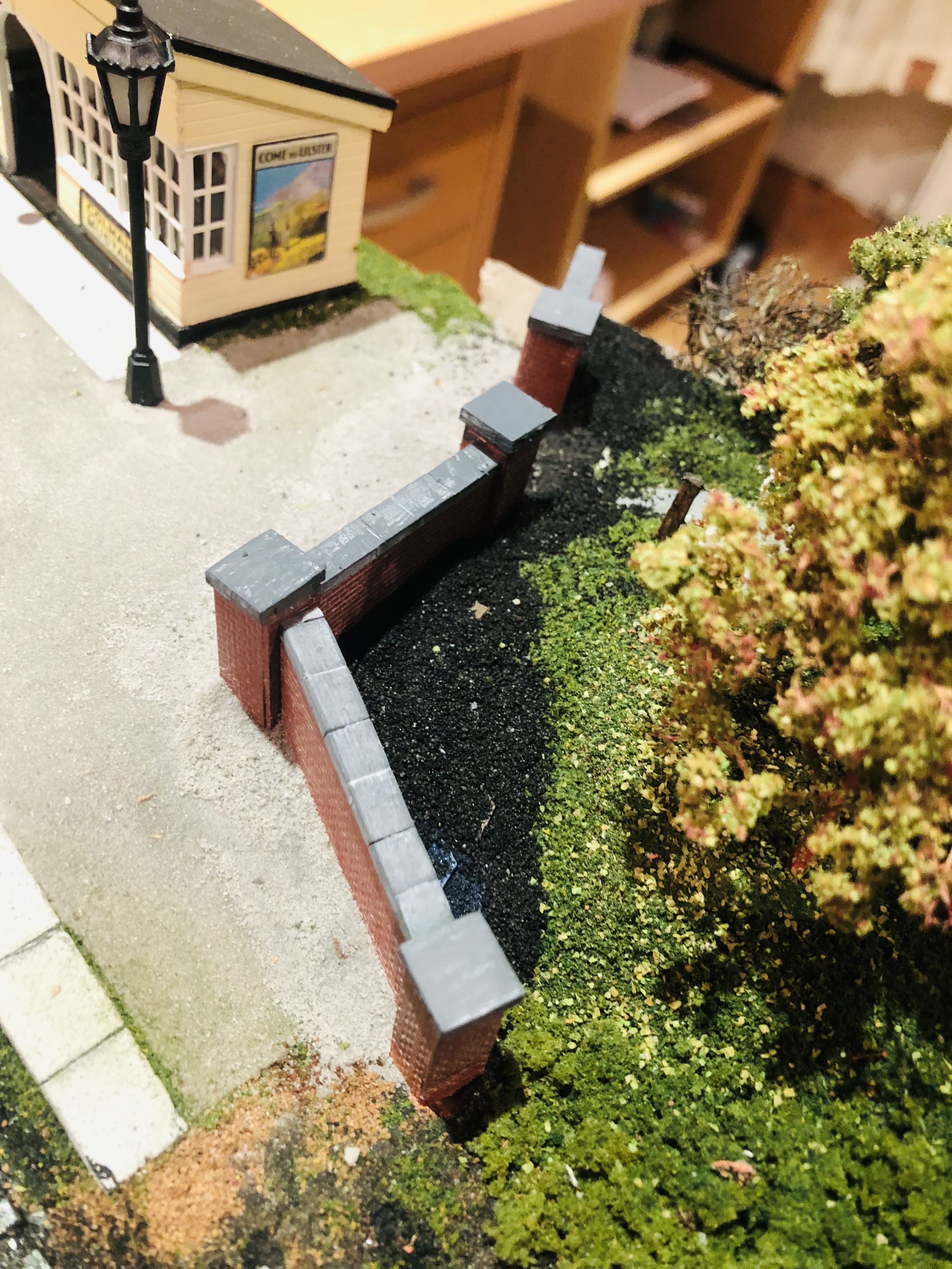
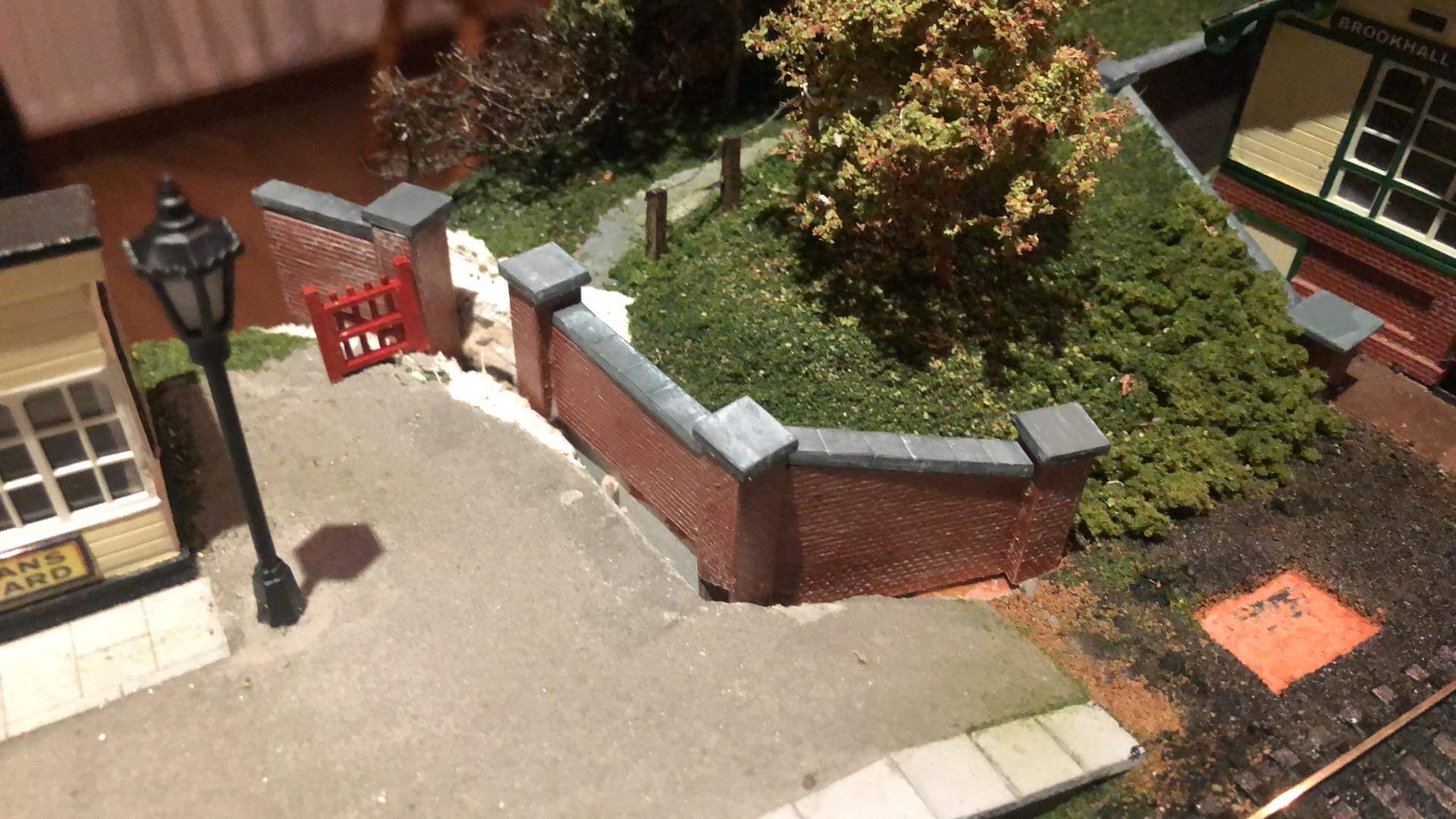
The droop has been de-droop-ified.
-
Brookhall Mill - A GNR(I) Micro Layout
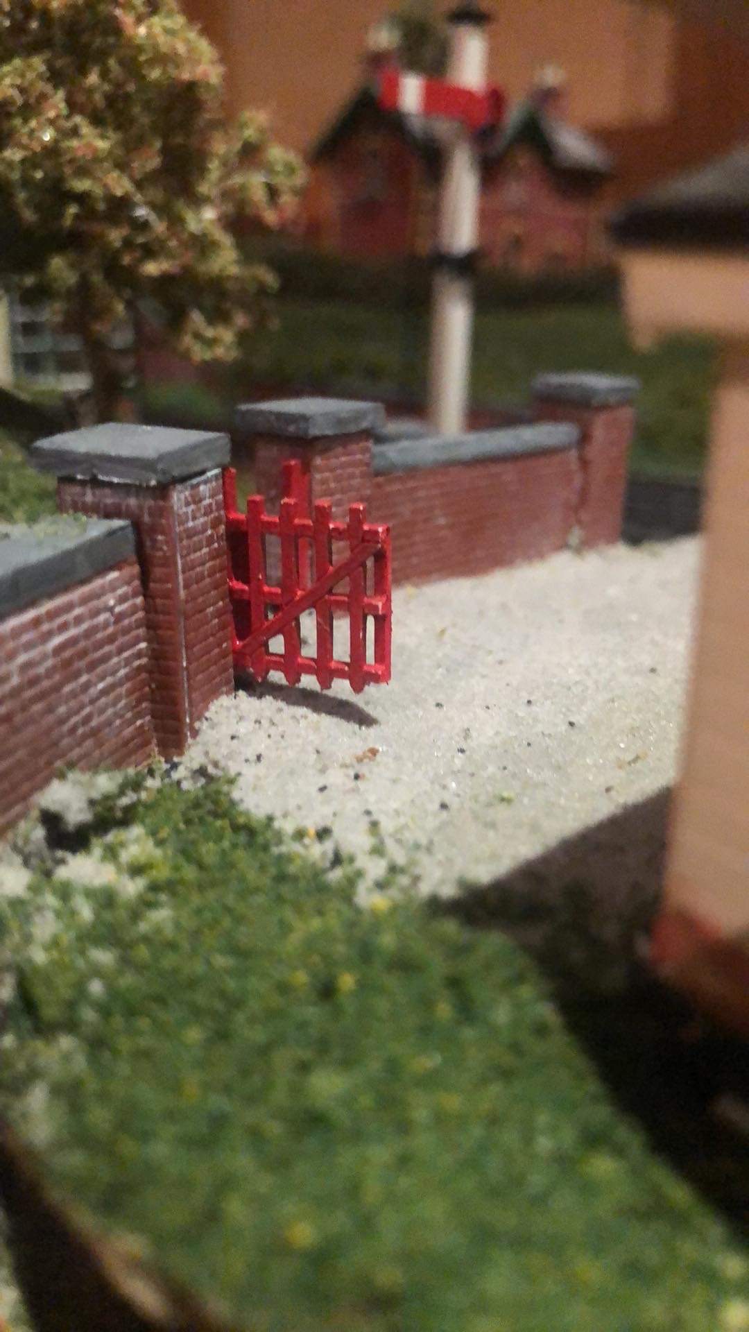
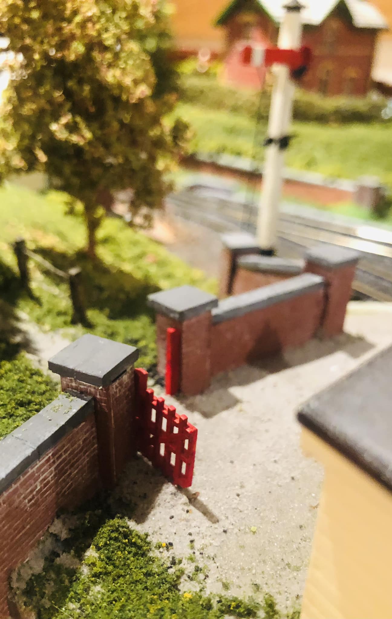
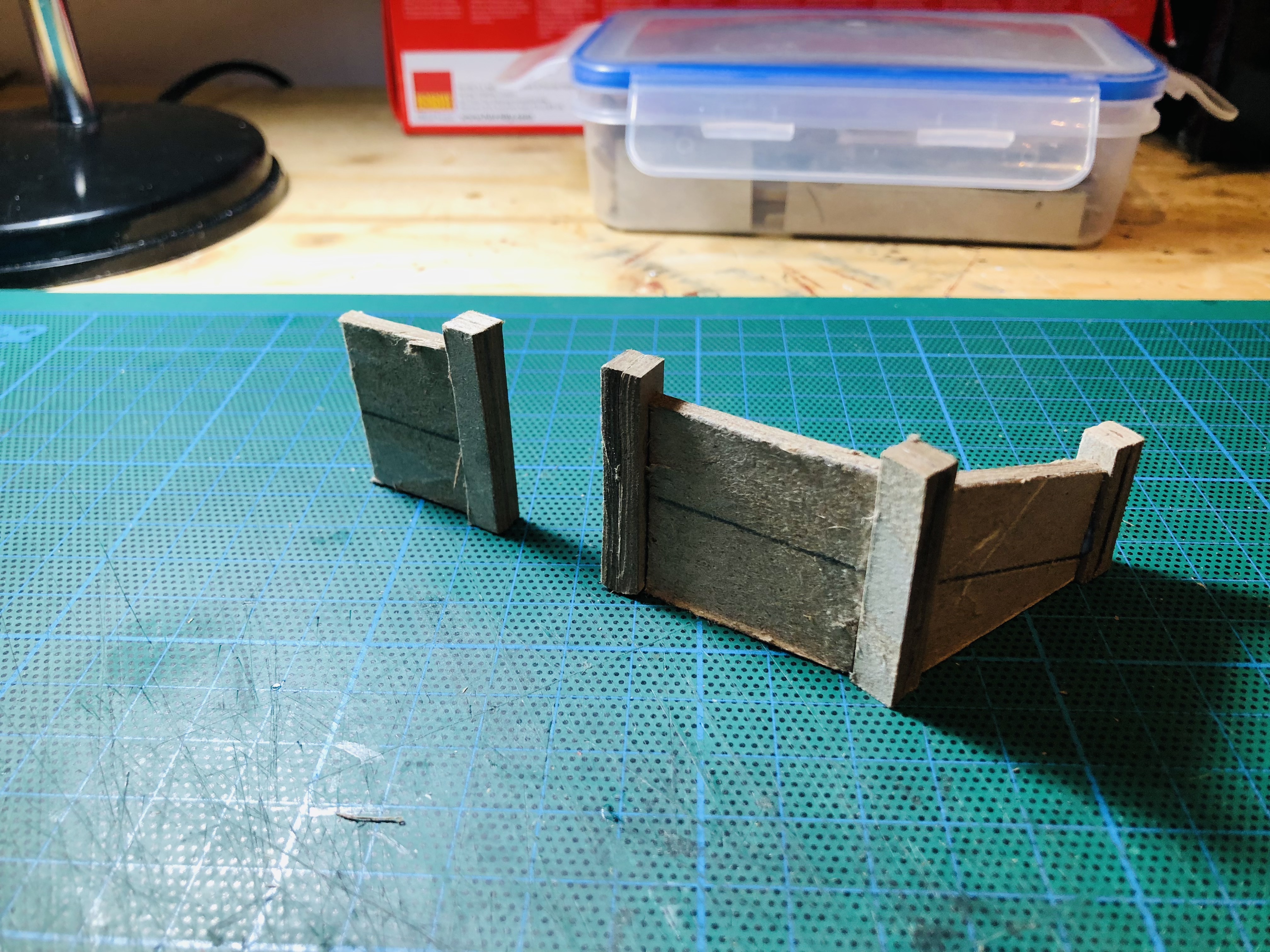
Patrick Davey replied to Patrick Davey's topic in Irish Model Layouts
The new wall now has a gate…… not glued in place yet hence the droop.....
-
Simply superb!
-
IRM At The Dublin Show 2022 - Just What Will We Announce?
Patrick Davey replied to Warbonnet's topic in News
Great announcements - not my era but impressive as always!! Eagerly awaiting the new tooling announcements........ hope I won't be BLUE and feel MAROONed........ -
Brookhall Mill - A GNR(I) Micro Layout
Patrick Davey replied to Patrick Davey's topic in Irish Model Layouts
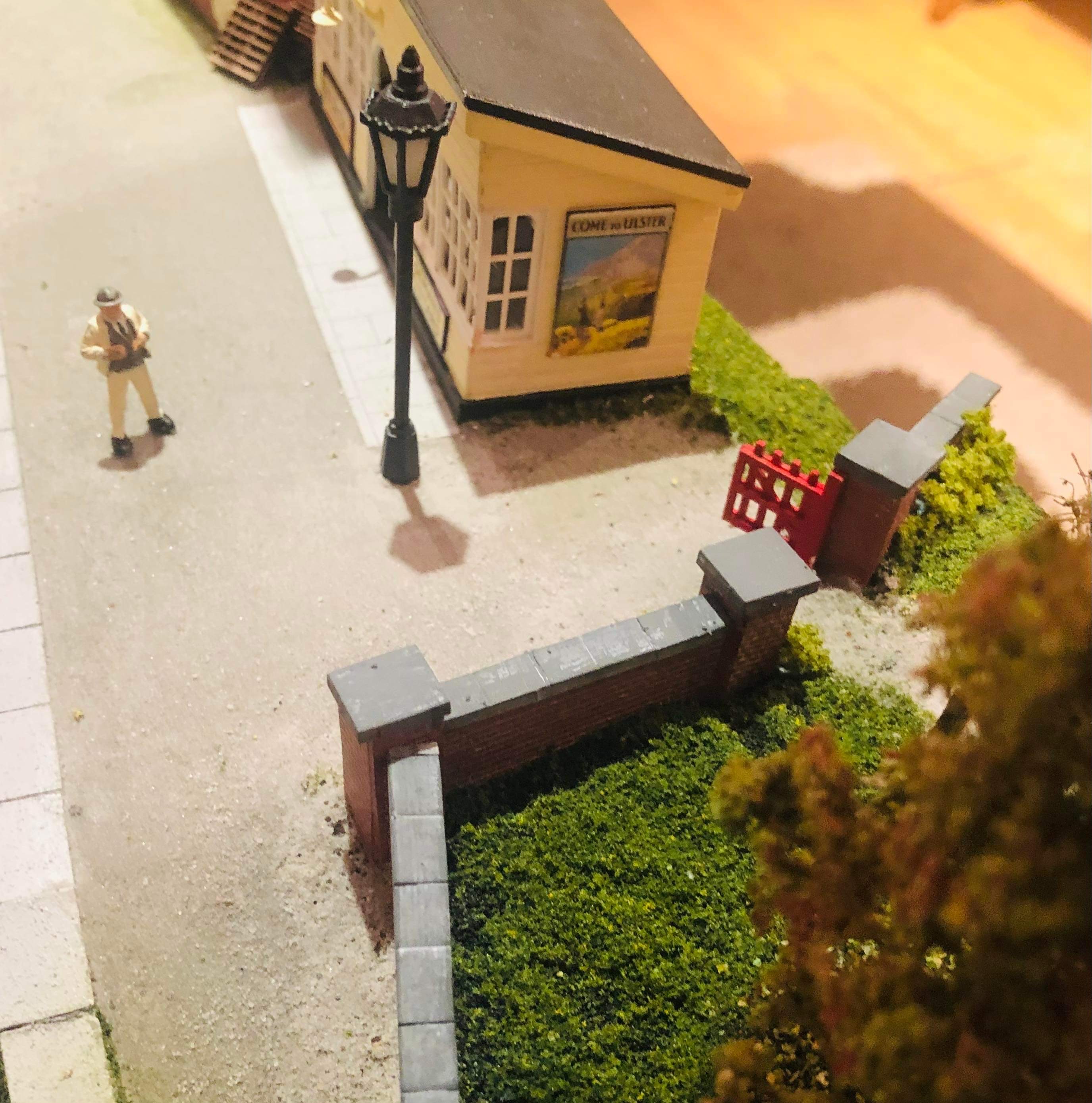
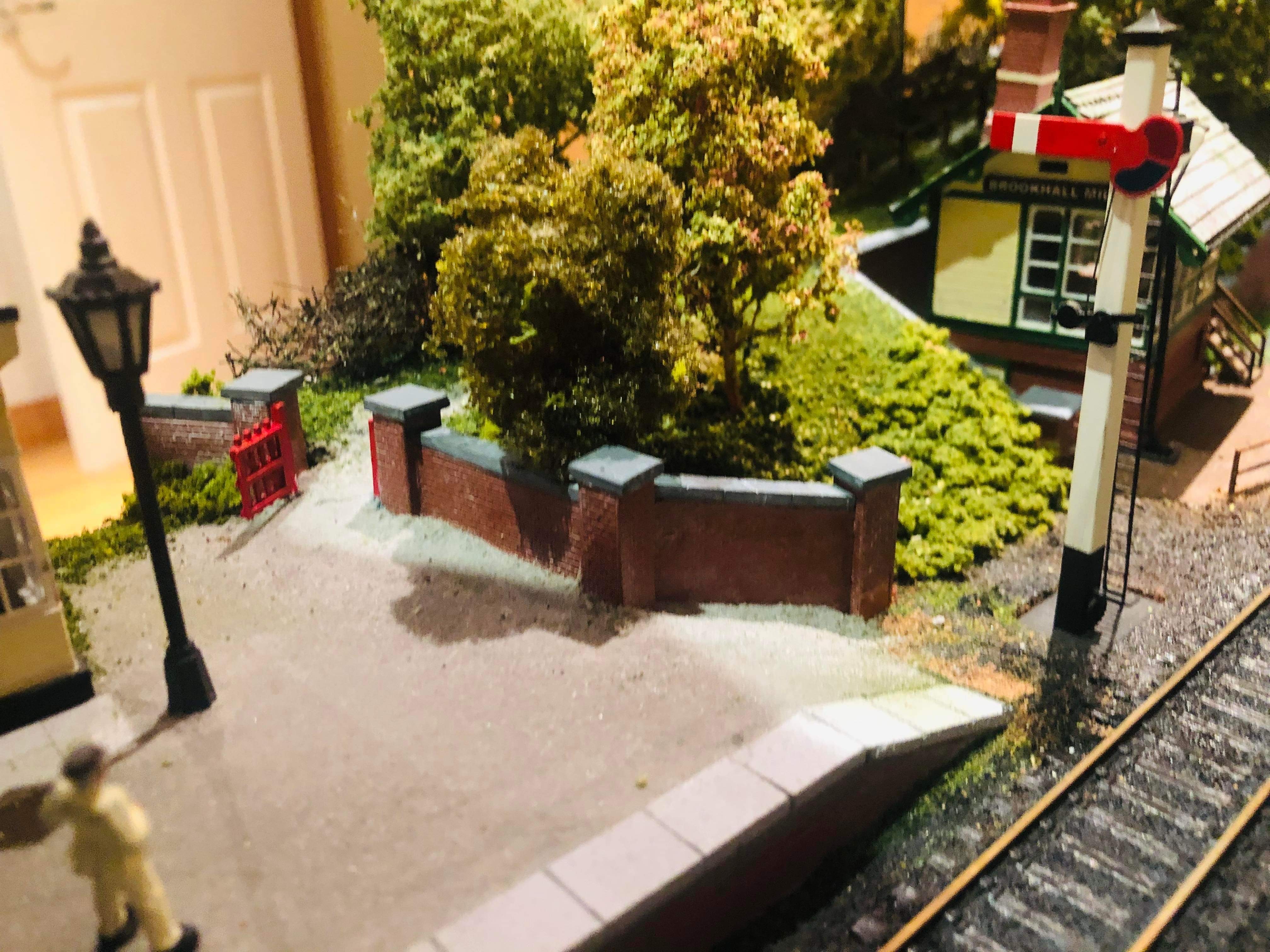
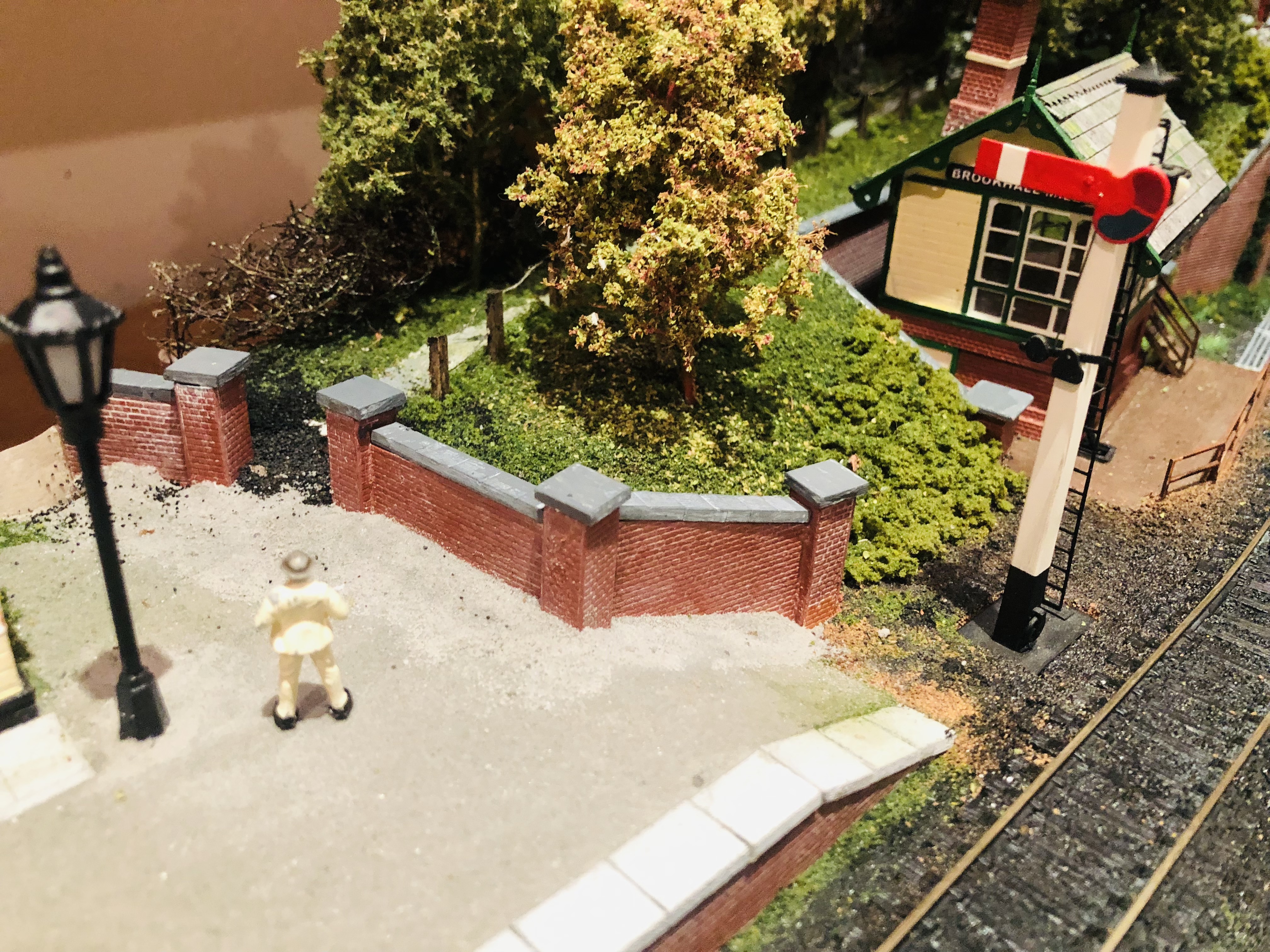
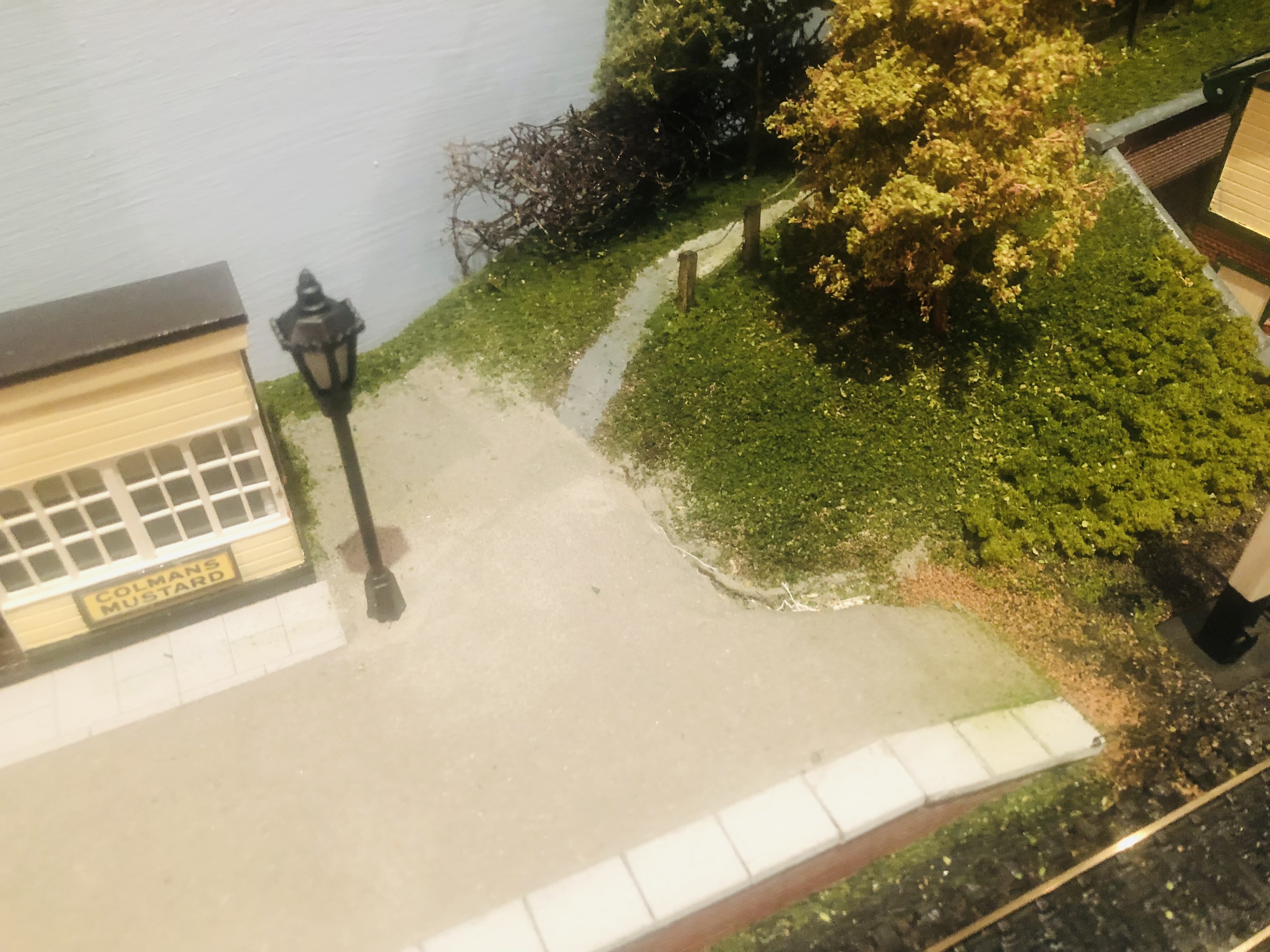
This part of the layout had been niggling at me, being one of the few areas remaining unfinished. I needed a means of marking the transition between the platform and the wooded area beyond: I had tried a few things in the past which didn't work so I decided to build a brick wall, using thick card covered in embossed brick plasticard: I had to excavate a bit to give it a solid foundation but it seems to work ok. There will be a short fence section between the back of the platform shelter and the new wall. Starting to blend the wall in with chinchilla dust, which was kindly provided for the platform a while back by Paul Chapman. Mr. Weaver is casting his eye over the work. This side has been built up using offcuts of the thick card covered with a layer of black scatter, then the whole lot was soaked in dilute PVA. Once dry, the black scatter will be covered with green scatter then foliage. I only used the black scatter here as I have lots of it and haven't found much use for it other than as a coal pile elsewhere on the layout.
-
More gems thanks Ernie, Aldergrove stands out for me!
-
Brookhall Mill - A GNR(I) Micro Layout
Patrick Davey replied to Patrick Davey's topic in Irish Model Layouts
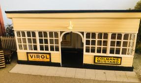
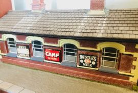
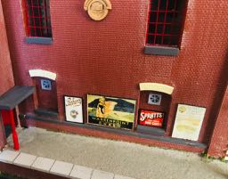
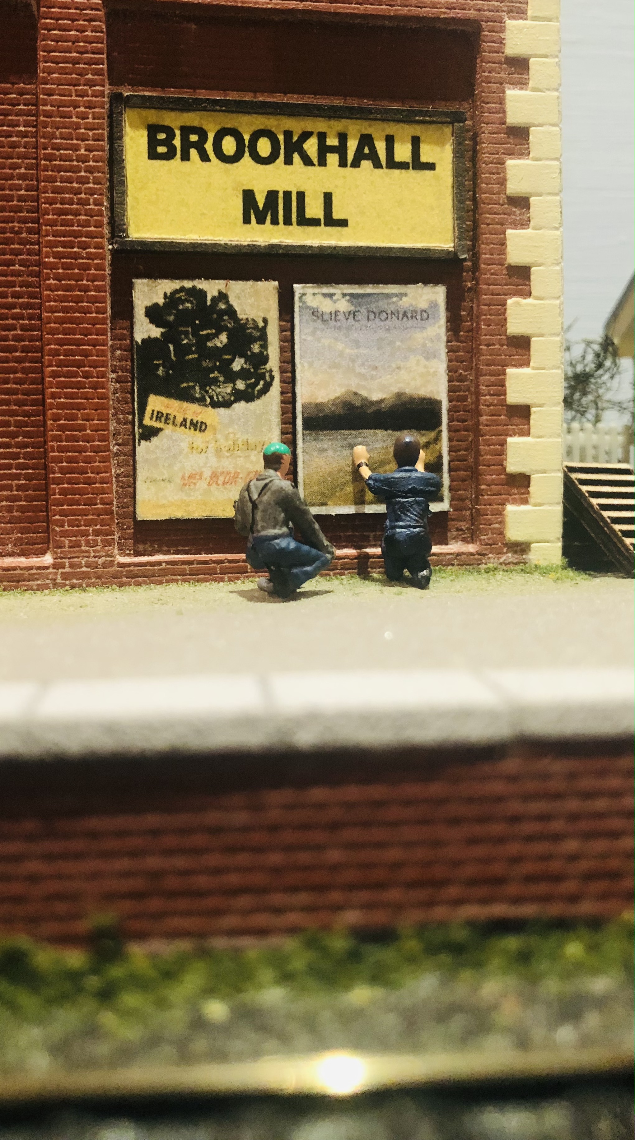
Tiny Signs for the tiny folk to read! Apologies for the tiny photos too.....
-
IRM At The Dublin Show 2022 - Just What Will We Announce?
Patrick Davey replied to Warbonnet's topic in News
Haven't heard this kind of build up before, getting interesting now! -
Sending you lots of good wishes Ken and my compliments also on a fantastic model.
-
IRM At The Dublin Show 2022 - Just What Will We Announce?
Patrick Davey replied to Warbonnet's topic in News
Same..... the IRM team haven't yet, as far as I know, told us when the pre-show announcement will be made, hopefully imminently as it would be a welcome diversion from the Downing Street shenanigans....... Am guessing the pre-show one will be more of an accessory (maybe the footbridge?) rather than a powered item though, because if they are indeed releasing what I hope they will, I imagine that it would be a major announcement suited to a major show..... all speculation though and I bet IRM Towers is enjoying this!! Whatever comes it will all be fab and my continued thanks to IRM for all they do. -
This is amazing - I am always in awe of anyone who can do something that I could never do and this is very firmly so!!!!
-
Brookhall Mill - A GNR(I) Micro Layout
Patrick Davey replied to Patrick Davey's topic in Irish Model Layouts
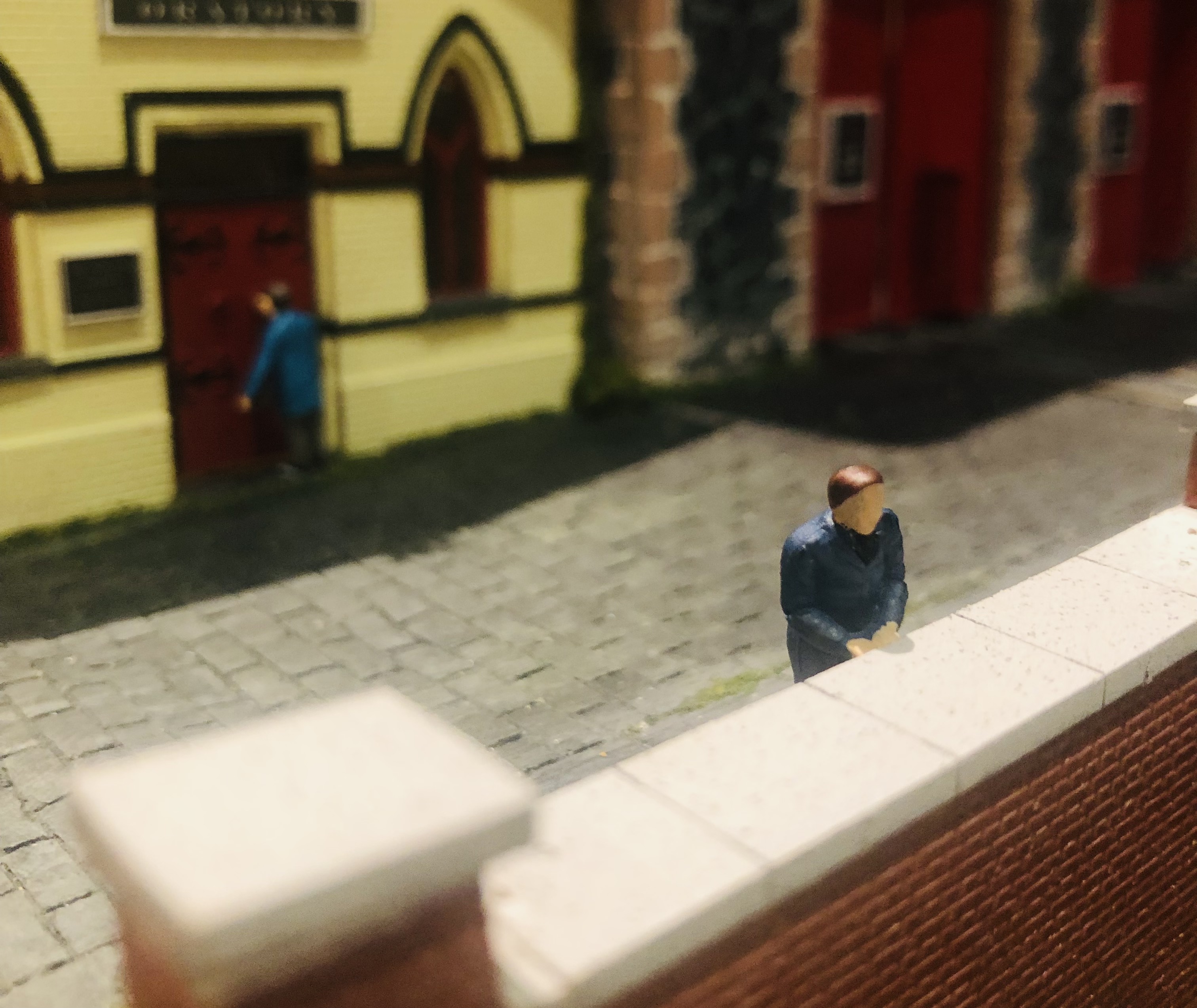
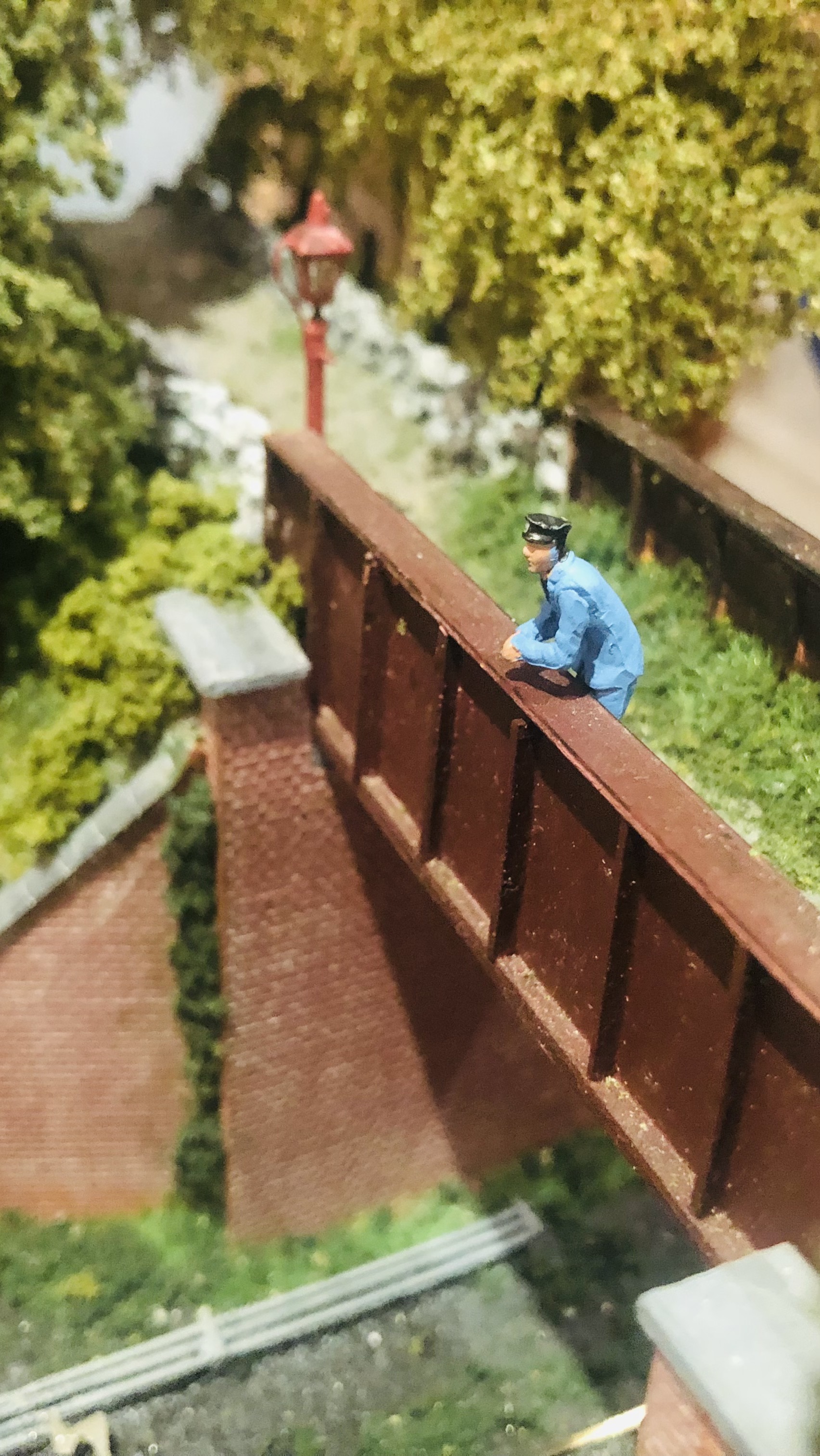
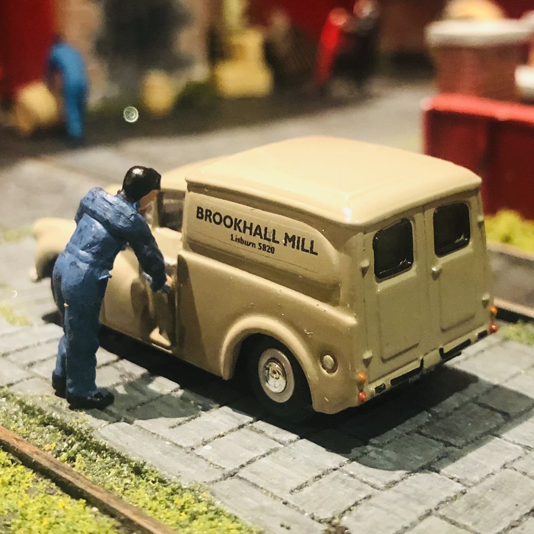
More tiny folk doing things at Brookhall Mill.
-
Congrats Tony - looking forward to this!!!
-
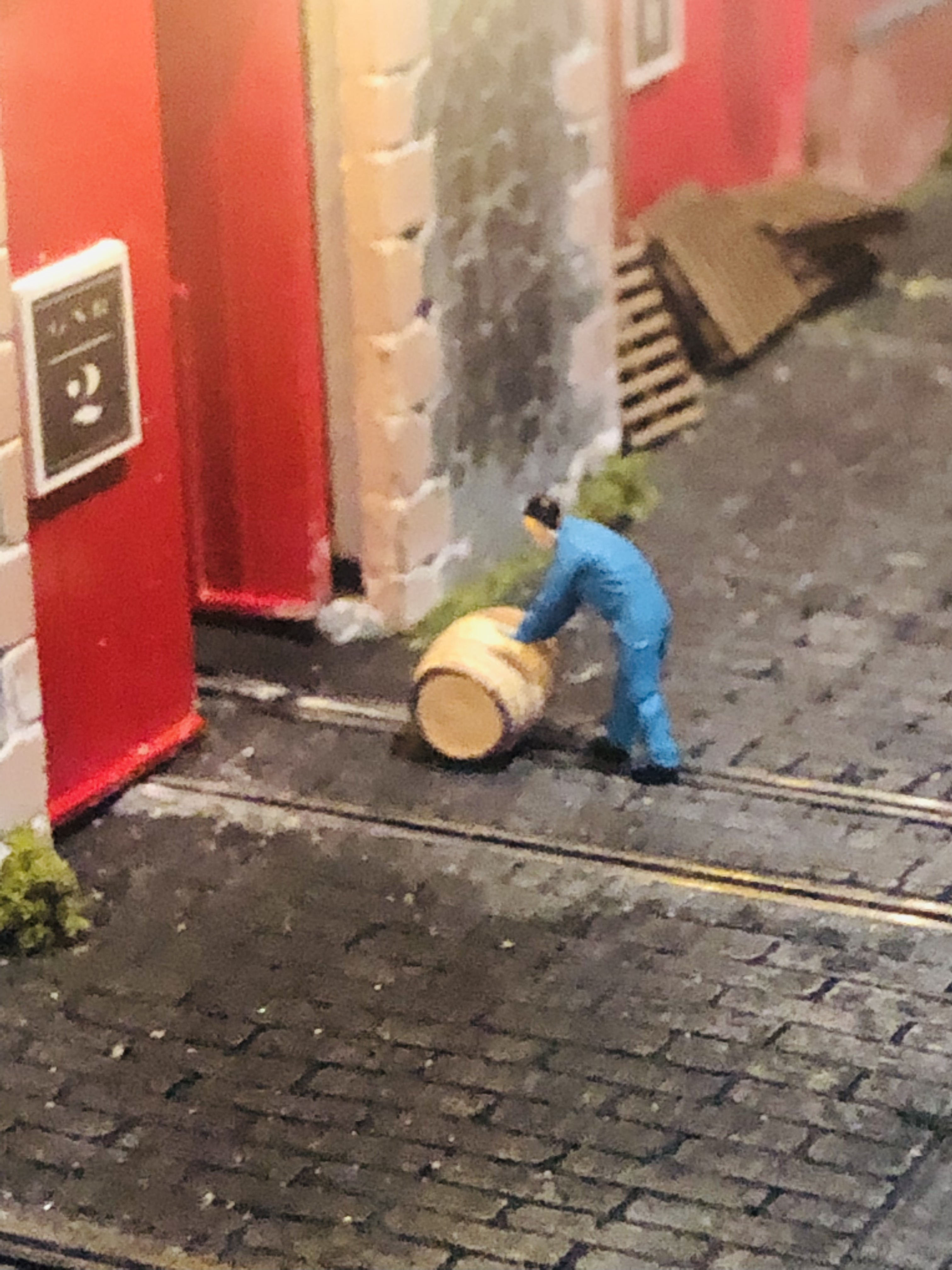
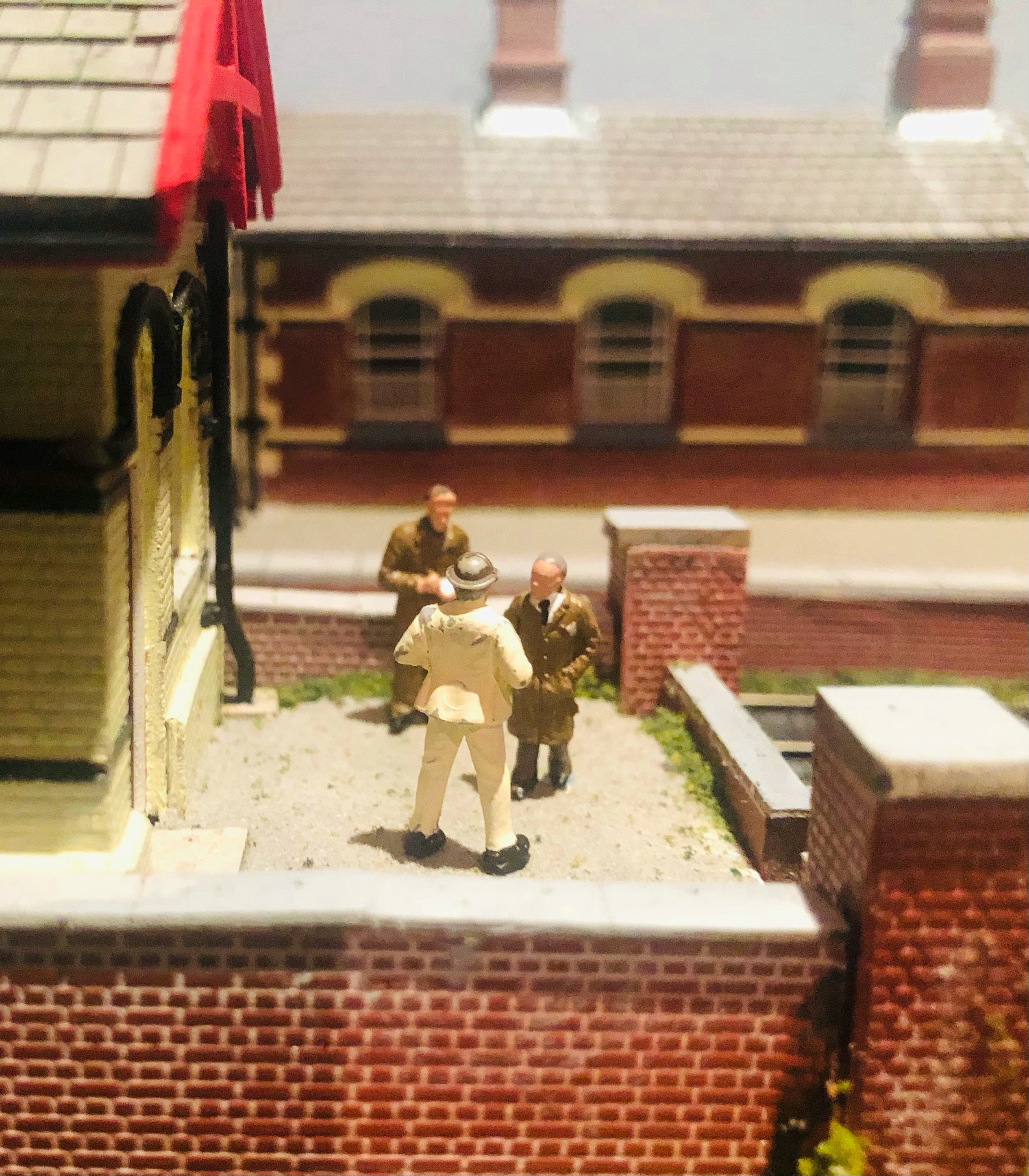
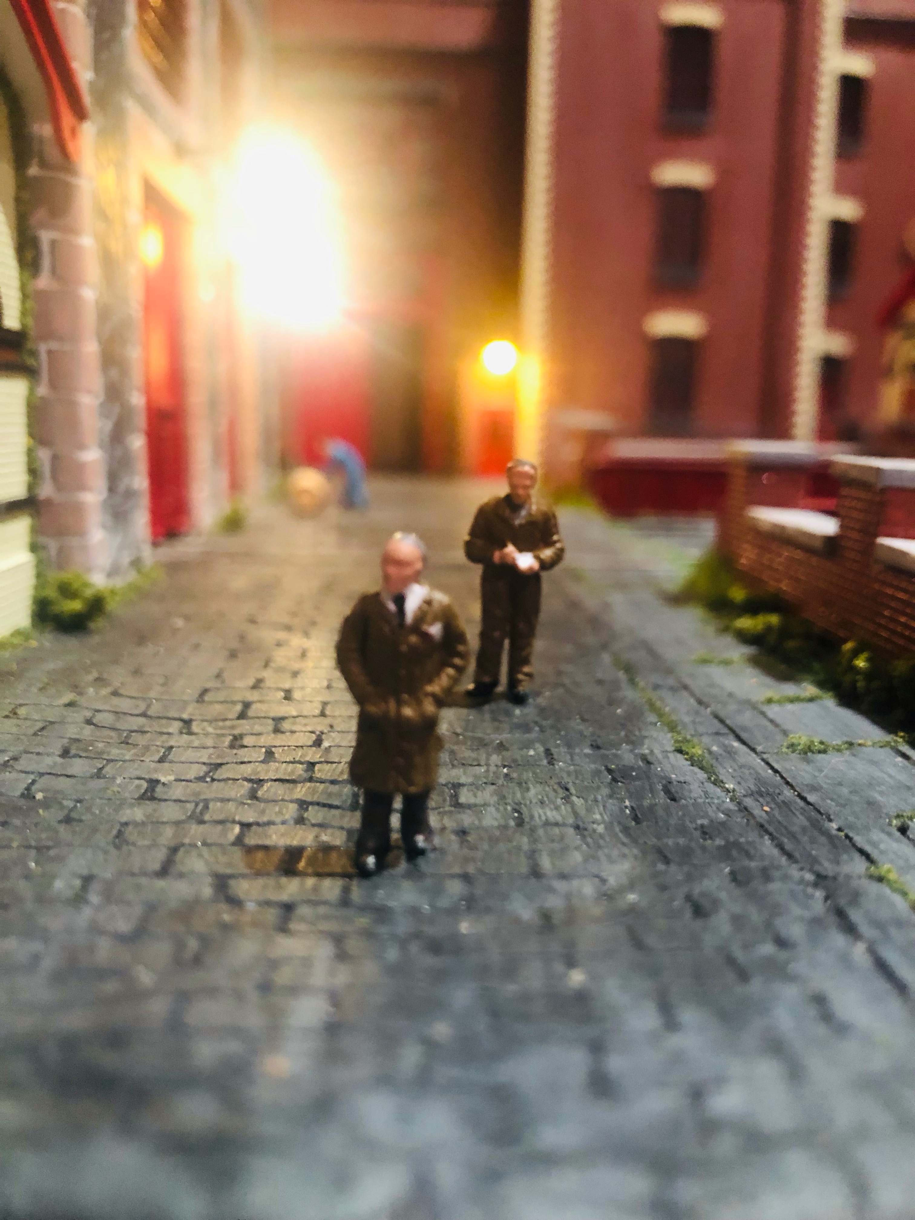
Brookhall Mill - A GNR(I) Micro Layout
Patrick Davey replied to Patrick Davey's topic in Irish Model Layouts
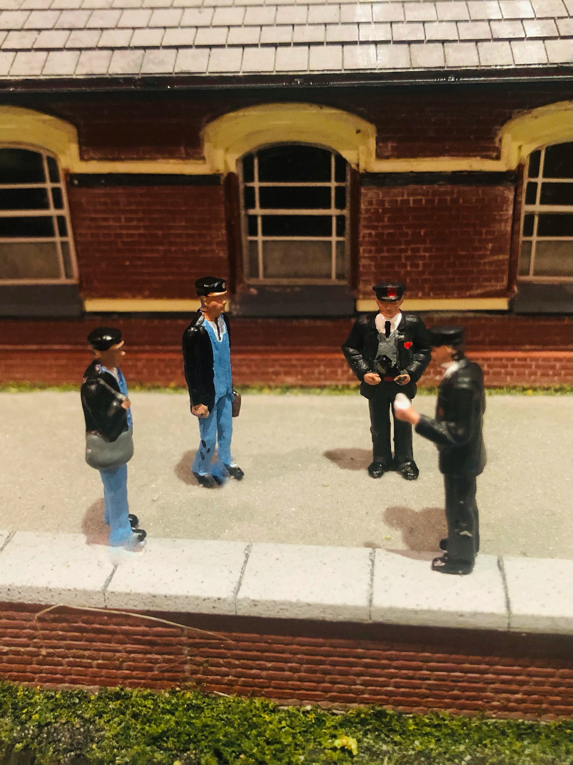
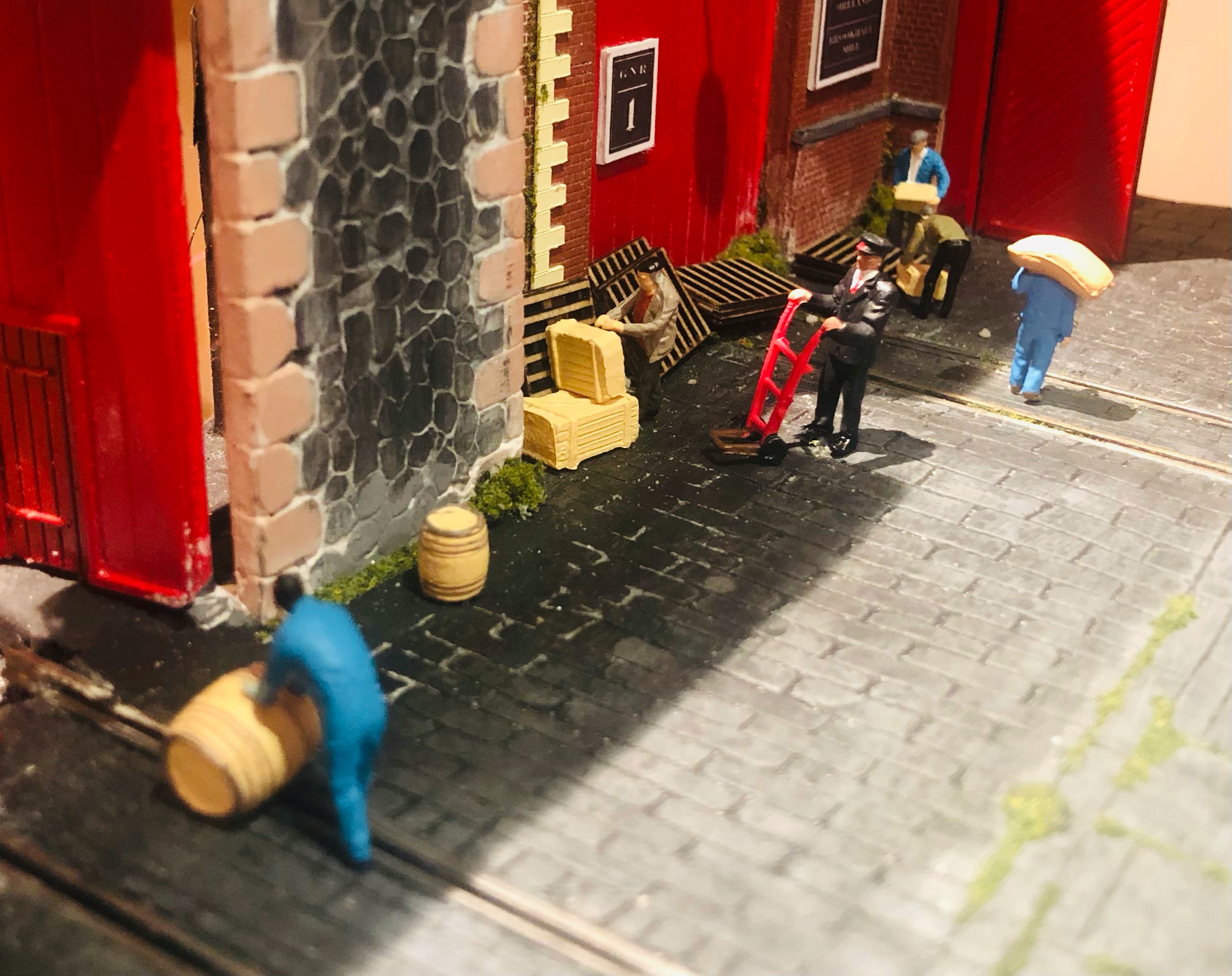
New members of the insanity inventory: Billy Barrel - his job is to roll out the barrel.....he even wrote a song about it.... The formidable Mr. Foreman, and his assistant, Mr. Threeman (slightly lower pay grade). Mr. Weaver dislikes Mr. Foreman (Mr. Threeman even less so) because he's always insisting that everything be done by the book.
-
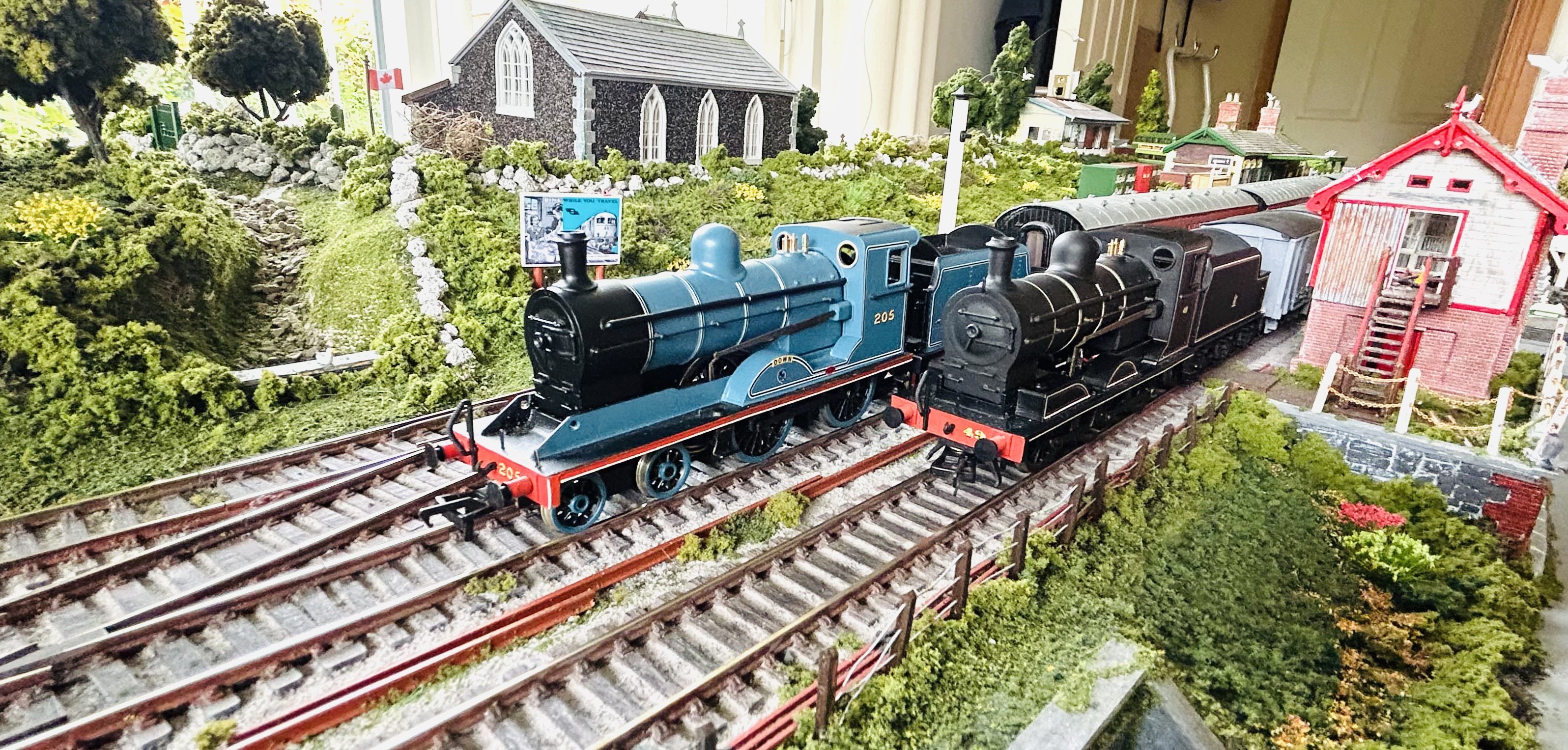
Congrats - a milestone has been achieved!!! Looks like a smooth runner too!!