Broithe
-
Posts
7,670 -
Joined
-
Last visited
-
Days Won
47
Content Type
Profiles
Forums
Events
Gallery
Blogs
Everything posted by Broithe
-
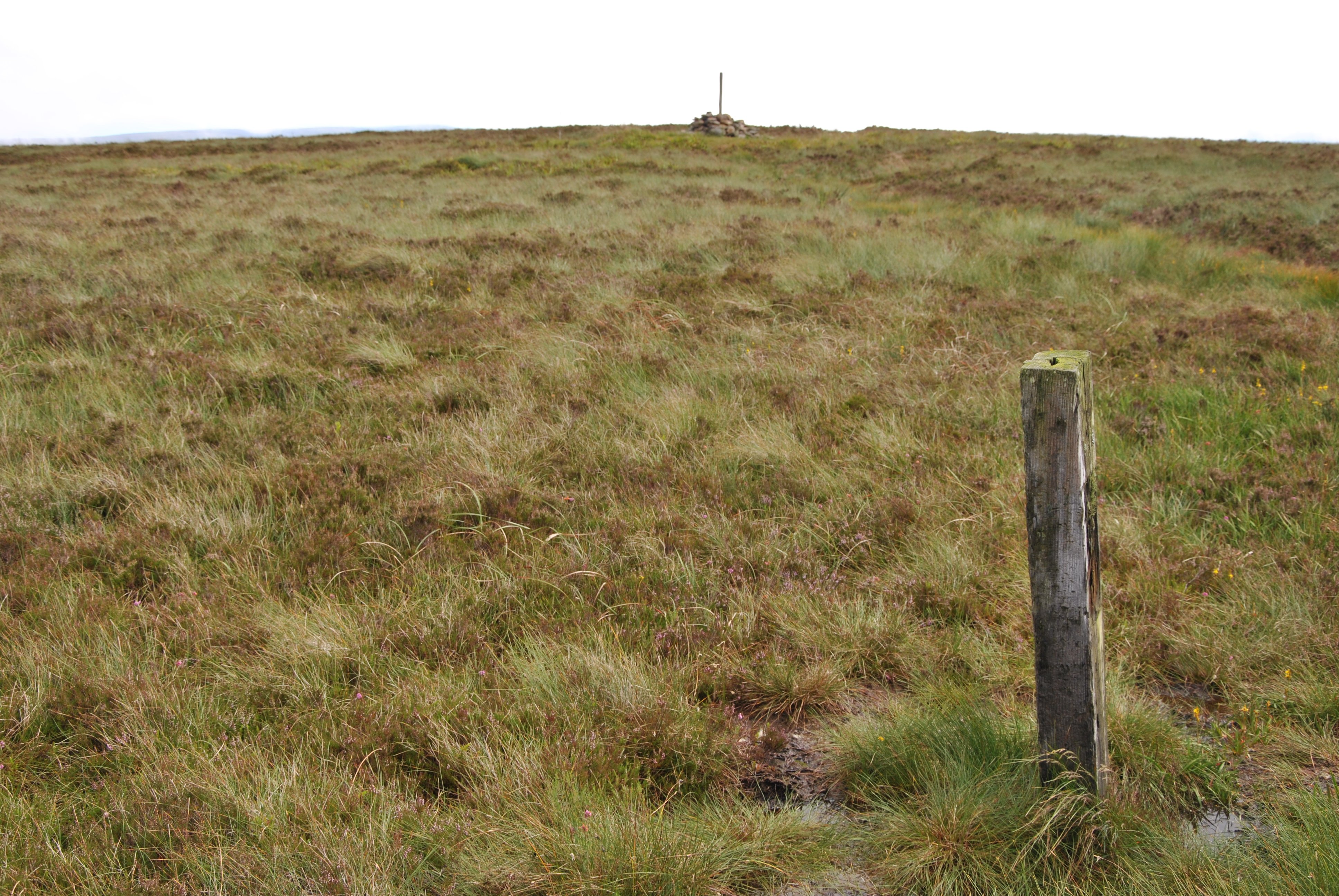
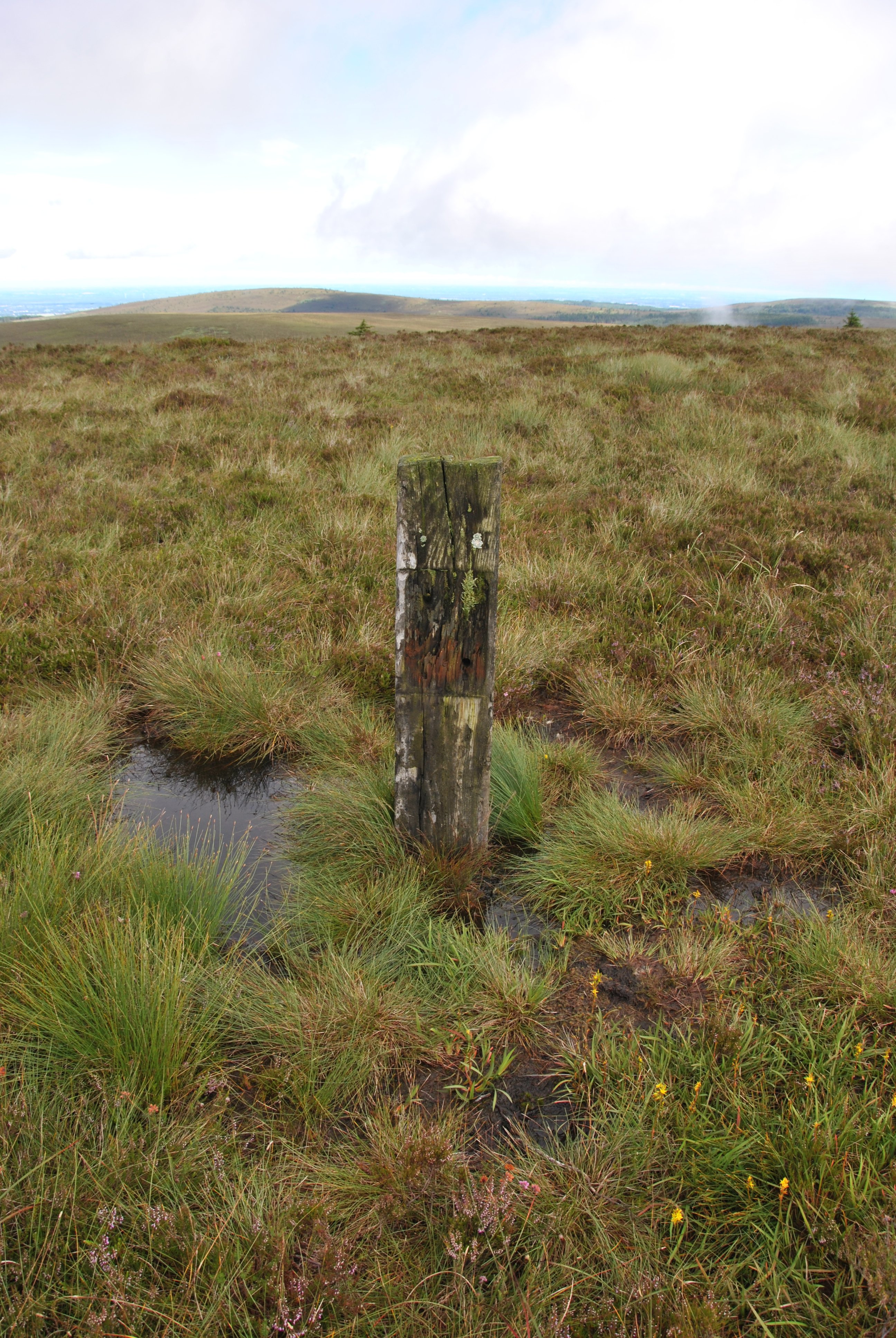
This morning's thunderstorm reduced the options for the Sunday morning excursion, but we made it to the summit of Arderin - 527m/1,729ft. This is only a short walk from the 'new road', despite being the highest point of the Slieve Blooms. Anyway, the point is that I found a solitary sleeper, half-buried and there for no clear reason, a hundred metres from the summit cairn. Possibly the sole remains of an abortive plan to rival the railway up Snowdon?

-

Clogherhead - A GNR(I) Seaside Terminus
Broithe replied to Patrick Davey's topic in Irish Model Layouts
I worked with a Japanese bloke who was very competent about most things. His Polish neighbour had a goldfish that was a bit poorly and she just assumed he would know all about koi carp, etc. He knew nothing, but he wasn't going to admit that. He went round and looked at the fish. It was clearly not well and had a few scales missing. He told her that she must make sure that the whole tank and the various filters and ornaments in it, etc., were all scrupulously clean, assuring her that it would probably all heal up, if she did that properly. She did all that, but the fish got slowly worse. He laboured the point about scrubbing everything to ensure total cleanliness. It still got worse. After about six cycles of this, he grudgingly volunteered to watch her, to see if he could see what she was missing. She seemed to be doing it all perfectly, putting the fish in a Pyrex jug whilst she removed cleaned and rinsed all the internals and the tank itself, scrubbing everything with a nail brush and a toothbrush. As everything seemed as good as it could be, he was about to admit that it was beyond his capacity to suggest anything else, when she hoicked the fish out of the jug, gave it a squeeze of Fairy Liquid and was about to scrub it under the hot tap. At that point, having managed to stop her in time, he assured her that merely replacing the fish and giving him time to recuperate would probably give a better result... -
Ernies Massive Irish 1930's to 2005 Photo Archive
Broithe replied to Glenderg's topic in Photos & Videos of the Prototype
And yet the two largest municipalities are ports... -
Ernies Massive Irish 1930's to 2005 Photo Archive
Broithe replied to Glenderg's topic in Photos & Videos of the Prototype
Of course, in Laois, a lot of the cars had Craggy Island plates. -
Ernies Massive Irish 1930's to 2005 Photo Archive
Broithe replied to Glenderg's topic in Photos & Videos of the Prototype
In 1958 you would have needed a TV set in a DeLorean to watch RTÉ. It would have been noticed if you'd parked one in Donegal town then. -
Ernies Massive Irish 1930's to 2005 Photo Archive
Broithe replied to Glenderg's topic in Photos & Videos of the Prototype
The aerials are interesting. When you could legitimately run a TV without having a licence..? -
Liberator + added confusion.
-
Large Logo Lookers - The Next 37 Trio About To Arrive!
Broithe replied to Warbonnet's topic in British Outline Modelling
Do as I do and imagine Accurascale to be a money-laundering operation that subsidises our ever-expanding addictions...- 13 replies
-
- 10
-

-

-

-
I presume this is from Naas, today or yesterday.
-
Near me in England was a rendering plant. Years ago, liquid 'stuff' - blood, guts and the sort of bits that didn't even go in sausages - were transported carefully in trucks with open tanks on the back. There was considerable dribbling of matter onto the roads, but people got used to that. Matters came to a head, ultimately, when a truck was approaching a pedestrian crossing and a woman with a pram made as if to cross at the last moment. The driver had no option but to stop sharply and the resultant tidal wave of guts, about a third to half the contents of the load, surged over the cab and onto the road. sweeping the woman and the pram for some distance. As it was midsummer, the shops along the street mostly had their doors open and the wave surged in. Nobody who saw this would ever forget it. Subsequently, the use of open tanks ceased.
-
This has popped up - 7.5 inch, I think - not small... http://tmrr.org/
- 1 reply
-
- 2
-

-
I have been made aware that the Vale of Rheidol shop has at least two of these available, for a mere twenty quid each. https://www.facebook.com/groups/1919014181547821?multi_permalinks=6251163201666209&hoisted_section_header_type=recently_seen
-
In a similar vein... https://www.facebook.com/permalink.php?story_fbid=pfbid0ixbKZ8fKVFTiP22wQFAYuVUB37w7QqGzcq8vfC3Fh9a6Rm6npFZ3o5waiNazES2ql&id=100089963332808 "How do you climb a mountain of stacked railway ties? This 1937 photograph by Fox for the Daily Herald was taken in the Great Western Railway sleeper creosoting works in Hayes, Middlesex, England."
-
And you just know that, on your first day there, you would knock a pot of paint off a plank, all over some posh woman in a fur coat sixty feet below...
-
When I had a 'proper job', I worked with lots of humans that I wouldn't have trusted that far...
-
https://www.facebook.com/HistoryColored/posts/pfbid0vLmRjnkjoLrgGqck58uwh38mxG4k4taCwXSQV5DsD3NnMc4JLbAm4LtEMY5o4JyBl "Double leg amputee railway signalman, James Wide, photographed working alongside his pet and assistant, Jack Baboon, in Cape Town during the 1880s. James Wide purchased a chacma baboon in 1881 and trained him to push his wheelchair and operate the railway signals under supervision. Credit: color_byangelina on Instagram"
-
There is this special edition planned.
-
https://www.facebook.com/Oldphotos10/posts/pfbid0aSR44MZq6SBj4EjQVfzf3e54KasFcuebCMXojjZdMMT7Tbf9KxG5kx85hRQMw3tkl "August 1935. Workmen painting girders beneath the roof of Liverpool Street Station, London. (Photo by Fox Photos/Getty Images)"
-
https://www.belfasttelegraph.co.uk/news/northern-ireland/lancaster-bomber-flies-in-for-armed-forces-day-display-in-larne-this-weekend/a762359719.html
-
I knew someone would do that, but I didn't expect it so soon, when we've only just begun.
-
Three different forms of propulsion to enter service
Broithe replied to spudfan's topic in Letting off Steam
A good bit smaller - between that and a 727, really. The story of the one that had an emergency landing at Izhma, ending up in the forest, being dragged back out, repaired enough to be flown out, then repaired properly and flown on for another decade, before being retired and put on display outside the airline's head office is a very 'Russian' thing. https://en.wikipedia.org/wiki/Alrosa_Flight_514 -
https://irishrailwaymodeller.com/profile/129-dave/
-
Three different forms of propulsion to enter service
Broithe replied to spudfan's topic in Letting off Steam
Hydrogen was, and probably still is, used in large generators for cooling purposes, in order to reduce the windage losses that would occur with 'thicker' gasses. Sealing issues were never-ending, the tiny molecules will always find a way, it seems. This did involve rotary seals on the shafts, which were the main source of the leaks, but stuff was kept outside as much as possible. Leaks did have the handy feature of disappearing upwards very quickly and the fire risk was probably a good bit less deadly than, say, LPG leaks would be. It was also not 'personally detectable', but I suppose a smell could be introduced for that purpose, as the low viscosity wouldn't be a feature that people would be desperate to keep for vehicle propulsion purposes... Hydrogen fires are generally not as fearsome as the Hindenburg would lead you to believe, a lot of that was the fabric covering and its associated paint, then the remaining fuel. We also used SF6, a non-toxic inert gas - for insulation purposes, and for controlling arcs during the opening of circuit breakers. It is, at atmospheric pressure, the densest gas around, you can actually float a tinfoil boat in a tank of it, at the air/SF6 surface, and it appears to be just floating in space. The opposite of hydrogen. This gas though, could drown you, if you unwittingly descended into a trench or cellar full of it, and there would be no 'breathing difficulty' to give the game away, you would just faint away with no distress, and then die. If the leak came from a circuit breaker, then there would be a smell, from the liberated fluorides, but if it was 'new' from a cylinder or from gas that was purely for insulation, then it was odourless. The dodgem car has never gone away.